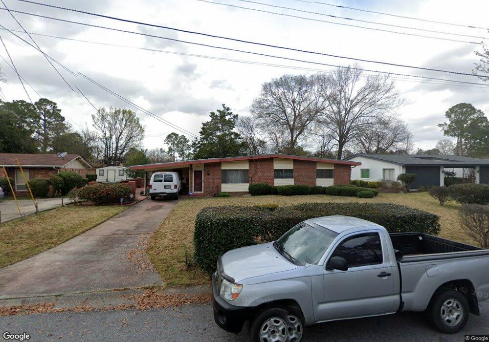
3405 Starner Dr Columbus, GA 31906
Lindsey Creek Park-Boxwood Estates NeighborhoodEstimated Value: $123,000 - $168,000
3
Beds
3
Baths
1,743
Sq Ft
$85/Sq Ft
Est. Value
About This Home
This home is located at 3405 Starner Dr, Columbus, GA 31906 and is currently estimated at $147,713, approximately $84 per square foot. 3405 Starner Dr is a home located in Muscogee County with nearby schools including Rigdon Road Elementary School, Richards Middle School, and Hardaway High School.
Ownership History
Date
Name
Owned For
Owner Type
Purchase Details
Closed on
Mar 2, 2021
Sold by
Hunt Denisha P
Bought by
Price Robert
Current Estimated Value
Purchase Details
Closed on
Mar 27, 2019
Sold by
Toney Byron Keith
Bought by
Hunt Denisha P
Purchase Details
Closed on
Mar 21, 2019
Sold by
Dews Yolanda
Bought by
Hunt Denisha P
Purchase Details
Closed on
Apr 30, 2018
Sold by
Toney
Bought by
Toney Eric and Toney Byron Keith
Create a Home Valuation Report for This Property
The Home Valuation Report is an in-depth analysis detailing your home's value as well as a comparison with similar homes in the area
Home Values in the Area
Average Home Value in this Area
Purchase History
| Date | Buyer | Sale Price | Title Company |
|---|---|---|---|
| Price Robert | -- | -- | |
| Hunt Denisha P | $16,332 | -- | |
| Hunt Denisha P | $16,333 | -- | |
| Hunt Denisha P | $16,332 | -- | |
| Toney Eric | -- | -- |
Source: Public Records
Tax History
| Year | Tax Paid | Tax Assessment Tax Assessment Total Assessment is a certain percentage of the fair market value that is determined by local assessors to be the total taxable value of land and additions on the property. | Land | Improvement |
|---|---|---|---|---|
| 2025 | $116 | $45,092 | $8,020 | $37,072 |
| 2024 | $116 | $45,092 | $8,020 | $37,072 |
| 2023 | $2 | $45,092 | $8,020 | $37,072 |
| 2022 | $121 | $24,456 | $8,020 | $16,436 |
| 2021 | $757 | $18,452 | $8,020 | $10,432 |
| 2020 | $754 | $18,452 | $8,020 | $10,432 |
| 2019 | $1,208 | $34,676 | $8,020 | $26,656 |
| 2018 | $315 | $34,676 | $8,020 | $26,656 |
| 2017 | $698 | $34,676 | $8,020 | $26,656 |
| 2016 | $320 | $33,429 | $5,208 | $28,221 |
| 2015 | $129 | $33,429 | $5,208 | $28,221 |
| 2014 | $129 | $33,429 | $5,208 | $28,221 |
| 2013 | -- | $33,429 | $5,208 | $28,221 |
Source: Public Records
Map
Nearby Homes
- 1104 Dunbar Ave
- 1061 Dunbar Ave
- 3122 Glenwood Dr
- 3019 Melrose Dr
- 1043 Vera Dr
- 3110 Morehouse St
- 1072 Rigdon Rd
- 3474 Melrose Dr
- 937 Diggs Ave
- 3035 Morehouse St
- 1035 Fisk Ave
- 1047 Fisk Ave
- 2920 Schaul St
- 3319 Decatur St
- 944 Booker Ave
- 1081 Benner Ave
- 2902 Hood St
- 2822 E Wynnton Ln
- 240 Kildee Dr
- 2829 Hood St
- 3411 Starner Dr
- 3329 Starner Dr
- 3384 Clairmont Rd
- 3390 Clairmont Rd
- 3378 Clairmont Rd
- 1103 Glenwood Rd
- 1092 E Lindsay Dr
- 3410 Starner Dr
- 3328 Starner Dr
- 3394 Clairmont Rd
- 1098 E Lindsay Dr
- 3372 Clairmont Rd
- 1077 Glenwood Rd
- 1072 E Lindsay Dr
- 1104 E Lindsay Dr
- 3366 Clairmont Rd
- 3387 Clairmont Rd
- 1066 E Lindsay Dr
- 3379 Clairmont Rd
- 1102 Glenwood Rd
Your Personal Tour Guide
Ask me questions while you tour the home.