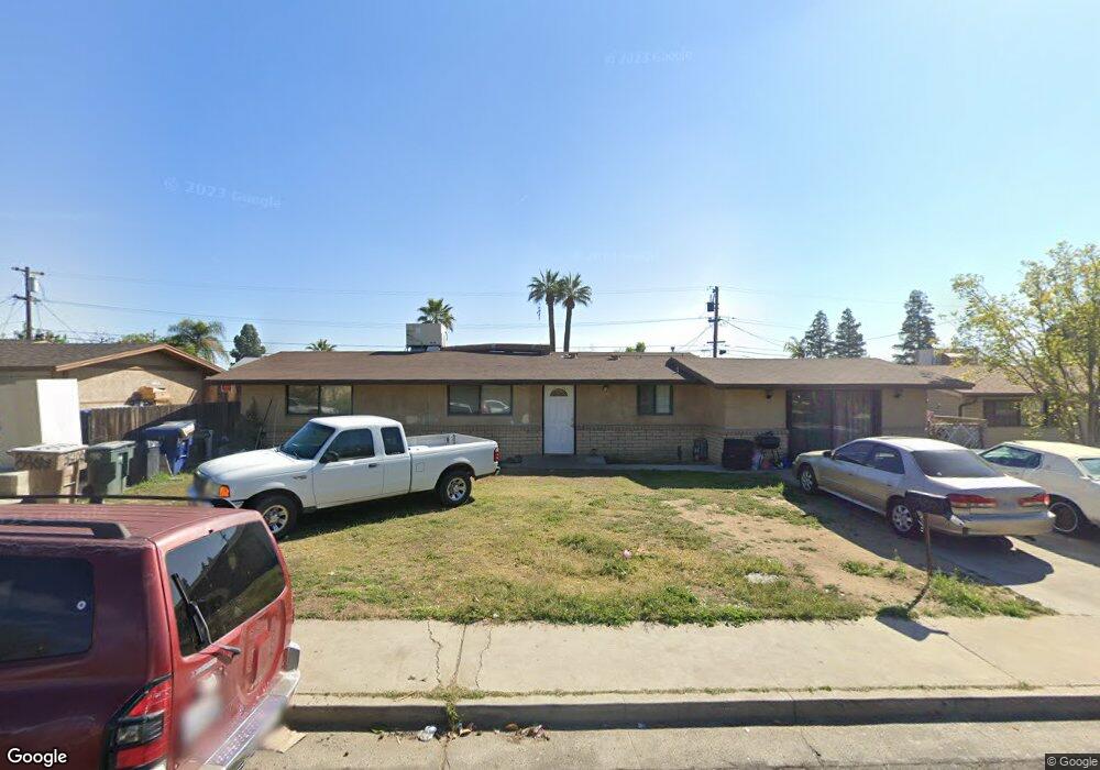
3407 Kaibab Ave Bakersfield, CA 93306
College Heights NeighborhoodEstimated Value: $289,362 - $365,000
3
Beds
2
Baths
1,504
Sq Ft
$213/Sq Ft
Est. Value
About This Home
This home is located at 3407 Kaibab Ave, Bakersfield, CA 93306 and is currently estimated at $320,341, approximately $212 per square foot. 3407 Kaibab Ave is a home located in Kern County with nearby schools including Colonel Howard Nichols Elementary School, Chipman Junior High School, and Highland High School.
Ownership History
Date
Name
Owned For
Owner Type
Purchase Details
Closed on
Apr 20, 2008
Sold by
Bonilla Maria D and Bonilla Manuel A
Bought by
Bank Of New York and Cwabs Inc Asset Backed Certificates Seri
Current Estimated Value
Purchase Details
Closed on
Oct 13, 2005
Sold by
Graham Paul and Graham Amy
Bought by
Bonilla Manuel and Bonilla Maria
Home Financials for this Owner
Home Financials are based on the most recent Mortgage that was taken out on this home.
Original Mortgage
$50,000
Interest Rate
5.93%
Mortgage Type
Stand Alone Second
Create a Home Valuation Report for This Property
The Home Valuation Report is an in-depth analysis detailing your home's value as well as a comparison with similar homes in the area
Home Values in the Area
Average Home Value in this Area
Purchase History
| Date | Buyer | Sale Price | Title Company |
|---|---|---|---|
| Bank Of New York | $112,000 | Landsafe Title | |
| Bonilla Manuel | $250,000 | -- | |
| Graham Paul | -- | -- |
Source: Public Records
Mortgage History
| Date | Status | Borrower | Loan Amount |
|---|---|---|---|
| Previous Owner | Bonilla Manuel | $50,000 | |
| Previous Owner | Graham Paul | $200,000 |
Source: Public Records
Tax History Compared to Growth
Tax History
| Year | Tax Paid | Tax Assessment Tax Assessment Total Assessment is a certain percentage of the fair market value that is determined by local assessors to be the total taxable value of land and additions on the property. | Land | Improvement |
|---|---|---|---|---|
| 2025 | $1,866 | $100,426 | $25,745 | $74,681 |
| 2024 | $1,822 | $98,458 | $25,241 | $73,217 |
| 2023 | $1,822 | $96,529 | $24,747 | $71,782 |
| 2022 | $1,770 | $94,637 | $24,262 | $70,375 |
| 2021 | $1,668 | $92,783 | $23,787 | $68,996 |
| 2020 | $1,633 | $91,833 | $23,544 | $68,289 |
| 2019 | $1,601 | $91,833 | $23,544 | $68,289 |
| 2018 | $1,567 | $88,269 | $22,631 | $65,638 |
| 2017 | $1,556 | $86,539 | $22,188 | $64,351 |
| 2016 | $1,445 | $84,843 | $21,753 | $63,090 |
Source: Public Records
Map
Nearby Homes
- 3200 University Ave
- 3221 Colgate Ln
- 3609 Cardinal Ave
- 3618 Redlands Dr
- 3119 University Ave
- 3206 Candlewood Dr
- 3818 Harvard Dr
- 3413 Redlands Dr
- 4200 Columbus St
- 3712 Harvard Dr
- 4019 Columbus St
- 3800 Columbus St
- 3613 Fleetwood Way
- 3706 Rampart St
- 3601 Harvard Dr
- 2801 Kaibab Ave
- 2818 San Pablo Ave
- 2913 Harmony Dr
- 2901 Dwight St
- 3019 Christmas Tree Ln
- 3413 Kaibab Ave
- 3401 Kaibab Ave
- 3406 Blade Ave
- 3412 Blade Ave
- 3400 Blade Ave
- 3319 Kaibab Ave
- 3419 Kaibab Ave
- 3406 Kaibab Ave
- 3400 Kaibab Ave
- 3412 Kaibab Ave
- 3318 Blade Ave
- 3418 Blade Ave
- 3318 Kaibab Ave
- 3418 Kaibab Ave
- 3313 Kaibab Ave
- 3312 Blade Ave
- 3312 Kaibab Ave
- 3407 Blade Ave
- 3401 Blade Ave
- 3413 Blade Ave