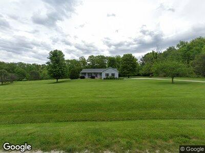
3407 Shady Point Ln Waverly, IL 62692
Estimated Value: $141,000 - $487,565
--
Bed
--
Bath
--
Sq Ft
8
Acres
About This Home
This home is located at 3407 Shady Point Ln, Waverly, IL 62692 and is currently estimated at $313,891. 3407 Shady Point Ln is a home located in Morgan County with nearby schools including Waverly Elementary School and Waverly Junior/Senior High School.
Ownership History
Date
Name
Owned For
Owner Type
Purchase Details
Closed on
Apr 25, 2008
Sold by
Grapes Charles A and Schroll Grapes Cynthia
Bought by
Grapes Charles A and Schroll Grapes Cynthia
Current Estimated Value
Home Financials for this Owner
Home Financials are based on the most recent Mortgage that was taken out on this home.
Original Mortgage
$187,650
Interest Rate
5.88%
Mortgage Type
New Conventional
Purchase Details
Closed on
Feb 12, 2007
Sold by
Grapes Charles A and Schroll Grapes Cythia
Bought by
Grapes Charles A and Schroll Grapes Cynthia
Create a Home Valuation Report for This Property
The Home Valuation Report is an in-depth analysis detailing your home's value as well as a comparison with similar homes in the area
Home Values in the Area
Average Home Value in this Area
Purchase History
| Date | Buyer | Sale Price | Title Company |
|---|---|---|---|
| Grapes Charles A | -- | None Available | |
| Grapes Charles A | -- | None Available |
Source: Public Records
Mortgage History
| Date | Status | Borrower | Loan Amount |
|---|---|---|---|
| Closed | Grapes Charles A | $180,800 | |
| Closed | Grapes Charles A | $172,978 | |
| Closed | Grapes Charles A | $24,500 | |
| Closed | Grapes Charles A | $187,650 | |
| Closed | Grapes Charles A | $212,500 | |
| Closed | Grapes Charles A | $188,000 |
Source: Public Records
Tax History Compared to Growth
Tax History
| Year | Tax Paid | Tax Assessment Tax Assessment Total Assessment is a certain percentage of the fair market value that is determined by local assessors to be the total taxable value of land and additions on the property. | Land | Improvement |
|---|---|---|---|---|
| 2023 | $5,627 | $75,260 | $18,800 | $56,460 |
| 2022 | $3,474 | $75,260 | $18,800 | $56,460 |
| 2021 | $4,693 | $73,300 | $18,800 | $54,500 |
| 2020 | $4,029 | $60,310 | $10,740 | $49,570 |
| 2019 | $3,947 | $58,870 | $10,740 | $48,130 |
| 2018 | $3,928 | $58,870 | $10,740 | $48,130 |
| 2017 | $4,127 | $61,970 | $11,310 | $50,660 |
| 2016 | $4,196 | $61,970 | $11,310 | $50,660 |
| 2015 | $4,229 | $61,970 | $11,310 | $50,660 |
| 2014 | $4,229 | $60,760 | $11,090 | $49,670 |
| 2013 | $4,193 | $60,760 | $11,090 | $49,670 |
Source: Public Records
Map
Nearby Homes
- 35545 Route 111
- 155 E Brown St
- 112 S Miller St
- 335 E Elm St
- 547 Seiz Rd
- Lots 2-4 Barton St
- 102 W Grand St
- 32624 Route 111
- 0 Nortonville Blacktop
- 10582 Main St
- 2976 State Highway 104
- 2977 Cheyenne Cir
- 204 E Prairie St
- 212 Main St
- 10570 Waverly Rd
- 16 Centennial
- 15674 N Lake Rd
- 15932 Spruce Ln
- 30342 Cedar Ln
- Lots 8-10 W Dean St