Estimated Value: $295,000 - $326,919
3
Beds
3
Baths
1,337
Sq Ft
$233/Sq Ft
Est. Value
About This Home
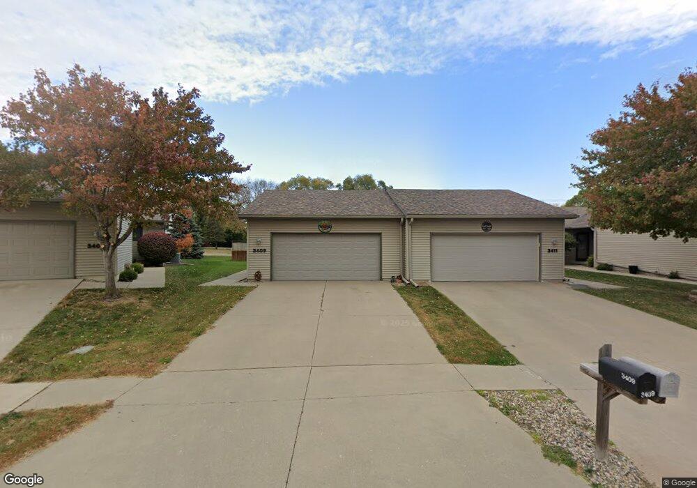
This home is located at 3409 Polaris Dr, Ames, IA 50010 and is currently estimated at $311,480, approximately $232 per square foot. 3409 Polaris Dr is a home located in Story County with nearby schools including Fellows Elementary School, Ames Middle School, and Ames High School.
Ownership History
Date
Name
Owned For
Owner Type
Purchase Details
Closed on
Jul 30, 2014
Sold by
Brenner Karen D
Bought by
Smith Valerie Lynn
Current Estimated Value
Home Financials for this Owner
Home Financials are based on the most recent Mortgage that was taken out on this home.
Original Mortgage
$178,600
Outstanding Balance
$56,665
Interest Rate
4.15%
Mortgage Type
New Conventional
Estimated Equity
$254,815
Purchase Details
Closed on
Feb 27, 2013
Sold by
Ballantine Laura A
Bought by
Brenner Karen D
Home Financials for this Owner
Home Financials are based on the most recent Mortgage that was taken out on this home.
Original Mortgage
$165,600
Interest Rate
3.34%
Mortgage Type
New Conventional
Purchase Details
Closed on
Jun 1, 2010
Sold by
H & B Properties Llc
Bought by
Brenner Karen Denise and Ballantine Laura A
Home Financials for this Owner
Home Financials are based on the most recent Mortgage that was taken out on this home.
Original Mortgage
$165,600
Interest Rate
5.13%
Mortgage Type
New Conventional
Create a Home Valuation Report for This Property
The Home Valuation Report is an in-depth analysis detailing your home's value as well as a comparison with similar homes in the area
Home Values in the Area
Average Home Value in this Area
Purchase History
| Date | Buyer | Sale Price | Title Company |
|---|---|---|---|
| Smith Valerie Lynn | $188,000 | None Available | |
| Brenner Karen D | -- | None Available | |
| Brenner Karen Denise | $184,000 | -- |
Source: Public Records
Mortgage History
| Date | Status | Borrower | Loan Amount |
|---|---|---|---|
| Open | Smith Valerie Lynn | $178,600 | |
| Previous Owner | Brenner Karen D | $165,600 | |
| Previous Owner | Brenner Karen Denise | $165,600 |
Source: Public Records
Tax History Compared to Growth
Tax History
| Year | Tax Paid | Tax Assessment Tax Assessment Total Assessment is a certain percentage of the fair market value that is determined by local assessors to be the total taxable value of land and additions on the property. | Land | Improvement |
|---|---|---|---|---|
| 2025 | $4,516 | $323,600 | $32,200 | $291,400 |
| 2024 | $4,418 | $321,500 | $55,800 | $265,700 |
| 2023 | $3,604 | $321,500 | $55,800 | $265,700 |
| 2022 | $3,558 | $223,100 | $55,800 | $167,300 |
| 2021 | $3,734 | $223,100 | $55,800 | $167,300 |
| 2020 | $3,678 | $220,900 | $55,200 | $165,700 |
| 2019 | $3,678 | $220,900 | $55,200 | $165,700 |
| 2018 | $3,706 | $220,900 | $55,200 | $165,700 |
| 2017 | $3,706 | $220,900 | $55,200 | $165,700 |
| 2016 | $3,482 | $206,400 | $24,100 | $182,300 |
| 2015 | $3,482 | $206,400 | $24,100 | $182,300 |
| 2014 | $3,310 | $192,900 | $22,400 | $170,500 |
Source: Public Records
Map
Nearby Homes
- 3500 Grand Ave
- 3917 Fletcher Ct
- 2003 Polk Dr
- 3814 Brookdale Ave
- 1216 26th St
- 1636 Johnson St
- 435 25th St
- 532 W Riverside Rd
- 4882 Copperstone Dr
- 2133 Polk Dr
- 2112 Furman Dr
- 2403 Clayton Dr
- 2425 Dalton Cir
- 2516 Somerset Dr
- 132 24th St
- 1310 20th St
- 0 Hyde Ave
- 619 18th St
- 2511 Bristol Dr Unit 204
- 1804 Wilson Ave
- 3411 Polaris Dr
- 3407 Polaris Dr
- 3413 Polaris Dr
- 3405 Polaris Dr
- 3415 Polaris Dr
- 3417 Polaris Dr
- 3403 Polaris Dr
- 3401 Polaris Dr
- 3419 Polaris Dr
- 3319 Polaris Dr
- 3317 Polaris Dr
- 1012 Top O Hollow Rd
- 1012 Top O Hollow Rd Unit Top-o
- 908 Top O Hollow Rd
- 3315 Polaris Dr
- 1022 Top O Hollow Rd
- 3330 Jefferson Cir
- 3336 Jefferson Cir
- 908 Top-O-hollow Rd
- 906 Top O Hollow Rd