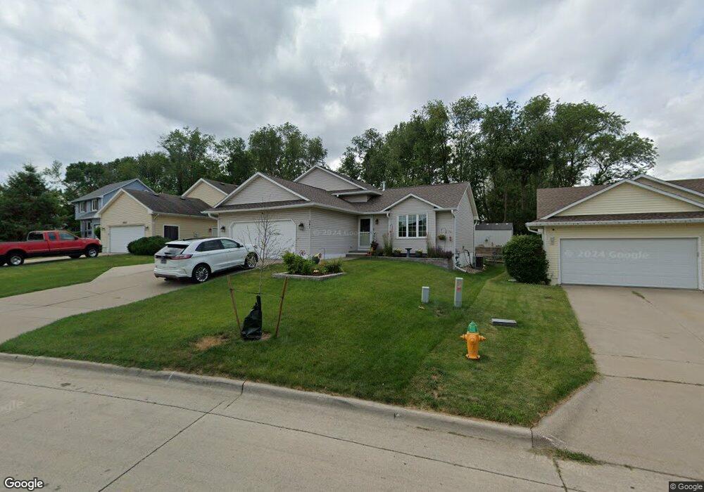
341 E Burnham Ave Des Moines, IA 50315
South Central DSM NeighborhoodEstimated Value: $237,000 - $293,000
4
Beds
2
Baths
1,208
Sq Ft
$229/Sq Ft
Est. Value
About This Home
This home is located at 341 E Burnham Ave, Des Moines, IA 50315 and is currently estimated at $276,189, approximately $228 per square foot. 341 E Burnham Ave is a home located in Polk County with nearby schools including Morris Elementary School, Mccombs Middle School, and Lincoln High School.
Ownership History
Date
Name
Owned For
Owner Type
Purchase Details
Closed on
Mar 17, 2010
Sold by
Graeve Dale E and Graeve Melissa M
Bought by
Herzog John A and Herzog Kristine A
Current Estimated Value
Home Financials for this Owner
Home Financials are based on the most recent Mortgage that was taken out on this home.
Original Mortgage
$158,574
Outstanding Balance
$107,387
Interest Rate
5.5%
Mortgage Type
FHA
Estimated Equity
$168,802
Purchase Details
Closed on
Nov 11, 1997
Sold by
Clarke Company Ltd
Bought by
Graeve Dale E and Graeve Melissa M
Home Financials for this Owner
Home Financials are based on the most recent Mortgage that was taken out on this home.
Original Mortgage
$127,650
Interest Rate
7.43%
Create a Home Valuation Report for This Property
The Home Valuation Report is an in-depth analysis detailing your home's value as well as a comparison with similar homes in the area
Home Values in the Area
Average Home Value in this Area
Purchase History
We collect this data history from publicly available records. To have your information removed, we recommend requesting removal directly through your county’s website.
| Date | Buyer | Sale Price | Title Company |
|---|---|---|---|
| Herzog John A | $161,000 | None Available | |
| Graeve Dale E | $134,000 | -- |
Source: Public Records
Mortgage History
We collect this data history from publicly available records. To have your information removed, we recommend requesting removal directly through your county’s website.
| Date | Status | Borrower | Loan Amount |
|---|---|---|---|
| Open | Herzog John A | $158,574 | |
| Previous Owner | Graeve Dale E | $127,650 |
Source: Public Records
Tax History
| Year | Tax Paid | Tax Assessment Tax Assessment Total Assessment is a certain percentage of the fair market value that is determined by local assessors to be the total taxable value of land and additions on the property. | Land | Improvement |
|---|---|---|---|---|
| 2025 | $4,874 | $307,800 | $50,400 | $257,400 |
| 2024 | $4,874 | $252,300 | $43,400 | $208,900 |
| 2023 | $4,506 | $258,200 | $43,400 | $214,800 |
| 2022 | $4,470 | $200,100 | $35,200 | $164,900 |
| 2021 | $4,462 | $200,100 | $35,200 | $164,900 |
| 2020 | $4,630 | $187,400 | $32,900 | $154,500 |
| 2019 | $4,764 | $187,400 | $32,900 | $154,500 |
| 2018 | $4,710 | $185,800 | $31,200 | $154,600 |
| 2017 | $4,456 | $185,800 | $31,200 | $154,600 |
| 2016 | $4,336 | $173,300 | $28,700 | $144,600 |
| 2015 | $4,336 | $173,300 | $28,700 | $144,600 |
| 2014 | $3,886 | $160,700 | $26,300 | $134,400 |
Source: Public Records
Map
Nearby Homes
- 6718 SE 2nd Ct
- 6208 SE 2nd St
- 6022 SE 4th St
- 6219 S Union St
- 6200 S Union St
- 433 E Payton Ave
- 7807 SE 2nd St
- 154 Crossroads Dr
- 603 Lally St
- 7913 SE 1st Ct
- 439 E Porter Ave
- 5805 SW 4th St
- 722 E Diehl Ave
- 817 E Diehl Ave
- 721 E Porter Ave
- 6006 SW 7th St
- 5501 S Union St
- 303 Porter Ave
- 7301 SE 14th St
- 1017 Geil Ave
- 319 E Burnham Ave
- 325 E Burnham Ave
- 313 E Burnham Ave
- 307 E Burnham Ave
- 335 E Burnham Ave
- 316 E Burnham Ave
- 312 E Burnham Ave
- 320 E Burnham Ave
- 306 E Burnham Ave
- 301 E Burnham Ave
- 324 E Burnham Ave
- 6800 SE 4th St
- 300 E Burnham Ave
- 328 E Burnham Ave
- 235 E Burnham Ave
- 6806 SE 4th St
- 336 E Burnham Ave
- 340 E Burnham Ave
- 6707 SE 3rd St
- 231 E Burnham Ave
Your Personal Tour Guide
Ask me questions while you tour the home.