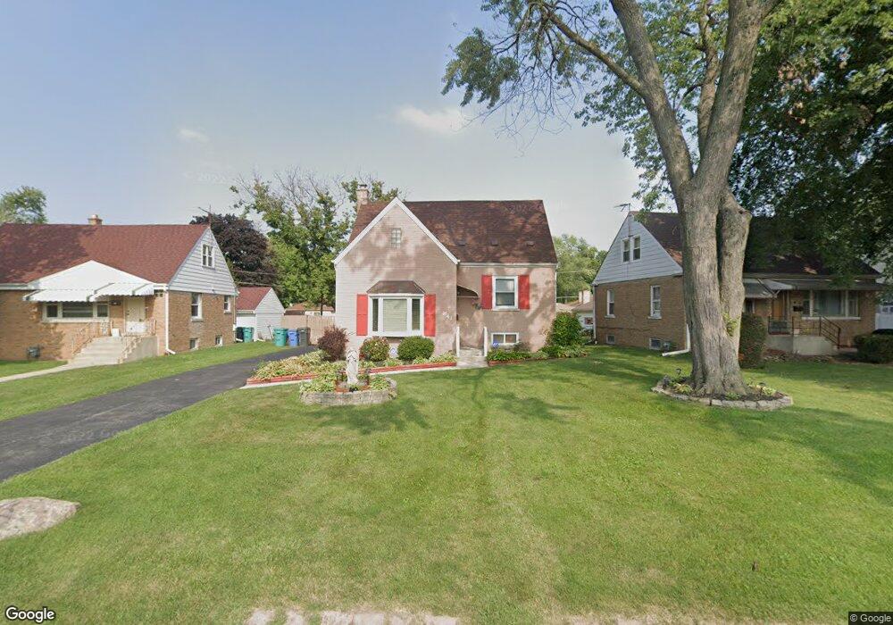
341 High Ridge Rd Hillside, IL 60162
Estimated Value: $254,545 - $345,000
2
Beds
2
Baths
862
Sq Ft
$335/Sq Ft
Est. Value
About This Home
This home is located at 341 High Ridge Rd, Hillside, IL 60162 and is currently estimated at $289,136, approximately $335 per square foot. 341 High Ridge Rd is a home located in Cook County with nearby schools including Hillside Elementary School, Proviso West High School, and Meca Elementary School.
Ownership History
Date
Name
Owned For
Owner Type
Purchase Details
Closed on
Oct 30, 2015
Sold by
Gonzalez Rogelio T and Cedeno Laura E
Bought by
Cedeno Laura E
Current Estimated Value
Purchase Details
Closed on
Dec 6, 2004
Sold by
Harlin Thomas M and Busch Harlin Patricia
Bought by
Gonzalez Rogelio and Cedeno Laura E
Home Financials for this Owner
Home Financials are based on the most recent Mortgage that was taken out on this home.
Original Mortgage
$198,400
Outstanding Balance
$95,790
Interest Rate
5.5%
Mortgage Type
Unknown
Estimated Equity
$193,346
Create a Home Valuation Report for This Property
The Home Valuation Report is an in-depth analysis detailing your home's value as well as a comparison with similar homes in the area
Home Values in the Area
Average Home Value in this Area
Purchase History
| Date | Buyer | Sale Price | Title Company |
|---|---|---|---|
| Cedeno Laura E | -- | Attorney | |
| Gonzalez Rogelio | $249,000 | Multiple |
Source: Public Records
Mortgage History
| Date | Status | Borrower | Loan Amount |
|---|---|---|---|
| Open | Gonzalez Rogelio | $198,400 | |
| Closed | Gonzalez Rogelio | $37,200 |
Source: Public Records
Tax History
| Year | Tax Paid | Tax Assessment Tax Assessment Total Assessment is a certain percentage of the fair market value that is determined by local assessors to be the total taxable value of land and additions on the property. | Land | Improvement |
|---|---|---|---|---|
| 2025 | $5,739 | $18,108 | $4,022 | $14,086 |
| 2024 | $5,739 | $18,108 | $4,022 | $14,086 |
| 2023 | $4,716 | $20,000 | $4,022 | $15,978 |
| 2022 | $4,716 | $16,061 | $2,742 | $13,319 |
| 2021 | $4,659 | $16,060 | $2,742 | $13,318 |
| 2020 | $5,175 | $17,513 | $2,742 | $14,771 |
| 2019 | $3,252 | $12,226 | $2,559 | $9,667 |
| 2018 | $3,564 | $12,581 | $2,559 | $10,022 |
| 2017 | $3,447 | $12,581 | $2,559 | $10,022 |
| 2016 | $3,035 | $10,433 | $2,376 | $8,057 |
| 2015 | $2,890 | $10,433 | $2,376 | $8,057 |
| 2014 | $2,837 | $10,433 | $2,376 | $8,057 |
| 2013 | $3,409 | $12,964 | $2,376 | $10,588 |
Source: Public Records
Map
Nearby Homes
- 311 Buckthorn Ln
- 500 N Laverne Ave
- 605 N Wolf Rd Unit B9
- 326 N Forest Ave
- 226 N Lind Ave
- 70 N Laverne Ave
- 4353 Butterfield Rd
- 512 50th Ave
- 250 N Irving Ave
- 504 N Irving Ave
- 768 N Rohde Ave
- 540 47th Ave
- 4904 W Hawthorne Ave
- 4938 W Randolph St
- 4929 W Randolph St
- 1529 N Hillside Ave
- 1426 N Rohde Ave
- 429 Geneva Ave
- 443 Granville Ave
- 241 48th Ave
- 345 High Ridge Rd
- 333 High Ridge Rd
- 342 Clayton Ave
- 338 Clayton Ave
- 346 Clayton Ave
- 334 Clayton Ave
- 401 High Ridge Rd
- 330 Clayton Ave
- 340 High Ridge Rd
- 346 High Ridge Rd
- 325 High Ridge Rd
- 336 High Ridge Rd
- 400 Clayton Ave
- 326 Clayton Ave
- 406 Clayton Ave
- 406 Clayton Ave
- 332 High Ridge Rd
- 405 High Ridge Rd
- 321 High Ridge Rd
Your Personal Tour Guide
Ask me questions while you tour the home.