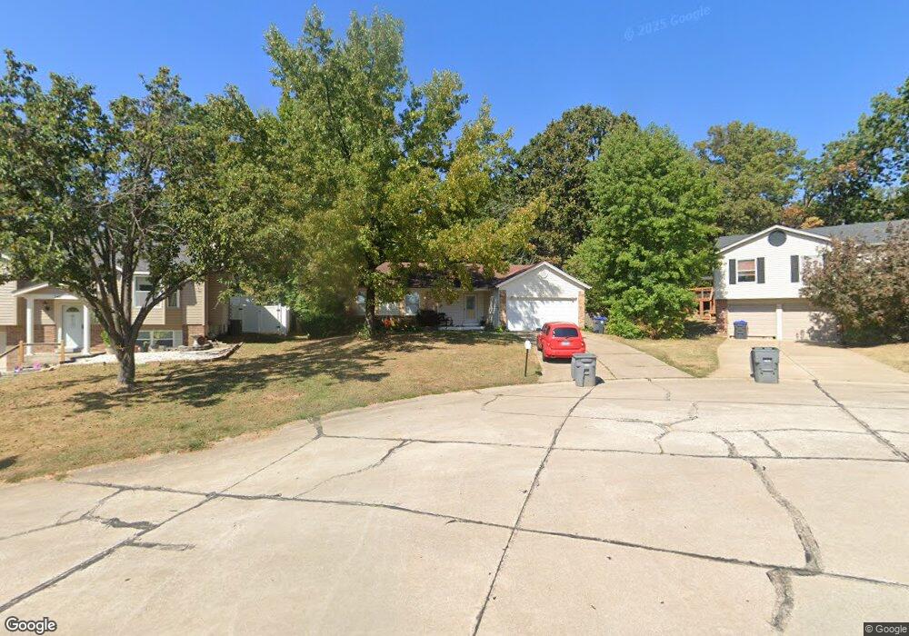
341 Westbrook Dr O Fallon, MO 63366
Estimated Value: $299,614 - $314,000
3
Beds
2
Baths
1,304
Sq Ft
$237/Sq Ft
Est. Value
About This Home
This home is located at 341 Westbrook Dr, O Fallon, MO 63366 and is currently estimated at $309,404, approximately $237 per square foot. 341 Westbrook Dr is a home located in St. Charles County with nearby schools including Joseph L. Mudd Elementary School, Forest Park Elementary School, and Fort Zumwalt North Middle School.
Ownership History
Date
Name
Owned For
Owner Type
Purchase Details
Closed on
Aug 21, 2009
Sold by
Brooks Barbara S
Bought by
Harvey Linton and Harvey Chermeka
Current Estimated Value
Home Financials for this Owner
Home Financials are based on the most recent Mortgage that was taken out on this home.
Original Mortgage
$132,554
Outstanding Balance
$86,205
Interest Rate
5.16%
Mortgage Type
FHA
Estimated Equity
$223,199
Purchase Details
Closed on
Feb 5, 2001
Sold by
Hassler Valerie and Hassler Wayne
Bought by
Brooks Barbara and Brooks Barbara S
Home Financials for this Owner
Home Financials are based on the most recent Mortgage that was taken out on this home.
Original Mortgage
$106,400
Interest Rate
9.99%
Purchase Details
Closed on
Oct 12, 1998
Sold by
Hassler Bruce A Lillie
Bought by
Hassler Valerie
Purchase Details
Closed on
Jan 8, 1998
Sold by
Fry Arline M and Fiedler Arline M
Bought by
Arline M Fiedlers Living Trust
Create a Home Valuation Report for This Property
The Home Valuation Report is an in-depth analysis detailing your home's value as well as a comparison with similar homes in the area
Home Values in the Area
Average Home Value in this Area
Purchase History
| Date | Buyer | Sale Price | Title Company |
|---|---|---|---|
| Harvey Linton | $135,000 | Ust | |
| Brooks Barbara | -- | -- | |
| Hassler Valerie | -- | -- | |
| Arline M Fiedlers Living Trust | -- | -- |
Source: Public Records
Mortgage History
| Date | Status | Borrower | Loan Amount |
|---|---|---|---|
| Open | Harvey Linton | $132,554 | |
| Previous Owner | Brooks Barbara | $106,400 |
Source: Public Records
Tax History
| Year | Tax Paid | Tax Assessment Tax Assessment Total Assessment is a certain percentage of the fair market value that is determined by local assessors to be the total taxable value of land and additions on the property. | Land | Improvement |
|---|---|---|---|---|
| 2025 | $2,966 | $49,086 | -- | -- |
| 2023 | $2,967 | $44,679 | $0 | $0 |
| 2022 | $2,790 | $39,072 | $0 | $0 |
| 2021 | $2,792 | $39,072 | $0 | $0 |
| 2020 | $2,515 | $34,105 | $0 | $0 |
| 2019 | $2,521 | $34,105 | $0 | $0 |
| 2018 | $2,333 | $30,120 | $0 | $0 |
| 2017 | $2,298 | $30,120 | $0 | $0 |
| 2016 | $2,165 | $28,263 | $0 | $0 |
| 2015 | $2,013 | $28,263 | $0 | $0 |
| 2014 | $2,129 | $29,409 | $0 | $0 |
Source: Public Records
Map
Nearby Homes
- 734 Sunset Ln
- 0 Montbrook Dr
- 731 Cordes St
- 24 Hawthorne Ct
- 503 Imperial Ct
- 6 Emerson Ct
- 849 Elaine Dr
- 151 N Wellington St
- 4 Shinnecock Hills
- 205 E Elm St
- 11 Southern Hills Ct
- 309 E Pitman St
- 10 Southern Hills Ct
- 962 Midpoint Dr
- 6 S Boxwood Ln
- 203 Saint Margaret Ln
- 201 Allen Dr
- 713 Plaza Dr
- 1117 Turtle Creek Dr
- 127 Columbia Meadows Ln
- 337 Westbrook Dr
- 93 Westbrook Dr
- 349 Westbrook Dr
- 333 Westbrook Dr
- 336 Westbrook Dr
- 329 Westbrook Dr
- 353 Westbrook Dr
- 350 Westbrook Dr
- 325 Westbrook Dr
- 90 Westbrook Dr
- 322 Westbrook Dr
- 357 Westbrook Dr
- 354 Westbrook Dr
- 12 Autumn Grove Ct
- 91 Westbrook Dr
- 321 Westbrook Dr
- 318 Westbrook Dr
- 361 Westbrook Dr
- 360 Westbrook Dr
- 10 Autumn Grove Ct
Your Personal Tour Guide
Ask me questions while you tour the home.