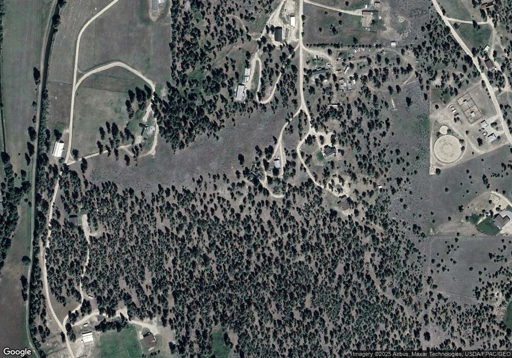
3412 Balsam Dr Stevensville, MT 59870
Estimated Value: $154,000 - $614,000
1
Bed
1
Bath
1,455
Sq Ft
$295/Sq Ft
Est. Value
About This Home
This home is located at 3412 Balsam Dr, Stevensville, MT 59870 and is currently estimated at $429,633, approximately $295 per square foot. 3412 Balsam Dr is a home located in Ravalli County with nearby schools including Stevensville Elementary School, Stevensville Junior High School, and Stevensville High School.
Ownership History
Date
Name
Owned For
Owner Type
Purchase Details
Closed on
Jul 16, 2021
Sold by
Hugene Rochon Daniel
Bought by
Brown Dalton M and Arne Jennifer R
Current Estimated Value
Home Financials for this Owner
Home Financials are based on the most recent Mortgage that was taken out on this home.
Original Mortgage
$148,000
Outstanding Balance
$111,655
Interest Rate
2.2%
Mortgage Type
New Conventional
Estimated Equity
$317,978
Purchase Details
Closed on
Dec 26, 2005
Bought by
Brown Denise M and Rochon Daniel Hugene
Create a Home Valuation Report for This Property
The Home Valuation Report is an in-depth analysis detailing your home's value as well as a comparison with similar homes in the area
Home Values in the Area
Average Home Value in this Area
Purchase History
| Date | Buyer | Sale Price | Title Company |
|---|---|---|---|
| Brown Dalton M | -- | None Listed On Document | |
| Brown Denise M | -- | -- |
Source: Public Records
Mortgage History
| Date | Status | Borrower | Loan Amount |
|---|---|---|---|
| Open | Brown Dalton M | $148,000 |
Source: Public Records
Tax History Compared to Growth
Tax History
| Year | Tax Paid | Tax Assessment Tax Assessment Total Assessment is a certain percentage of the fair market value that is determined by local assessors to be the total taxable value of land and additions on the property. | Land | Improvement |
|---|---|---|---|---|
| 2025 | $1,374 | $423,940 | $0 | $0 |
| 2024 | $1,997 | $356,840 | $0 | $0 |
| 2023 | $2,004 | $356,840 | $0 | $0 |
| 2022 | $1,563 | $224,600 | $0 | $0 |
| 2021 | $1,517 | $200,990 | $0 | $0 |
| 2020 | $1,410 | $179,000 | $0 | $0 |
| 2019 | $1,398 | $179,000 | $0 | $0 |
| 2018 | $1,282 | $171,400 | $0 | $0 |
| 2017 | $1,266 | $171,400 | $0 | $0 |
| 2016 | $1,087 | $147,800 | $0 | $0 |
| 2015 | $1,091 | $147,800 | $0 | $0 |
| 2014 | $1,191 | $96,300 | $0 | $0 |
Source: Public Records
Map
Nearby Homes
- 655 Treece Gulch Rd
- 2813 Pine Lakes Ct
- 763 S Sunset Bench Rd
- 2837 Caribou Ln
- 3542 Vista View Ct
- 804 Drift In
- 878 S Sunset Bench Rd
- 3682 Dietz Dr
- 1030 S Sunset Bench Rd
- 843 Lecoure Ln
- 1013 Majestic Pine Place
- 605 Groff Ln
- 3707 Eastside Hwy
- 586 Cash Nichols Rd
- 101 Binks Way Unit 19
- 211 Middle Burnt Fork Rd
- 3806 Eastside Hwy
- 3808 Eastside Hwy
- NHN Mystic River Rd
- 623 Park St Unit 3
- 3418 Balsam Dr
- 3428 Balsam Dr
- 3406 Balsam Dr
- 3435 Balsam Dr
- 3435 Balsam Dr
- 3430 Balsam Dr
- 3264 Snowflake Dr
- 3440 Balsam Dr
- 3454 Balsam Dr
- 3454 Balsam Dr
- 3414 Kinsler Ln
- 3459 Balsam Dr
- 3242 Snowflake Dr
- 543 Treece Gulch Rd
- Nhn Snowflake Dr
- 520 Treece Gulch Rd
- 3469 Balsam Dr
- 501 Treece Gulch Rd
- 512 Treece Gulch Rd
- 3312 Newsom Ln
