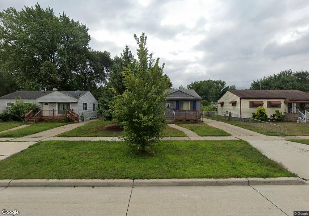
3412 Toepfer Rd Warren, MI 48091
Southwest Warren NeighborhoodEstimated Value: $148,000 - $185,000
--
Bed
2
Baths
1,424
Sq Ft
$114/Sq Ft
Est. Value
About This Home
This home is located at 3412 Toepfer Rd, Warren, MI 48091 and is currently estimated at $162,018, approximately $113 per square foot. 3412 Toepfer Rd is a home located in Macomb County with nearby schools including Schofield Elementary School, Mound Park Elementary School, and Westview Elementary School.
Ownership History
Date
Name
Owned For
Owner Type
Purchase Details
Closed on
Aug 24, 2001
Sold by
Sia Roniel C
Bought by
Gray Pamela M
Current Estimated Value
Purchase Details
Closed on
Dec 22, 1994
Sold by
Cook Sheila L
Bought by
Cook Sheila L and Sia Marieta
Home Financials for this Owner
Home Financials are based on the most recent Mortgage that was taken out on this home.
Original Mortgage
$59,969
Interest Rate
9.27%
Mortgage Type
FHA
Create a Home Valuation Report for This Property
The Home Valuation Report is an in-depth analysis detailing your home's value as well as a comparison with similar homes in the area
Home Values in the Area
Average Home Value in this Area
Purchase History
| Date | Buyer | Sale Price | Title Company |
|---|---|---|---|
| Gray Pamela M | $109,000 | -- | |
| Cook Sheila L | $59,900 | -- |
Source: Public Records
Mortgage History
| Date | Status | Borrower | Loan Amount |
|---|---|---|---|
| Previous Owner | Cook Sheila L | $59,969 |
Source: Public Records
Tax History Compared to Growth
Tax History
| Year | Tax Paid | Tax Assessment Tax Assessment Total Assessment is a certain percentage of the fair market value that is determined by local assessors to be the total taxable value of land and additions on the property. | Land | Improvement |
|---|---|---|---|---|
| 2025 | $1,360 | $71,170 | $0 | $0 |
| 2024 | $1,323 | $60,380 | $0 | $0 |
| 2023 | $1,251 | $44,860 | $0 | $0 |
| 2022 | $1,182 | $38,380 | $0 | $0 |
| 2021 | $1,228 | $36,220 | $0 | $0 |
| 2020 | $1,174 | $32,790 | $0 | $0 |
| 2019 | $1,104 | $29,190 | $0 | $0 |
| 2018 | $31 | $24,930 | $0 | $0 |
| 2017 | $1,046 | $24,380 | $2,990 | $21,390 |
| 2016 | $1,022 | $24,380 | $0 | $0 |
| 2015 | -- | $22,580 | $0 | $0 |
| 2013 | $2,042 | $19,040 | $0 | $0 |
Source: Public Records
Map
Nearby Homes
- 3167 Berkshire Ave
- 3701 Berkshire Ave
- 3168 Berkshire Ave
- 3925 Toepfer Rd
- 3228 Rome Ave
- 3754 Wasmund Ave
- 2746 John B Ave
- 21299 Sunset Ave
- 2195 Michael Ave
- 3590 Dallas Ave
- 23420 Harned St Unit 1
- 23428 Harned St Unit 2
- 3616 Dallas Ave
- 23421 Harned St Unit 4
- 20499 Yonka St
- 2135 Jarvis Ave
- 2144 Pearl Ave
- 22321 Logue Ave
- 2216 Goulson Ave
- 2000 Pearl Ave
- 3424 Toepfer Rd
- 3356 Toepfer Rd
- 3436 Toepfer Rd
- 3344 Toepfer Rd
- 3401 Poplar Ave
- 3423 Poplar Ave
- 3379 Poplar Ave
- 3448 Toepfer Rd
- 3332 Toepfer Rd
- 3357 Poplar Ave
- 3411 Toepfer Rd
- 3357 Toepfer Rd
- 3423 Toepfer Rd
- 3322 Toepfer Rd
- 3506 Toepfer Rd Unit Bldg-Unit
- 3506 Toepfer Rd
- 3345 Toepfer Rd
- 3435 Toepfer Rd
- 3339 Poplar Ave
- 3485 Poplar Ave