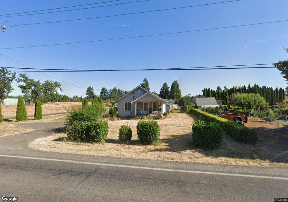
34161 E Cloverdale Rd Creswell, OR 97426
Estimated Value: $273,000 - $486,000
2
Beds
1
Bath
1,112
Sq Ft
$336/Sq Ft
Est. Value
About This Home
This home is located at 34161 E Cloverdale Rd, Creswell, OR 97426 and is currently estimated at $374,024, approximately $336 per square foot. 34161 E Cloverdale Rd is a home located in Lane County with nearby schools including Creslane Elementary School, Creswell Middle School, and Creswell High School.
Ownership History
Date
Name
Owned For
Owner Type
Purchase Details
Closed on
May 4, 2021
Sold by
Lose Phillip R and Lose Dorothy J
Bought by
Phillip R Lose & Nita Lose Living Trust and Lose
Current Estimated Value
Purchase Details
Closed on
Sep 12, 2011
Sold by
Lose Phillip R and Juanita Lose D
Bought by
Lose Phillip R and Lose Dorothy J
Home Financials for this Owner
Home Financials are based on the most recent Mortgage that was taken out on this home.
Original Mortgage
$90,000
Interest Rate
4.37%
Mortgage Type
New Conventional
Create a Home Valuation Report for This Property
The Home Valuation Report is an in-depth analysis detailing your home's value as well as a comparison with similar homes in the area
Home Values in the Area
Average Home Value in this Area
Purchase History
| Date | Buyer | Sale Price | Title Company |
|---|---|---|---|
| Phillip R Lose & Nita Lose Living Trust | -- | None Listed On Document | |
| Lose Phillip R | -- | Cascade Title Company |
Source: Public Records
Mortgage History
| Date | Status | Borrower | Loan Amount |
|---|---|---|---|
| Previous Owner | Lose Phillip R | $90,000 |
Source: Public Records
Tax History Compared to Growth
Tax History
| Year | Tax Paid | Tax Assessment Tax Assessment Total Assessment is a certain percentage of the fair market value that is determined by local assessors to be the total taxable value of land and additions on the property. | Land | Improvement |
|---|---|---|---|---|
| 2025 | $1,422 | $103,505 | -- | -- |
| 2024 | $1,002 | $100,491 | -- | -- |
| 2023 | $1,002 | $97,565 | $0 | $0 |
| 2022 | $1,116 | $94,724 | $0 | $0 |
| 2021 | $1,077 | $91,966 | $0 | $0 |
| 2020 | $1,065 | $89,288 | $0 | $0 |
| 2019 | $1,043 | $86,688 | $0 | $0 |
| 2018 | $1,032 | $81,713 | $0 | $0 |
| 2017 | $1,001 | $81,713 | $0 | $0 |
| 2016 | $1,037 | $79,333 | $0 | $0 |
| 2015 | $998 | $77,022 | $0 | $0 |
| 2014 | $994 | $74,779 | $0 | $0 |
Source: Public Records
Map
Nearby Homes
- 83 Sunday Dr
- 1765 Trevino Rd
- 0 River Dr
- 316 Sunday Dr
- 336 Sunday Dr
- 375 Sunday Dr
- 370 Magnolia Dr
- 491 Ironwood Loop
- 685 St Andrews Loop
- 700 N Mill St Unit 109
- 689 Blue Jay Loop
- 692 N 1st St
- 156 N 1st St
- 368 Hillegas Ave
- 0 Holbrook Ln Unit 339588620
- 589 Mary Neal Ln
- 1 Queens Ave Unit 1
- 521 S 7th St
- 645 Boulder Loop
- 82277 Davisson Rd
- 34175 E Cloverdale Rd
- 82970 Dale Kuni Rd
- 34157 E Cloverdale Rd
- 34159 E Cloverdale Rd
- 82998 Dale Kuni Rd
- 34162 E Cloverdale Rd
- 0 E Cloverdale Rd
- 34137 E Cloverdale Rd
- 34184 E Cloverdale Rd
- 83020 Dale Kuni Rd
- 82950 River Dr
- 51 Bobby Jones Ave
- 34121 E Cloverdale Rd
- 34118 E Cloverdale Rd
- 83026 Dale Kuni Rd
- 34223 E Cloverdale Rd
- 65 Bobby Jones Ave
- 66 Hagens Ct
- 34120 E Cloverdale Rd
- 83060 Dale Kuni Rd