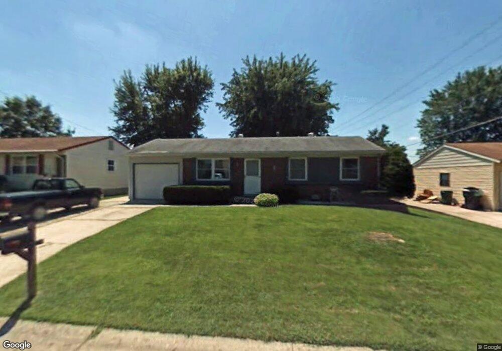
3417 Fleet Ln Saint Charles, MO 63301
Old Town Saint Charles NeighborhoodEstimated Value: $242,824 - $257,000
3
Beds
1
Bath
864
Sq Ft
$288/Sq Ft
Est. Value
About This Home
This home is located at 3417 Fleet Ln, Saint Charles, MO 63301 and is currently estimated at $248,706, approximately $287 per square foot. 3417 Fleet Ln is a home located in St. Charles County with nearby schools including Monroe Elementary School, Jefferson Intermediate School, and Hardin Middle School.
Ownership History
Date
Name
Owned For
Owner Type
Purchase Details
Closed on
Sep 17, 2025
Sold by
Bridget Theusch Trust and Theusch Bridget E
Bought by
Bridget Theusch Trust and Theusch
Current Estimated Value
Home Financials for this Owner
Home Financials are based on the most recent Mortgage that was taken out on this home.
Original Mortgage
$214,400
Outstanding Balance
$214,206
Interest Rate
6.5%
Mortgage Type
New Conventional
Estimated Equity
$34,500
Purchase Details
Closed on
Jan 23, 2025
Sold by
Theusch Bridget E
Bought by
Bridget Theusch Trust and Theusch
Purchase Details
Closed on
Jul 14, 2004
Sold by
Lahm Fred W and Lahm Christine E
Bought by
Theusch Bridget
Home Financials for this Owner
Home Financials are based on the most recent Mortgage that was taken out on this home.
Original Mortgage
$134,900
Interest Rate
6.26%
Mortgage Type
Purchase Money Mortgage
Purchase Details
Closed on
Sep 30, 1999
Sold by
Smith Dianne M and Smith Joseph
Bought by
Lahn Fred W and Lahn Christine E
Home Financials for this Owner
Home Financials are based on the most recent Mortgage that was taken out on this home.
Original Mortgage
$89,760
Interest Rate
8.02%
Mortgage Type
VA
Create a Home Valuation Report for This Property
The Home Valuation Report is an in-depth analysis detailing your home's value as well as a comparison with similar homes in the area
Home Values in the Area
Average Home Value in this Area
Purchase History
| Date | Buyer | Sale Price | Title Company |
|---|---|---|---|
| Bridget Theusch Trust | -- | None Listed On Document | |
| Bridget Theusch Trust | -- | None Listed On Document | |
| Theusch Bridget | $134,900 | Freedom Title | |
| Lahn Fred W | -- | -- |
Source: Public Records
Mortgage History
| Date | Status | Borrower | Loan Amount |
|---|---|---|---|
| Open | Bridget Theusch Trust | $214,400 | |
| Previous Owner | Theusch Bridget | $134,900 | |
| Previous Owner | Lahn Fred W | $89,760 |
Source: Public Records
Tax History
| Year | Tax Paid | Tax Assessment Tax Assessment Total Assessment is a certain percentage of the fair market value that is determined by local assessors to be the total taxable value of land and additions on the property. | Land | Improvement |
|---|---|---|---|---|
| 2025 | $2,390 | $38,644 | -- | -- |
| 2023 | $2,384 | $36,110 | $0 | $0 |
| 2022 | $2,147 | $30,202 | $0 | $0 |
| 2021 | $2,143 | $30,202 | $0 | $0 |
| 2020 | $1,911 | $26,211 | $0 | $0 |
| 2019 | $1,896 | $26,211 | $0 | $0 |
| 2018 | $1,814 | $24,010 | $0 | $0 |
| 2017 | $1,805 | $24,010 | $0 | $0 |
| 2016 | $1,734 | $23,079 | $0 | $0 |
| 2015 | $1,731 | $23,079 | $0 | $0 |
| 2014 | $1,635 | $21,489 | $0 | $0 |
Source: Public Records
Map
Nearby Homes
- 3407 Highgate Ln
- 3263 Janton Ln
- 710 Antler Ridge Dr
- 3051 Saint Daphne Dr
- 2876 Danube Way
- 160 Dornoch Dr
- 3321 Clemens Dr
- 2233 Campus Dr
- 2965 Landau Ct
- 3079 Shady Oak Dr Unit 15B
- 3031 Bluffwood Dr
- 3401 Droste Rd
- 3457 Truman Terrace Dr Unit 11
- 76 Ruth Dr
- 3508 Truman Terrace Dr Unit 55
- 3430 Riverchase Pkwy
- 3465 Foxborough Cir
- 3429 Riverchase Pkwy
- 21 Cambrian Way
- 3 Fairways Cir Unit J
Your Personal Tour Guide
Ask me questions while you tour the home.