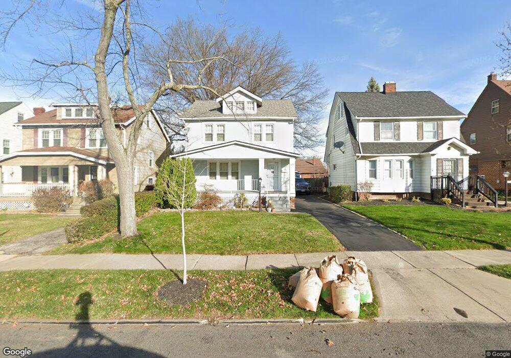
3417 Sylvanhurst Rd Cleveland, OH 44112
Monticello-Noble NeighborhoodEstimated Value: $128,362 - $162,000
4
Beds
2
Baths
1,471
Sq Ft
$98/Sq Ft
Est. Value
About This Home
This home is located at 3417 Sylvanhurst Rd, Cleveland, OH 44112 and is currently estimated at $144,841, approximately $98 per square foot. 3417 Sylvanhurst Rd is a home located in Cuyahoga County with nearby schools including Shaw High School, Apex Academy, and Citizens Academy.
Ownership History
Date
Name
Owned For
Owner Type
Purchase Details
Closed on
Feb 11, 2026
Sold by
Huffman Marcia and Huffman Luvenia
Bought by
Huffman Luvenia and Huffman Cornelius
Current Estimated Value
Purchase Details
Closed on
May 12, 1994
Sold by
Kritzer Larry
Bought by
Huffman Cornelius
Purchase Details
Closed on
May 28, 1993
Bought by
Kritzer Larry
Purchase Details
Closed on
Feb 24, 1993
Sold by
Gates Thaddeus E
Bought by
Ohio Savings Bank
Purchase Details
Closed on
Aug 12, 1980
Sold by
Stewart Carol J
Bought by
Gates Thaddeus E
Purchase Details
Closed on
Feb 28, 1979
Sold by
Stewart Jack E
Bought by
Stewart Carol J
Purchase Details
Closed on
Sep 29, 1975
Sold by
Malec William Frank and Malec Sarah
Bought by
Stewart Jack E
Purchase Details
Closed on
Jan 1, 1975
Bought by
Malec William Frank and Malec Sarah
Create a Home Valuation Report for This Property
The Home Valuation Report is an in-depth analysis detailing your home's value as well as a comparison with similar homes in the area
Home Values in the Area
Average Home Value in this Area
Purchase History
| Date | Buyer | Sale Price | Title Company |
|---|---|---|---|
| Huffman Luvenia | -- | None Listed On Document | |
| Huffman Cornelius | $72,900 | -- | |
| Kritzer Larry | $48,000 | -- | |
| Ohio Savings Bank | $38,000 | -- | |
| Gates Thaddeus E | $42,900 | -- | |
| Stewart Carol J | $26,200 | -- | |
| Stewart Jack E | $24,900 | -- | |
| Malec William Frank | -- | -- |
Source: Public Records
Tax History
| Year | Tax Paid | Tax Assessment Tax Assessment Total Assessment is a certain percentage of the fair market value that is determined by local assessors to be the total taxable value of land and additions on the property. | Land | Improvement |
|---|---|---|---|---|
| 2025 | $2,694 | $43,820 | $7,805 | $36,015 |
| 2024 | $2,694 | $43,820 | $7,805 | $36,015 |
| 2023 | $2,150 | $25,070 | $3,610 | $21,460 |
| 2022 | $2,143 | $25,060 | $3,610 | $21,460 |
| 2021 | $2,125 | $25,060 | $3,610 | $21,460 |
| 2020 | $2,080 | $22,580 | $3,260 | $19,320 |
| 2019 | $2,181 | $64,500 | $9,300 | $55,200 |
| 2018 | $2,261 | $22,580 | $3,260 | $19,320 |
| 2017 | $2,341 | $25,900 | $4,340 | $21,560 |
| 2016 | $2,356 | $25,900 | $4,340 | $21,560 |
| 2015 | $2,605 | $25,900 | $4,340 | $21,560 |
| 2014 | $2,605 | $31,230 | $5,220 | $26,010 |
Source: Public Records
Map
Nearby Homes
- 3377 Lownesdale Rd
- 1073 Woodview Rd
- 1005 Woodview Rd
- 1068 Nela View Rd
- 2370 N Taylor Rd
- 3513 Boynton Rd
- 945 Nela View Rd
- 924 Greyton Rd
- 1151 Haselton Rd
- 1033 Rushleigh Rd
- 907 Nela View Rd
- 917 Helmsdale Rd
- 967 Pembrook Rd
- 2145 N Taylor Rd
- 2137 N Taylor Rd
- 980 Brunswick Rd
- 971 Rushleigh Rd
- 994 Yellowstone Rd
- 1231 Hereford Rd
- 941 Dresden Rd
- 3415 Sylvanhurst Rd
- 3419 Sylvanhurst Rd
- 3423 Sylvanhurst Rd
- 3407 Sylvanhurst Rd
- 3427 Sylvanhurst Rd
- 3414 Lownesdale Rd
- 3403 Sylvanhurst Rd
- 3410 Lownesdale Rd
- 3418 Lownesdale Rd
- 3422 Lownesdale Rd
- 3406 Lownesdale Rd
- 3431 Sylvanhurst Rd
- 3399 Sylvanhurst Rd
- 3424 Lownesdale Rd
- 3418 Sylvanhurst Rd
- 3402 Lownesdale Rd
- 3410 Sylvanhurst Rd
- 3422 Sylvanhurst Rd
- 3406 Sylvanhurst Rd
- 3398 Lownesdale Rd
Your Personal Tour Guide
Ask me questions while you tour the home.