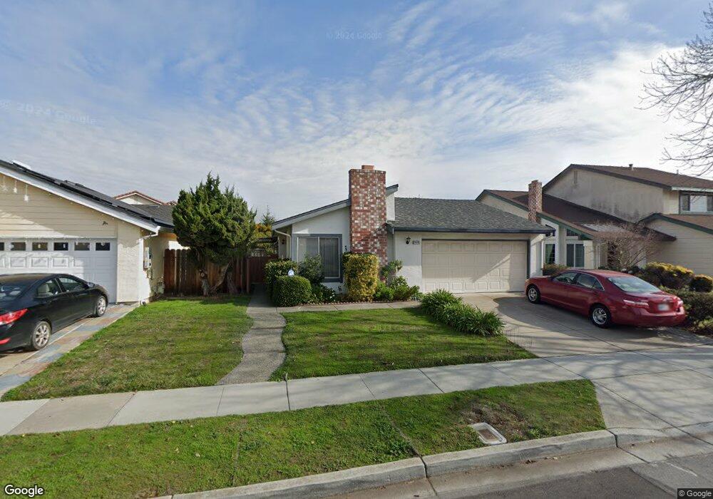
34180 Siward Dr Fremont, CA 94555
Ardenwood NeighborhoodEstimated Value: $1,358,844 - $1,627,000
3
Beds
2
Baths
1,241
Sq Ft
$1,168/Sq Ft
Est. Value
About This Home
This home is located at 34180 Siward Dr, Fremont, CA 94555 and is currently estimated at $1,449,211, approximately $1,167 per square foot. 34180 Siward Dr is a home located in Alameda County with nearby schools including Ardenwood Elementary, Thornton Middle School, and American High School.
Ownership History
Date
Name
Owned For
Owner Type
Purchase Details
Closed on
Sep 21, 2018
Sold by
Chen Michael Q
Bought by
Chen Michael and Chen Linda
Current Estimated Value
Purchase Details
Closed on
Sep 23, 2008
Sold by
Chen Hannah L
Bought by
Chen Hannah L and The Hannah L Chen Revocable Li
Purchase Details
Closed on
Dec 6, 2004
Sold by
Wong Amy M and John B Chen Revocable Trust
Bought by
Chen Sophia N and Chen Michael Q
Purchase Details
Closed on
Aug 15, 2003
Sold by
Chen John B
Bought by
Chen John B and John B Chen Revocable Trust
Create a Home Valuation Report for This Property
The Home Valuation Report is an in-depth analysis detailing your home's value as well as a comparison with similar homes in the area
Home Values in the Area
Average Home Value in this Area
Purchase History
| Date | Buyer | Sale Price | Title Company |
|---|---|---|---|
| Chen Michael | -- | None Available | |
| Chen Hannah L | -- | None Available | |
| Chen Sophia N | -- | -- | |
| Chen John B | -- | -- |
Source: Public Records
Tax History Compared to Growth
Tax History
| Year | Tax Paid | Tax Assessment Tax Assessment Total Assessment is a certain percentage of the fair market value that is determined by local assessors to be the total taxable value of land and additions on the property. | Land | Improvement |
|---|---|---|---|---|
| 2025 | $4,074 | $292,847 | $117,139 | $175,708 |
| 2024 | $4,074 | $287,105 | $114,842 | $172,263 |
| 2023 | $3,951 | $281,475 | $112,590 | $168,885 |
| 2022 | $3,879 | $275,957 | $110,383 | $165,574 |
| 2021 | $3,790 | $270,547 | $108,219 | $162,328 |
| 2020 | $3,732 | $267,773 | $107,109 | $160,664 |
| 2019 | $3,694 | $262,523 | $105,009 | $157,514 |
| 2018 | $3,620 | $257,377 | $102,951 | $154,426 |
| 2017 | $3,531 | $252,330 | $100,932 | $151,398 |
| 2016 | $3,460 | $247,383 | $98,953 | $148,430 |
| 2015 | $3,405 | $243,668 | $97,467 | $146,201 |
| 2014 | $3,339 | $238,895 | $95,558 | $143,337 |
Source: Public Records
Map
Nearby Homes
- 4512 Macbeth Ave
- 4480 Norocco Cir
- 4516 Roderigo Ct
- 4243 Nerissa Cir
- 34579 Bluestone Common
- 3840 Springfield Common
- 34512 Nantucket Common
- 34552 Nantucket Common
- 34768 Swain Common
- 3851 Milton Terrace
- 4141 Deep Creek Rd Unit 137
- 34627 Pueblo Terrace
- 34607 Pueblo Terrace
- 34648 Musk Terrace
- 4015 Clydesdale Common
- 34565 Pueblo Terrace
- 3691 Thrush Terrace
- 34771 Tuxedo Common Unit 52
- 5301 Shamrock Common
- 34179 Bowling Green Common
- 34188 Siward Dr
- 34172 Siward Dr
- 4620 Donalbain Cir
- 34221 Angus Ct
- 4484 Donalbain Cir
- 4614 Donalbain Cir
- 34225 Angus Ct
- 34217 Angus Ct
- 34179 Siward Dr
- 34171 Siward Dr
- 34187 Siward Dr
- 4608 Donalbain Cir
- 34163 Siward Dr
- 4627 Donalbain Cir
- 34195 Siward Dr
- 4621 Donalbain Cir
- 34155 Siward Dr
- 4602 Donalbain Cir
- 34204 Siward Dr
- 4615 Donalbain Cir