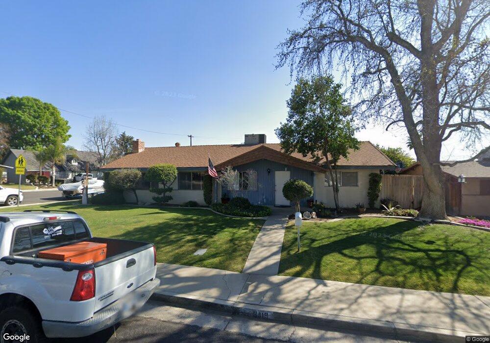
3419 Kaibab Ave Bakersfield, CA 93306
College Heights NeighborhoodEstimated Value: $336,000 - $369,000
3
Beds
2
Baths
1,540
Sq Ft
$226/Sq Ft
Est. Value
About This Home
This home is located at 3419 Kaibab Ave, Bakersfield, CA 93306 and is currently estimated at $348,435, approximately $226 per square foot. 3419 Kaibab Ave is a home located in Kern County with nearby schools including Colonel Howard Nichols Elementary School, Chipman Junior High School, and Highland High School.
Ownership History
Date
Name
Owned For
Owner Type
Purchase Details
Closed on
Sep 6, 2007
Sold by
Smith Pamela R and Blythe Pamela R
Bought by
Smith Pamela R and Pamela R Smith 2007 Trust
Current Estimated Value
Purchase Details
Closed on
Jul 28, 2003
Sold by
Foley Philip M and Foley Rose G
Bought by
Blythe Pamela R
Home Financials for this Owner
Home Financials are based on the most recent Mortgage that was taken out on this home.
Original Mortgage
$96,000
Outstanding Balance
$41,782
Interest Rate
5.46%
Mortgage Type
Purchase Money Mortgage
Estimated Equity
$306,653
Create a Home Valuation Report for This Property
The Home Valuation Report is an in-depth analysis detailing your home's value as well as a comparison with similar homes in the area
Home Values in the Area
Average Home Value in this Area
Purchase History
| Date | Buyer | Sale Price | Title Company |
|---|---|---|---|
| Smith Pamela R | -- | None Available | |
| Smith Pamela R | -- | None Available | |
| Blythe Pamela R | $120,000 | Chicago Title |
Source: Public Records
Mortgage History
| Date | Status | Borrower | Loan Amount |
|---|---|---|---|
| Open | Blythe Pamela R | $96,000 |
Source: Public Records
Tax History Compared to Growth
Tax History
| Year | Tax Paid | Tax Assessment Tax Assessment Total Assessment is a certain percentage of the fair market value that is determined by local assessors to be the total taxable value of land and additions on the property. | Land | Improvement |
|---|---|---|---|---|
| 2025 | $2,675 | $170,594 | $49,752 | $120,842 |
| 2024 | $2,617 | $167,250 | $48,777 | $118,473 |
| 2023 | $2,617 | $163,971 | $47,821 | $116,150 |
| 2022 | $2,554 | $160,757 | $46,884 | $113,873 |
| 2021 | $2,445 | $157,606 | $45,965 | $111,641 |
| 2020 | $2,408 | $155,991 | $45,494 | $110,497 |
| 2019 | $2,361 | $155,991 | $45,494 | $110,497 |
| 2018 | $2,307 | $149,935 | $43,728 | $106,207 |
| 2017 | $2,294 | $146,996 | $42,871 | $104,125 |
| 2016 | $2,107 | $144,115 | $42,031 | $102,084 |
| 2015 | $2,094 | $141,951 | $41,400 | $100,551 |
| 2014 | $2,027 | $139,172 | $40,590 | $98,582 |
Source: Public Records
Map
Nearby Homes
- 3221 Colgate Ln
- 3618 Redlands Dr
- 3609 Cardinal Ave
- 3200 University Ave
- 3119 University Ave
- 3206 Candlewood Dr
- 3413 Redlands Dr
- 3818 Harvard Dr
- 3712 Harvard Dr
- 4200 Columbus St
- 4019 Columbus St
- 3800 Columbus St
- 3601 Harvard Dr
- 3613 Fleetwood Way
- 3706 Rampart St
- 2801 Kaibab Ave
- 2818 San Pablo Ave
- 2901 Dwight St
- 2913 Harmony Dr
- 3019 Christmas Tree Ln
- 3413 Kaibab Ave
- 3418 Blade Ave
- 3412 Blade Ave
- 3407 Kaibab Ave
- 3331 Boise St
- 3418 Kaibab Ave
- 3325 Boise St
- 3412 Kaibab Ave
- 3406 Blade Ave
- 3500 Kaibab Ave
- 3406 Kaibab Ave
- 3401 Kaibab Ave
- 3400 Blade Ave
- 3506 Kaibab Ave
- 3313 Boise St
- 3419 Blade Ave
- 3400 Kaibab Ave
- 3324 Colgate Ln
- 3413 Blade Ave
- 3318 Colgate Ln