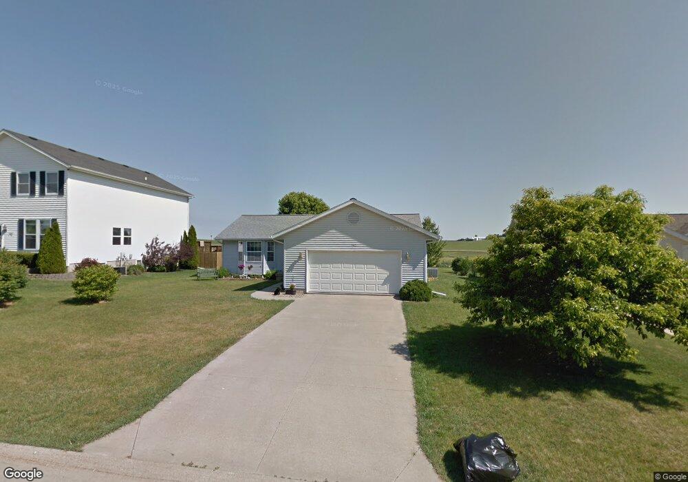
342 Aaron Ct SW Swisher, IA 52338
Estimated Value: $291,000 - $317,000
3
Beds
4
Baths
1,436
Sq Ft
$210/Sq Ft
Est. Value
About This Home
This home is located at 342 Aaron Ct SW, Swisher, IA 52338 and is currently estimated at $302,185, approximately $210 per square foot. 342 Aaron Ct SW is a home located in Johnson County with nearby schools including Prairie Crest Elementary School, Prairie Heights Elementary School, and Prairie View Elementary School.
Ownership History
Date
Name
Owned For
Owner Type
Purchase Details
Closed on
Mar 2, 2022
Sold by
Wernimont Cheryl A
Bought by
Wernimont Cheryl A and Wernimont Brian T
Current Estimated Value
Home Financials for this Owner
Home Financials are based on the most recent Mortgage that was taken out on this home.
Original Mortgage
$207,200
Outstanding Balance
$167,205
Interest Rate
3.15%
Mortgage Type
New Conventional
Estimated Equity
$134,980
Create a Home Valuation Report for This Property
The Home Valuation Report is an in-depth analysis detailing your home's value as well as a comparison with similar homes in the area
Home Values in the Area
Average Home Value in this Area
Purchase History
| Date | Buyer | Sale Price | Title Company |
|---|---|---|---|
| Wernimont Cheryl A | -- | Boston National Title | |
| Wernimont Cheryl A | -- | Boston National Title |
Source: Public Records
Mortgage History
| Date | Status | Borrower | Loan Amount |
|---|---|---|---|
| Open | Wernimont Cheryl A | $207,200 | |
| Closed | Wernimont Cheryl A | $207,200 |
Source: Public Records
Tax History Compared to Growth
Tax History
| Year | Tax Paid | Tax Assessment Tax Assessment Total Assessment is a certain percentage of the fair market value that is determined by local assessors to be the total taxable value of land and additions on the property. | Land | Improvement |
|---|---|---|---|---|
| 2024 | $4,420 | $275,400 | $45,900 | $229,500 |
| 2023 | $4,582 | $275,400 | $45,900 | $229,500 |
| 2022 | $4,390 | $233,400 | $38,200 | $195,200 |
| 2021 | $4,480 | $233,400 | $38,200 | $195,200 |
| 2020 | $4,480 | $233,400 | $38,200 | $195,200 |
| 2019 | $4,146 | $233,400 | $38,200 | $195,200 |
| 2018 | $3,732 | $212,800 | $38,200 | $174,600 |
| 2017 | $3,436 | $212,800 | $38,200 | $174,600 |
| 2016 | $3,250 | $191,900 | $30,600 | $161,300 |
| 2015 | $3,250 | $191,900 | $30,600 | $161,300 |
| 2014 | $2,910 | $173,100 | $30,600 | $142,500 |
Source: Public Records
Map
Nearby Homes
- 527 Swisher View Dr SW
- 241 Howard Ave NW
- 230 Howard Ave NW
- 260 Howard Ave NW
- 75 Jefferson Ave SW
- 2538 120th St NW
- 160 Pleasant Hill Dr NW
- 170 Pleasant Hill Dr NW
- 79 3rd St SE
- 110 Division St NE
- 4.91 Acres M L Seneca Rd NW
- 4.76 Acres M L Seneca Rd NW
- Lot
- 0 Seneca Rd NW
- 000 Seneca Rd NW
- Lot 5 Joco 50 Subdivision
- 1065 Highway 965 NW
- Lot
- 0 Hwy 965 140th St NW Unit 202505814
- 0 Hwy 965 140th St NW Unit 2507854
- 340 Aaron Ct SW
- 344 Aaron Ct SW
- 331 Amy St #C
- 331 Amy St Unit D
- 331 Amy St Sw #D
- 331 Amy St Unit A
- 331 Amy St Unit D
- 331 Amy St Unit B
- 331 Amy St Unit C
- 346 Aaron Ct SW
- 320 Aaron Ct SW
- 151 Alan Ave SW Unit D
- 151 Alan Ave SW Unit C
- 151 Alan Ave SW Unit A
- 341 Aaron Ct SW
- 345 Aaron Ct SW
- 321 Amy St Unit A
- 321 Amy St Unit D
- 321 Amy St Unit B
- 321 Amy St Unit C