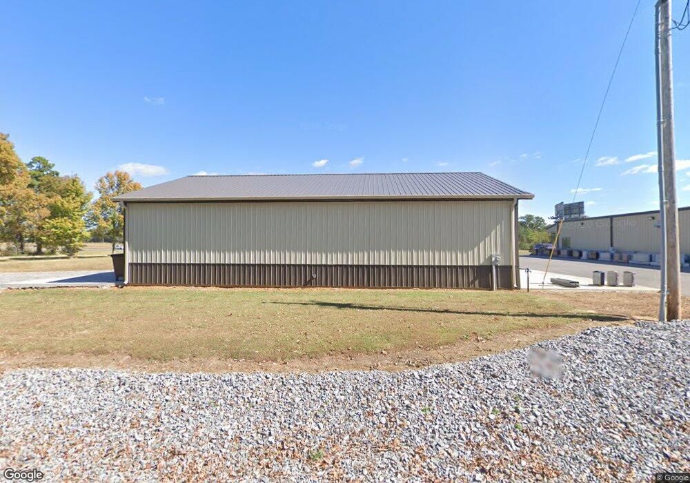
342 Flint Rd Murray, KY 42071
Estimated Value: $218,000 - $448,000
--
Bed
--
Bath
--
Sq Ft
3.1
Acres
About This Home
This home is located at 342 Flint Rd, Murray, KY 42071 and is currently estimated at $333,000. 342 Flint Rd is a home with nearby schools including North Calloway Elementary School, Calloway County Middle School, and Calloway County High School.
Ownership History
Date
Name
Owned For
Owner Type
Purchase Details
Closed on
Feb 9, 2017
Sold by
Penniston Eric Lee and Penniston Regina Ann
Bought by
G & G Properties Of Kentucky Llc
Current Estimated Value
Home Financials for this Owner
Home Financials are based on the most recent Mortgage that was taken out on this home.
Original Mortgage
$60,218
Outstanding Balance
$49,746
Interest Rate
4.12%
Mortgage Type
Commercial
Estimated Equity
$283,254
Purchase Details
Closed on
Oct 5, 2007
Sold by
Rickman James E and Rickman Barbara J
Bought by
Premiere Athletics Inc
Create a Home Valuation Report for This Property
The Home Valuation Report is an in-depth analysis detailing your home's value as well as a comparison with similar homes in the area
Home Values in the Area
Average Home Value in this Area
Purchase History
| Date | Buyer | Sale Price | Title Company |
|---|---|---|---|
| G & G Properties Of Kentucky Llc | $69,500 | None Available | |
| Premiere Athletics Inc | $60,000 | None Available |
Source: Public Records
Mortgage History
| Date | Status | Borrower | Loan Amount |
|---|---|---|---|
| Open | G & G Properties Of Kentucky Llc | $60,218 |
Source: Public Records
Tax History Compared to Growth
Tax History
| Year | Tax Paid | Tax Assessment Tax Assessment Total Assessment is a certain percentage of the fair market value that is determined by local assessors to be the total taxable value of land and additions on the property. | Land | Improvement |
|---|---|---|---|---|
| 2024 | $1,946 | $220,000 | $0 | $0 |
| 2023 | $2,003 | $220,000 | $0 | $0 |
| 2022 | $2,043 | $220,000 | $0 | $0 |
| 2021 | $2,083 | $220,000 | $0 | $0 |
| 2020 | $2,050 | $220,000 | $0 | $0 |
| 2019 | $2,017 | $220,000 | $0 | $0 |
| 2018 | $1,332 | $150,000 | $0 | $0 |
| 2017 | $561 | $65,000 | $0 | $0 |
| 2016 | $555 | $65,000 | $0 | $0 |
| 2015 | $549 | $65,000 | $0 | $0 |
| 2011 | -- | $60,000 | $0 | $0 |
Source: Public Records
Map
Nearby Homes
- 000 North Dr
- 206 Metcalf Ln
- 202 John Purdom Dr
- 1515 Boggess Dr
- Lot 17 Jordyn Bailey Rd
- 0 U S 641 N
- 1783 Radio Rd
- 1536 Almo Rd
- 0000 Brinn Rd
- 445 John Purdom Dr
- 363 Grant Rd
- 2809 W Fork Rd
- 000 Spring Rd
- 1087 Poor Farm Rd
- 00 N 16th St
- 1612 N 16th St
- 906 Southwood Dr
- 1005 Southwood Dr
- 00 Streetland Ln
- Lot# 32 Hunters Glen Unit Hunters Pointe