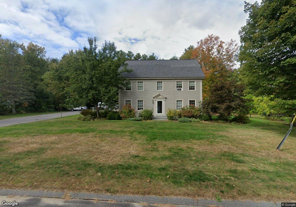
342 Main St Cumberland Center, ME 04021
Estimated Value: $938,000 - $1,387,000
4
Beds
4
Baths
3,640
Sq Ft
$325/Sq Ft
Est. Value
About This Home
This home is located at 342 Main St, Cumberland Center, ME 04021 and is currently estimated at $1,184,046, approximately $325 per square foot. 342 Main St is a home located in Cumberland County with nearby schools including Mabel I. Wilson School, Greely Middle School 4-5, and Greely Middle School.
Ownership History
Date
Name
Owned For
Owner Type
Purchase Details
Closed on
Mar 30, 2023
Sold by
Small David R
Bought by
Northwood Jack & Const Ll
Current Estimated Value
Create a Home Valuation Report for This Property
The Home Valuation Report is an in-depth analysis detailing your home's value as well as a comparison with similar homes in the area
Home Values in the Area
Average Home Value in this Area
Purchase History
| Date | Buyer | Sale Price | Title Company |
|---|---|---|---|
| Northwood Jack & Const Ll | $340,000 | None Available |
Source: Public Records
Tax History Compared to Growth
Tax History
| Year | Tax Paid | Tax Assessment Tax Assessment Total Assessment is a certain percentage of the fair market value that is determined by local assessors to be the total taxable value of land and additions on the property. | Land | Improvement |
|---|---|---|---|---|
| 2025 | $14,159 | $562,300 | $110,400 | $451,900 |
| 2024 | $13,073 | $562,300 | $110,400 | $451,900 |
| 2023 | $12,455 | $562,300 | $110,400 | $451,900 |
| 2022 | $11,921 | $562,300 | $110,400 | $451,900 |
| 2021 | $11,555 | $562,300 | $110,400 | $451,900 |
| 2020 | $11,443 | $562,300 | $110,400 | $451,900 |
| 2019 | $11,162 | $562,300 | $110,400 | $451,900 |
| 2018 | $10,906 | $553,600 | $110,400 | $443,200 |
| 2017 | $10,022 | $533,100 | $110,400 | $422,700 |
| 2016 | $9,729 | $533,100 | $110,400 | $422,700 |
| 2015 | $9,649 | $533,100 | $110,400 | $422,700 |
| 2014 | $9,276 | $533,100 | $110,400 | $422,700 |
| 2013 | $9,063 | $533,100 | $110,400 | $422,700 |
Source: Public Records
Map
Nearby Homes
- 294 Greely Rd
- 445 Greely Extension Rd
- 193 Main St
- 9 Black Oak Dr
- 133 Longwoods Rd
- 8 Summer Way
- 31 Stony Brook Ln
- 39 Harris Rd
- 7 Parsonage Rd Unit 4
- 90 Harris Lot 1 Rd
- Lot 8 Coastal Pines
- 11 Coastal Pines Lot 5
- 160 Memorial Hwy
- 9 Newell Rd
- 15 Inverness Rd
- 0 Thomes Way
- 90 W Main St
- 27 Carriage Hill
- Lot #4 Secretariat Dr
- Lot #3 Secretariat Dr