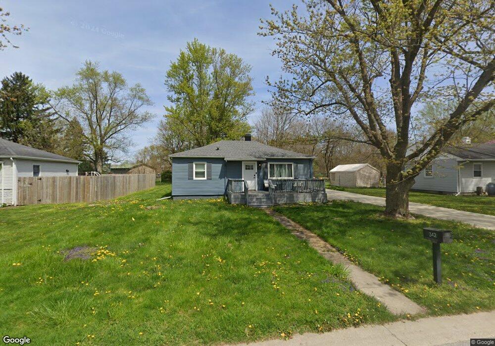
342 Maple St Crown Point, IN 46307
Estimated Value: $203,753 - $234,000
3
Beds
1
Bath
1,750
Sq Ft
$125/Sq Ft
Est. Value
About This Home
This home is located at 342 Maple St, Crown Point, IN 46307 and is currently estimated at $219,438, approximately $125 per square foot. 342 Maple St is a home located in Lake County with nearby schools including Timothy Ball Elementary School, Robert Taft Middle School, and Crown Point High School.
Ownership History
Date
Name
Owned For
Owner Type
Purchase Details
Closed on
Aug 5, 2022
Sold by
Kevin Hutnick
Bought by
Arnold Madison
Current Estimated Value
Home Financials for this Owner
Home Financials are based on the most recent Mortgage that was taken out on this home.
Original Mortgage
$179,450
Outstanding Balance
$170,550
Interest Rate
5.3%
Mortgage Type
New Conventional
Estimated Equity
$48,888
Purchase Details
Closed on
Jun 20, 2022
Sold by
Lambe Sikoski
Bought by
Hutnick Kevin
Home Financials for this Owner
Home Financials are based on the most recent Mortgage that was taken out on this home.
Original Mortgage
$179,450
Outstanding Balance
$170,550
Interest Rate
5.3%
Mortgage Type
New Conventional
Estimated Equity
$48,888
Purchase Details
Closed on
Oct 4, 2019
Sold by
Goings Alan W and U S Bank National Association
Bought by
Sikoski Lambe
Purchase Details
Closed on
May 29, 2008
Sold by
A & A Real Estate Properties Llc
Bought by
Goings Alan W
Purchase Details
Closed on
Feb 25, 2008
Sold by
Goings Alan W
Bought by
A & A Real Estate Properties Llc
Purchase Details
Closed on
Aug 1, 2007
Sold by
A & A Real Estate Properties Llc
Bought by
Goings Alan W
Purchase Details
Closed on
Jun 7, 2006
Sold by
Goings Alan W
Bought by
A & A Real Estate Properties Llc
Purchase Details
Closed on
May 31, 2006
Sold by
Stults Aaron M and Goings Alan W
Bought by
Goings Alan W
Purchase Details
Closed on
Apr 5, 2006
Sold by
Brines William and Brines Jane
Bought by
A & A Real Estate Properties Llc
Create a Home Valuation Report for This Property
The Home Valuation Report is an in-depth analysis detailing your home's value as well as a comparison with similar homes in the area
Home Values in the Area
Average Home Value in this Area
Purchase History
| Date | Buyer | Sale Price | Title Company |
|---|---|---|---|
| Arnold Madison | -- | Chicago Title | |
| Hutnick Kevin | -- | Chicago Title | |
| Sikoski Lambe | $81,100 | None Available | |
| Goings Alan W | -- | None Available | |
| A & A Real Estate Properties Llc | -- | None Available | |
| Goings Alan W | -- | None Available | |
| A & A Real Estate Properties Llc | -- | The Talon Group | |
| Goings Alan W | -- | None Available | |
| A & A Real Estate Properties Llc | -- | Chicago Title Insurance Co | |
| Brines William | -- | Chicago Title Insurance Co |
Source: Public Records
Mortgage History
| Date | Status | Borrower | Loan Amount |
|---|---|---|---|
| Open | Arnold Madison | $179,450 |
Source: Public Records
Tax History
| Year | Tax Paid | Tax Assessment Tax Assessment Total Assessment is a certain percentage of the fair market value that is determined by local assessors to be the total taxable value of land and additions on the property. | Land | Improvement |
|---|---|---|---|---|
| 2025 | $1,000 | $152,800 | $25,500 | $127,300 |
| 2024 | $3,183 | $141,500 | $25,500 | $116,000 |
| 2023 | $957 | $115,800 | $25,500 | $90,300 |
| 2022 | $957 | $110,600 | $25,500 | $85,100 |
| 2021 | $2,277 | $103,000 | $21,100 | $81,900 |
| 2020 | $2,212 | $100,000 | $21,100 | $78,900 |
| 2019 | $2,149 | $95,100 | $21,100 | $74,000 |
| 2018 | $2,382 | $91,700 | $21,100 | $70,600 |
| 2017 | $2,411 | $91,700 | $21,100 | $70,600 |
| 2016 | $2,371 | $88,600 | $21,100 | $67,500 |
| 2014 | $2,179 | $87,700 | $21,100 | $66,600 |
| 2013 | $2,039 | $81,100 | $21,100 | $60,000 |
Source: Public Records
Map
Nearby Homes
- 324 Maple St
- 316 Oak Cir
- 1465 Mybeck Place
- 350 Cochran Dr
- 1436 Bohling Place
- 11200 Oak Ridge Ct
- 900 Easy St
- 772 Kenmare Pkwy
- 771 Kenmare Pkwy
- 767 Kenmare Pkwy
- 1718 Silver Hawk Dr
- 805 Veterans Ln
- 1065 Easy St Unit C
- 802 Veterans Ln
- 862 Veterans Ln
- 511 N West St
- 1555 Chalone Ct
- 1845 W 99th Place
- 9542 Roosevelt Place
- 7770 W 106th Ln
Your Personal Tour Guide
Ask me questions while you tour the home.