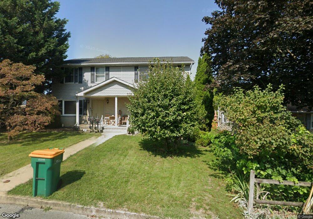
342 Ridge Ave Waynesboro, PA 17268
Estimated Value: $186,342 - $224,000
--
Bed
1
Bath
1,120
Sq Ft
$179/Sq Ft
Est. Value
About This Home
This home is located at 342 Ridge Ave, Waynesboro, PA 17268 and is currently estimated at $200,336, approximately $178 per square foot. 342 Ridge Ave is a home located in Franklin County with nearby schools including Waynesboro Area Senior High School, St. Andrew Catholic School, and Noah's Ark Christian Child Care Center.
Ownership History
Date
Name
Owned For
Owner Type
Purchase Details
Closed on
May 19, 2006
Sold by
Nicholson Patricia Anne and Estates Of Terry Lynn Salvermo
Bought by
Lawn Jr Robert T
Current Estimated Value
Home Financials for this Owner
Home Financials are based on the most recent Mortgage that was taken out on this home.
Original Mortgage
$140,000
Outstanding Balance
$81,776
Interest Rate
6.55%
Mortgage Type
New Conventional
Estimated Equity
$118,560
Create a Home Valuation Report for This Property
The Home Valuation Report is an in-depth analysis detailing your home's value as well as a comparison with similar homes in the area
Home Values in the Area
Average Home Value in this Area
Purchase History
| Date | Buyer | Sale Price | Title Company |
|---|---|---|---|
| Lawn Jr Robert T | $165,000 | None Available |
Source: Public Records
Mortgage History
| Date | Status | Borrower | Loan Amount |
|---|---|---|---|
| Open | Lawn Jr Robert T | $140,000 |
Source: Public Records
Tax History Compared to Growth
Tax History
| Year | Tax Paid | Tax Assessment Tax Assessment Total Assessment is a certain percentage of the fair market value that is determined by local assessors to be the total taxable value of land and additions on the property. | Land | Improvement |
|---|---|---|---|---|
| 2025 | $2,334 | $12,880 | $400 | $12,480 |
| 2024 | $2,276 | $12,880 | $400 | $12,480 |
| 2023 | $2,226 | $12,880 | $400 | $12,480 |
| 2022 | $2,155 | $12,880 | $400 | $12,480 |
| 2021 | $2,046 | $12,880 | $400 | $12,480 |
| 2020 | $2,030 | $12,880 | $400 | $12,480 |
| 2019 | $1,991 | $12,880 | $400 | $12,480 |
| 2018 | $1,879 | $12,880 | $400 | $12,480 |
| 2017 | $1,843 | $12,880 | $400 | $12,480 |
| 2016 | $369 | $12,880 | $400 | $12,480 |
| 2015 | $344 | $12,880 | $400 | $12,480 |
| 2014 | $344 | $12,880 | $400 | $12,480 |
Source: Public Records
Map
Nearby Homes
- 422 Cleveland Ave
- 217 Fairview Ave
- 208 Hamilton Ave
- 462 Scott Ave Unit 4
- 0 Westview Ave
- 130 Hamilton Ave
- 105 Fairview Ave
- 305 W 7th St
- 25 Fairview Ave
- 115 Cleveland Ave
- 144 W Main St
- 6668 Marsh Rd
- 111 E 5th St
- 911 Park St
- 121 Harrison Ave
- 0 N Church St Unit PAFL2029878
- 0 N Church St Unit PAFL2027222
- 107 Garfield St
- Frankford Plan at Pheasant Run
- Ruby Plan at Pheasant Run
- 326 Ridge Ave
- 326 Ridge Ave Unit 1
- 324 Ridge Ave
- 333 Fairview Ave
- 337 Fairview Ave
- 331 Fairview Ave
- 339 Fairview Ave
- 322 Ridge Ave
- 329 Fairview Ave
- 341 Fairview Ave
- 327 Fairview Ave
- 343 Fairview Ave
- 325 Fairview Ave
- 345 Fairview Ave
- 323 Fairview Ave
- 321 Fairview Ave
- 319 Fairview Ave
- 317 Fairview Ave
- 336 Fairview Ave
- 405 Fairview Ave