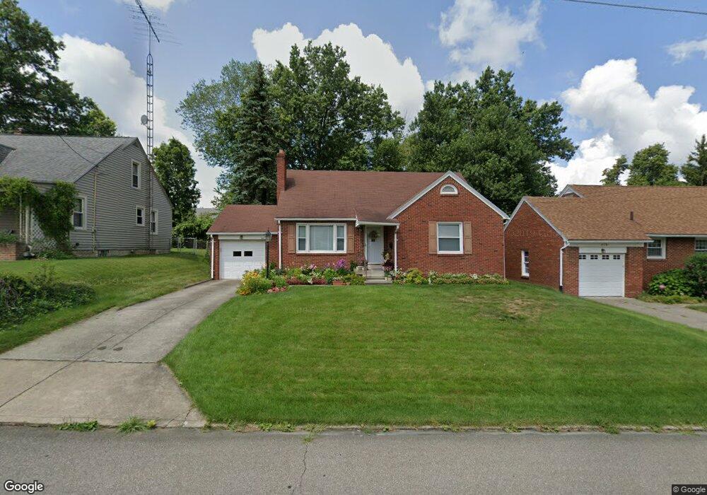
342 Taylor Rd Mansfield, OH 44903
Estimated Value: $162,554 - $170,000
2
Beds
2
Baths
1,425
Sq Ft
$116/Sq Ft
Est. Value
About This Home
This home is located at 342 Taylor Rd, Mansfield, OH 44903 and is currently estimated at $165,889, approximately $116 per square foot. 342 Taylor Rd is a home located in Richland County with nearby schools including Discovery School, St. Peter's High School/Junior High, and St. Peter's Elementary/Montessori School.
Ownership History
Date
Name
Owned For
Owner Type
Purchase Details
Closed on
Oct 12, 2020
Sold by
Holzwarth Luise O
Bought by
Holzwarth Ingrid A
Current Estimated Value
Purchase Details
Closed on
Nov 7, 1990
Sold by
Bambach George
Bought by
Holzwarth Louise O
Create a Home Valuation Report for This Property
The Home Valuation Report is an in-depth analysis detailing your home's value as well as a comparison with similar homes in the area
Home Values in the Area
Average Home Value in this Area
Purchase History
| Date | Buyer | Sale Price | Title Company |
|---|---|---|---|
| Holzwarth Ingrid A | -- | None Available | |
| Holzwarth Ingrid A | -- | None Available | |
| Holzwarth Louise O | -- | -- |
Source: Public Records
Tax History Compared to Growth
Tax History
| Year | Tax Paid | Tax Assessment Tax Assessment Total Assessment is a certain percentage of the fair market value that is determined by local assessors to be the total taxable value of land and additions on the property. | Land | Improvement |
|---|---|---|---|---|
| 2024 | $1,789 | $38,200 | $4,450 | $33,750 |
| 2023 | $1,789 | $38,200 | $4,450 | $33,750 |
| 2022 | $1,499 | $26,820 | $3,820 | $23,000 |
| 2021 | $1,509 | $26,820 | $3,820 | $23,000 |
| 2020 | $1,543 | $26,820 | $3,820 | $23,000 |
| 2019 | $1,710 | $26,820 | $3,820 | $23,000 |
| 2018 | $1,687 | $26,820 | $3,820 | $23,000 |
| 2017 | $1,714 | $26,820 | $3,820 | $23,000 |
| 2016 | $1,786 | $28,310 | $4,890 | $23,420 |
| 2015 | $1,786 | $28,310 | $4,890 | $23,420 |
| 2014 | $1,684 | $28,310 | $4,890 | $23,420 |
| 2012 | $642 | $28,310 | $5,150 | $23,160 |
Source: Public Records
Map
Nearby Homes
- 679 Coleman Rd
- 408 Fairlawn Ave
- 212 Marlow Rd
- 616 Cline Ave
- 191 Fairlawn Ave
- 143 Fairlawn Ave
- 135 Fairlawn Ave
- 190 S Linden Rd
- 538 Broadview Ave
- 129 Fairlawn Ave
- 118 Parkwood Blvd
- 143 Kingwood Place
- 244 S Trimble Rd Unit 246
- 232 S Trimble Rd Unit 234
- 133 Stewart Ave S
- 216 S Trimble Rd Unit 218
- 78 Glenwood Blvd
- 126 Dawson Ave
- 655 Woodhill Rd
- 41 Parkwood Blvd
- 348 Taylor Rd
- 338 Taylor Rd
- 341 Taylor Rd
- 356 Taylor Rd Unit 54
- 349 Taylor Rd
- 333 Taylor Rd
- 360 Taylor Rd
- 355 Taylor Rd
- 359 Taylor Rd
- 345 Fairlawn Ave
- 339 Fairlawn Ave
- 324 Taylor Rd
- 351 Fairlawn Ave
- 335 Fairlawn Ave
- 715 Barnard Ave
- 736 Manchester Rd
- 366 Taylor Rd
- 750 Barnard Ave
- 357 Fairlawn Ave
- 325 Taylor Rd