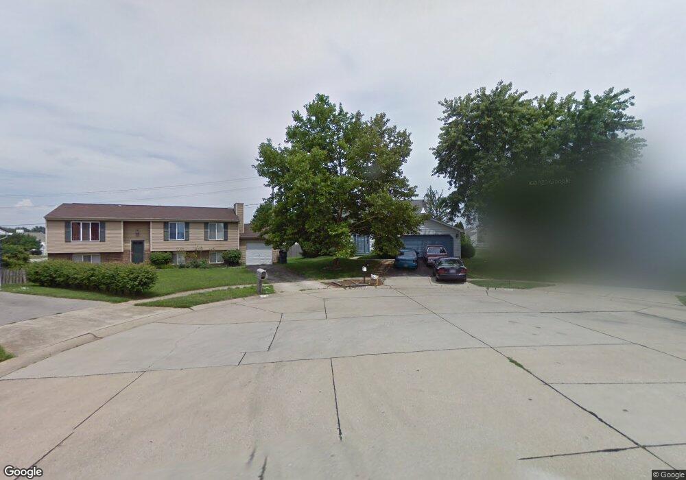
3420 Furrow Ct Canal Winchester, OH 43110
Estimated Value: $263,000 - $310,770
4
Beds
2
Baths
1,980
Sq Ft
$147/Sq Ft
Est. Value
About This Home
This home is located at 3420 Furrow Ct, Canal Winchester, OH 43110 and is currently estimated at $291,693, approximately $147 per square foot. 3420 Furrow Ct is a home located in Franklin County with nearby schools including Groveport Madison High School, A+ Arts Academy, and Brice Christian Academy Elementary School.
Ownership History
Date
Name
Owned For
Owner Type
Purchase Details
Closed on
Nov 17, 2000
Sold by
Brown Melvin E
Bought by
Jenkins Zachary and Jenkins Fini H
Current Estimated Value
Home Financials for this Owner
Home Financials are based on the most recent Mortgage that was taken out on this home.
Original Mortgage
$116,280
Outstanding Balance
$42,816
Interest Rate
7.87%
Mortgage Type
VA
Estimated Equity
$248,877
Purchase Details
Closed on
Jan 27, 1993
Bought by
Brown Melvin E
Purchase Details
Closed on
Jan 1, 1986
Purchase Details
Closed on
Oct 1, 1985
Create a Home Valuation Report for This Property
The Home Valuation Report is an in-depth analysis detailing your home's value as well as a comparison with similar homes in the area
Home Values in the Area
Average Home Value in this Area
Purchase History
| Date | Buyer | Sale Price | Title Company |
|---|---|---|---|
| Jenkins Zachary | $114,000 | Title First Agency Inc | |
| Brown Melvin E | $85,900 | -- | |
| -- | $64,000 | -- | |
| -- | -- | -- |
Source: Public Records
Mortgage History
| Date | Status | Borrower | Loan Amount |
|---|---|---|---|
| Open | Jenkins Zachary | $116,280 |
Source: Public Records
Tax History Compared to Growth
Tax History
| Year | Tax Paid | Tax Assessment Tax Assessment Total Assessment is a certain percentage of the fair market value that is determined by local assessors to be the total taxable value of land and additions on the property. | Land | Improvement |
|---|---|---|---|---|
| 2024 | $3,954 | $93,250 | $24,820 | $68,430 |
| 2023 | $3,917 | $93,240 | $24,815 | $68,425 |
| 2022 | $2,647 | $52,430 | $8,400 | $44,030 |
| 2021 | $2,655 | $52,430 | $8,400 | $44,030 |
| 2020 | $2,660 | $52,430 | $8,400 | $44,030 |
| 2019 | $2,473 | $43,610 | $7,000 | $36,610 |
| 2018 | $2,440 | $43,610 | $7,000 | $36,610 |
| 2017 | $2,497 | $43,610 | $7,000 | $36,610 |
| 2016 | $2,366 | $37,770 | $7,670 | $30,100 |
| 2015 | $2,392 | $37,770 | $7,670 | $30,100 |
| 2014 | $2,419 | $37,770 | $7,670 | $30,100 |
| 2013 | $1,012 | $37,765 | $7,665 | $30,100 |
Source: Public Records
Map
Nearby Homes
- 6286 Stoney Glenn Ct
- 3471 Treehouse Ln
- 6167 Kensington Glen Dr
- 3000 High St
- 5978 Abernathy Ln
- 5976 Abernathy Ln
- 5970 Abernathy Ln
- 5968 Abernathy Ln
- 5962 Abernathy Ln
- 5969 Hollett Dr S
- 5993 Columbus St
- 5960 Abernathy Ln
- 5957 Hollett Dr S
- St Martin Plan at Chatterton Commons
- 3310 Joshstock Dr
- 3304 Joshstock Dr
- 3298 Joshstock Dr
- 5946 Abernathy Ln
- 5944 Abernathy Ln
- 5938 Abernathy Ln
- 3426 Furrow Ct
- 3417 Furrow Ct
- 3432 Furrow Ct
- 3431 Furrow Ct
- 3438 Furrow Ct
- 3447 Taco Ct
- 3441 Taco Ct
- 3301 Woodmore Hollow Dr
- 3439 Furrow Ct
- 6350 Barnside Dr
- 3264 Canyon Bluff Dr
- 3455 Taco Ct
- 3418 Barnside Ct
- 3295 Woodmore Hollow Dr
- 3258 Canyon Bluff Dr
- 3289 Woodmore Hollow Dr
- 3440 Taco Ct
- 6233 Bysenwood Dr
- 6239 Bysenwood Dr
- 6245 Bysenwood Dr