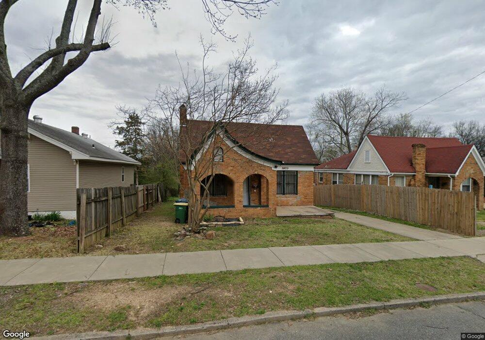
3420 W 10th St Little Rock, AR 72204
Capitol View NeighborhoodEstimated Value: $87,000 - $114,000
--
Bed
1
Bath
1,036
Sq Ft
$96/Sq Ft
Est. Value
About This Home
This home is located at 3420 W 10th St, Little Rock, AR 72204 and is currently estimated at $99,441, approximately $95 per square foot. 3420 W 10th St is a home located in Pulaski County with nearby schools including Stephens Elementary School, Pulaski Heights Middle School, and Central High School.
Ownership History
Date
Name
Owned For
Owner Type
Purchase Details
Closed on
Jun 19, 2017
Sold by
Walls Steve
Bought by
Patterson Perry
Current Estimated Value
Purchase Details
Closed on
Aug 11, 2014
Sold by
Walls Salynthia
Bought by
Patterson Perry
Purchase Details
Closed on
Oct 6, 2006
Sold by
Crenshaw John and Crenshaw Donna
Bought by
Walls Salynthia and Walls Steve
Purchase Details
Closed on
Sep 11, 2006
Sold by
Crenshaw John and Crenshaw Donna
Bought by
Walls Salynthia and Walls Steve
Create a Home Valuation Report for This Property
The Home Valuation Report is an in-depth analysis detailing your home's value as well as a comparison with similar homes in the area
Home Values in the Area
Average Home Value in this Area
Purchase History
| Date | Buyer | Sale Price | Title Company |
|---|---|---|---|
| Patterson Perry | -- | None Available | |
| Patterson Perry | -- | None Available | |
| Walls Salynthia | -- | None Available | |
| Walls Salynthia | -- | None Available |
Source: Public Records
Tax History Compared to Growth
Tax History
| Year | Tax Paid | Tax Assessment Tax Assessment Total Assessment is a certain percentage of the fair market value that is determined by local assessors to be the total taxable value of land and additions on the property. | Land | Improvement |
|---|---|---|---|---|
| 2025 | $643 | $12,049 | $1,800 | $10,249 |
| 2024 | $551 | $12,049 | $1,800 | $10,249 |
| 2023 | $551 | $12,049 | $1,800 | $10,249 |
| 2022 | $505 | $12,049 | $1,800 | $10,249 |
| 2021 | $462 | $6,820 | $600 | $6,220 |
| 2020 | $428 | $6,820 | $600 | $6,220 |
| 2019 | $397 | $6,820 | $600 | $6,220 |
| 2018 | $397 | $6,820 | $600 | $6,220 |
| 2017 | $335 | $6,820 | $600 | $6,220 |
| 2016 | $305 | $9,220 | $920 | $8,300 |
| 2015 | $285 | $4,061 | $920 | $3,141 |
| 2014 | $285 | $3,481 | $920 | $2,561 |
Source: Public Records
Map
Nearby Homes
- 3419 W 10th St
- 3407 Maryland Ave
- 3224 W 11th St
- 3401 W 12th St
- 520 S Martin St Unit S. Martin St. north
- 3700 Maryland Ave
- 1004 Johnson St
- 3724 W 10th St
- 3705 W 12th St
- 903 S Oak St
- 904 S Oak St
- 3212 Lamar St
- 1418 S Martin St
- 923 Booker St
- 605 S Oak St
- 3123 W 15th St
- 3319 W Capitol Ave
- 1519 S Oak St
- 3112 W 16th St
- 1520 S Oak St
- 3414 W 10th St
- 3422 W 10th St
- 3412 W 10th St
- 3409 Maryland Ave
- 3404 W 10th St
- 3500 W 10th St
- 3415 W 10th St
- 3400 W 10th St
- 3405 Maryland Ave
- 3413 W 10th St
- 3506 W 10th St
- 3501 Maryland Ave
- 3501 W 10th St
- 3411 W 10th St
- 3503 Maryland Ave
- 3505 W 10th St
- 3318 W 10th St
- 3510 W 10th St
- 3401 W 10th St
- 821 Valmar St