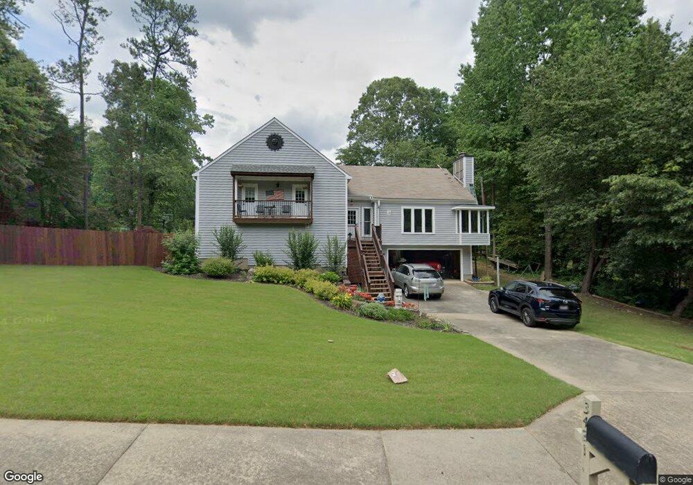
3421 Post Oak Tritt Rd Unit 1 Marietta, GA 30062
East Cobb NeighborhoodEstimated Value: $463,000 - $630,000
3
Beds
2
Baths
1,673
Sq Ft
$322/Sq Ft
Est. Value
About This Home
This home is located at 3421 Post Oak Tritt Rd Unit 1, Marietta, GA 30062 and is currently estimated at $538,260, approximately $321 per square foot. 3421 Post Oak Tritt Rd Unit 1 is a home located in Cobb County with nearby schools including Murdock Elementary School, Hightower Trail Middle School, and Pope High School.
Ownership History
Date
Name
Owned For
Owner Type
Purchase Details
Closed on
Nov 20, 2016
Sold by
Bickford Deborah D
Bought by
Richard Bickford
Current Estimated Value
Purchase Details
Closed on
Sep 5, 2006
Sold by
Trask Jenny M L and Trask Robert A
Bought by
Forster Deborah D
Home Financials for this Owner
Home Financials are based on the most recent Mortgage that was taken out on this home.
Original Mortgage
$140,000
Interest Rate
6.67%
Mortgage Type
New Conventional
Create a Home Valuation Report for This Property
The Home Valuation Report is an in-depth analysis detailing your home's value as well as a comparison with similar homes in the area
Home Values in the Area
Average Home Value in this Area
Purchase History
| Date | Buyer | Sale Price | Title Company |
|---|---|---|---|
| Richard Bickford | -- | -- | |
| Forster Deborah D | $175,000 | -- |
Source: Public Records
Mortgage History
| Date | Status | Borrower | Loan Amount |
|---|---|---|---|
| Previous Owner | Forster Deborah D | $140,000 |
Source: Public Records
Tax History Compared to Growth
Tax History
| Year | Tax Paid | Tax Assessment Tax Assessment Total Assessment is a certain percentage of the fair market value that is determined by local assessors to be the total taxable value of land and additions on the property. | Land | Improvement |
|---|---|---|---|---|
| 2025 | $5,120 | $169,920 | $54,000 | $115,920 |
| 2024 | $5,084 | $168,620 | $54,000 | $114,620 |
| 2023 | $5,370 | $178,112 | $46,800 | $131,312 |
| 2022 | $4,072 | $134,168 | $32,000 | $102,168 |
| 2021 | $3,598 | $118,540 | $28,000 | $90,540 |
| 2020 | $2,863 | $94,320 | $24,000 | $70,320 |
| 2019 | $2,863 | $94,320 | $24,000 | $70,320 |
| 2018 | $2,544 | $83,816 | $20,000 | $63,816 |
| 2017 | $2,410 | $83,816 | $20,000 | $63,816 |
| 2016 | $2,410 | $83,816 | $20,000 | $63,816 |
| 2015 | $2,184 | $74,120 | $22,000 | $52,120 |
| 2014 | $2,202 | $74,120 | $0 | $0 |
Source: Public Records
Map
Nearby Homes
- 2510 Camelot Cir
- 3297 Post Oak Tritt Rd
- 2268 Woodsfield Ln NE
- 2570 Rocky Springs Dr
- 2628 Tritt Springs Trace NE Unit 2
- 3287 Harvest Way
- 2608 Tritt Springs Trace NE
- 3237 Harvest Way
- 3152 Normandy Cir NE
- 2694 Tritt Springs Dr NE
- 2410 Kingsley Dr NE
- 2760 Hembree Rd NE
- 2567 Kingsley Dr NE
- 3246 Able Ct
- 2041 Kramer Way
- 3741 Bays Ferry Way
- 2493 Camelot Cir
- 3367 Post Oak Tritt Rd
- 3367 Post Oak Tritt Rd Unit TRITT
- 3431 Post Oak Tritt Rd
- 3381 Falling Brook Dr
- 2440 Mitchell Rd NE
- 2489 Camelot Cir
- 3385 Falling Brook Dr
- 3383 Falling Brook Dr
- 2505 Camelot Cir
- 3361 Post Oak Tritt Rd
- 2451 Mitchell Rd NE
- 3387 Falling Brook Dr
- 3441 Post Oak Tritt Rd Unit 1
- 2490 Camelot Cir
- 0 Falling Brook Dr Unit 7276934
- 0 Falling Brook Dr Unit 7263933
- 0 Falling Brook Dr Unit 7157157
- 0 Falling Brook Dr Unit 7027178
- 3389 Falling Brook Dr Unit 4