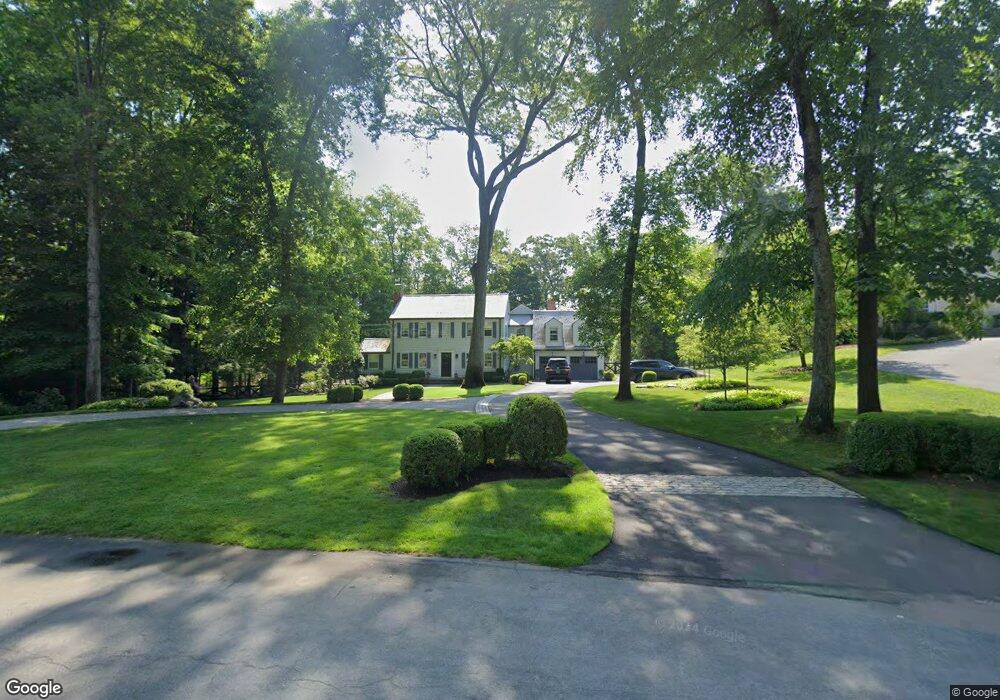
343 N Cedar Rd Fairfield, CT 06824
University NeighborhoodEstimated Value: $1,714,000 - $2,032,000
4
Beds
5
Baths
3,009
Sq Ft
$625/Sq Ft
Est. Value
About This Home
This home is located at 343 N Cedar Rd, Fairfield, CT 06824 and is currently estimated at $1,880,509, approximately $624 per square foot. 343 N Cedar Rd is a home located in Fairfield County with nearby schools including Dwight Elementary School, Roger Ludlowe Middle School, and Fairfield Ludlowe High School.
Ownership History
Date
Name
Owned For
Owner Type
Purchase Details
Closed on
Jun 11, 2015
Sold by
Blair Frnacis and Blair Sarah
Bought by
Blair Francis
Current Estimated Value
Purchase Details
Closed on
Oct 3, 2011
Sold by
Rosow Christopher
Bought by
Blair Francis
Home Financials for this Owner
Home Financials are based on the most recent Mortgage that was taken out on this home.
Original Mortgage
$375,000
Interest Rate
4.15%
Purchase Details
Closed on
May 26, 2005
Sold by
Curtiss 2Nd Donald L and Curtiss Lynne A
Bought by
Rosow Christopher D and Rosow Meghan O
Create a Home Valuation Report for This Property
The Home Valuation Report is an in-depth analysis detailing your home's value as well as a comparison with similar homes in the area
Home Values in the Area
Average Home Value in this Area
Purchase History
| Date | Buyer | Sale Price | Title Company |
|---|---|---|---|
| Blair Francis | -- | -- | |
| Blair Francis | -- | -- | |
| Blair Francis | $1,287,500 | -- | |
| Blair Francis | $1,287,500 | -- | |
| Rosow Christopher D | $985,000 | -- | |
| Rosow Christopher D | $985,000 | -- |
Source: Public Records
Mortgage History
| Date | Status | Borrower | Loan Amount |
|---|---|---|---|
| Previous Owner | Rosow Christopher D | $375,000 |
Source: Public Records
Tax History Compared to Growth
Tax History
| Year | Tax Paid | Tax Assessment Tax Assessment Total Assessment is a certain percentage of the fair market value that is determined by local assessors to be the total taxable value of land and additions on the property. | Land | Improvement |
|---|---|---|---|---|
| 2025 | $22,061 | $777,070 | $401,380 | $375,690 |
| 2024 | $21,680 | $777,070 | $401,380 | $375,690 |
| 2023 | $21,377 | $777,070 | $401,380 | $375,690 |
| 2022 | $21,034 | $772,170 | $401,380 | $370,790 |
| 2021 | $19,341 | $716,870 | $401,380 | $315,490 |
| 2020 | $20,471 | $764,120 | $396,900 | $367,220 |
| 2019 | $20,471 | $764,120 | $396,900 | $367,220 |
| 2018 | $20,142 | $764,120 | $396,900 | $367,220 |
| 2017 | $19,730 | $764,120 | $396,900 | $367,220 |
| 2016 | $18,877 | $741,720 | $396,900 | $344,820 |
| 2015 | $16,897 | $681,590 | $426,510 | $255,080 |
| 2014 | $16,631 | $681,590 | $426,510 | $255,080 |
Source: Public Records
Map
Nearby Homes
- 254 Sherwood Farm Rd
- 11 Twin Brooks Ln
- 56 Drake Ln
- 66 Adams Rd
- 232 Pell Meadow Dr
- 23 Robert Ct
- 33 Middlebrook Place
- 105 Charter Oak Rd
- 83 Pell Meadow Dr
- 2683 Bronson Rd
- 25 Millspaugh Dr
- 1135 Mill Hill Rd
- 44 Deer Run Rd
- 338 Orchard Hill Ln
- 1207 Stillson Rd
- 476 Mill Hill Terrace
- 647 Bronson Rd
- 1165 Stillson Rd
- 688 Hulls Farm Rd
- 1137 Stillson Rd
- 305 N Cedar Rd
- 365 N Cedar Rd
- 310 N Cedar Rd
- 275 N Cedar Rd
- 332 N Cedar Rd
- 370 N Cedar Rd
- 272 N Cedar Rd
- 425 N Cedar Rd
- 245 N Cedar Rd
- 245 N Cedar Rd
- 410 N Cedar Rd
- 208 N Cedar Rd
- 217 N Cedar Rd
- 240 N Cedar Rd
- 515 Hill Farm Rd
- 189 N Cedar Rd
- 497 Hill Farm Rd
- 405 N Cedar Rd
- 268 Sherwood Farm Rd
- 450 N Cedar Rd