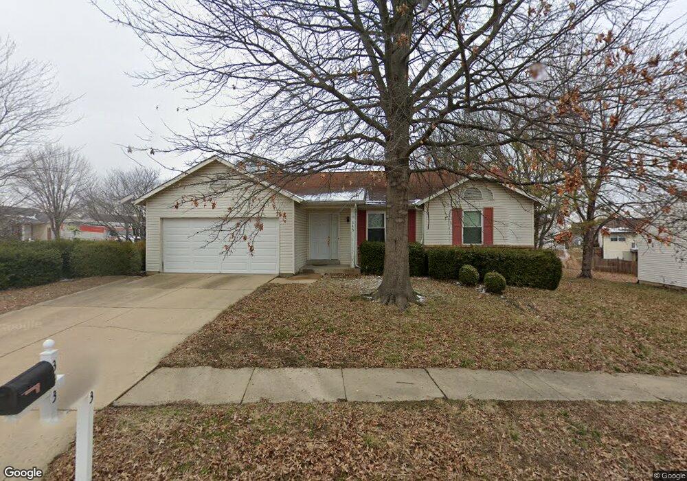
343 Pheasant Point Blvd O Fallon, MO 63368
Estimated Value: $277,000 - $324,000
3
Beds
2
Baths
1,206
Sq Ft
$241/Sq Ft
Est. Value
About This Home
This home is located at 343 Pheasant Point Blvd, O Fallon, MO 63368 and is currently estimated at $290,922, approximately $241 per square foot. 343 Pheasant Point Blvd is a home located in St. Charles County with nearby schools including Pheasant Point Elementary School, Fort Zumwalt West Middle School, and Fort Zumwalt West High School.
Ownership History
Date
Name
Owned For
Owner Type
Purchase Details
Closed on
Apr 29, 2005
Sold by
Durand David D and Durand Natalie
Bought by
Burkhart David J
Current Estimated Value
Home Financials for this Owner
Home Financials are based on the most recent Mortgage that was taken out on this home.
Original Mortgage
$118,000
Outstanding Balance
$62,393
Interest Rate
6.06%
Mortgage Type
Fannie Mae Freddie Mac
Estimated Equity
$228,529
Purchase Details
Closed on
Feb 27, 2002
Sold by
Curran Michael L and Curran Olivia D
Bought by
Durand David D
Home Financials for this Owner
Home Financials are based on the most recent Mortgage that was taken out on this home.
Original Mortgage
$111,617
Interest Rate
5.89%
Mortgage Type
FHA
Purchase Details
Closed on
May 23, 2001
Sold by
Rose Rexroat Olivia D and Curran Olivia D
Bought by
Curran Michael L and Curran Olivia D
Home Financials for this Owner
Home Financials are based on the most recent Mortgage that was taken out on this home.
Original Mortgage
$99,900
Interest Rate
7.07%
Create a Home Valuation Report for This Property
The Home Valuation Report is an in-depth analysis detailing your home's value as well as a comparison with similar homes in the area
Home Values in the Area
Average Home Value in this Area
Purchase History
| Date | Buyer | Sale Price | Title Company |
|---|---|---|---|
| Burkhart David J | $147,800 | Ust | |
| Durand David D | -- | -- | |
| Curran Michael L | -- | -- |
Source: Public Records
Mortgage History
| Date | Status | Borrower | Loan Amount |
|---|---|---|---|
| Open | Burkhart David J | $118,000 | |
| Previous Owner | Durand David D | $111,617 | |
| Previous Owner | Curran Michael L | $99,900 |
Source: Public Records
Tax History
| Year | Tax Paid | Tax Assessment Tax Assessment Total Assessment is a certain percentage of the fair market value that is determined by local assessors to be the total taxable value of land and additions on the property. | Land | Improvement |
|---|---|---|---|---|
| 2025 | $2,990 | $47,771 | -- | -- |
| 2023 | $2,991 | $45,051 | $0 | $0 |
| 2022 | $2,468 | $34,500 | $0 | $0 |
| 2021 | $2,470 | $34,500 | $0 | $0 |
| 2020 | $2,176 | $29,451 | $0 | $0 |
| 2019 | $2,181 | $29,451 | $0 | $0 |
| 2018 | $2,019 | $26,005 | $0 | $0 |
| 2017 | $1,985 | $26,005 | $0 | $0 |
| 2016 | $1,818 | $23,711 | $0 | $0 |
| 2015 | $1,690 | $23,711 | $0 | $0 |
| 2014 | $1,772 | $24,459 | $0 | $0 |
Source: Public Records
Map
Nearby Homes
- 12 McCluer Ct
- 178 Christina Marie Dr
- 1130 Spring Orchard Dr
- 703 Tinsley Ct
- 2858 Dardenne Links Dr
- 1343 Avondale Spring Dr
- 2756 Dunvegan Dr
- 7101 Curtis Dr Unit 795B
- 71 Harrisburg Ct
- 7131 Curtis Dr Unit 779C
- 4 Wild Senna Ct
- 14 Rock Church Dr
- 249 Dardenne Farms Dr
- 2916 Spring Blossom Dr
- 262 Royallsprings Pkwy
- 611 Bennington Dr
- 3 Royallbend Ct
- 101 Winterbrooke Ct
- 7132 Oak Stream Dr
- 2143 Alexandria Row
- 6 Tailor Square
- 337 Pheasant Point Blvd
- 8 Tailor Square
- 1 Tailor Square
- 340 Pheasant Point Blvd
- 3 Tailor Square
- 329 Pheasant Point Blvd
- 350 Pheasant Point Blvd
- 428 Tailor Ln
- 5 Tailor Square
- 430 Tailor Ln
- 330 Pheasant Point Blvd
- 426 Tailor Ln
- 7 Tailor Square
- 432 Tailor Ln
- 150 Pheasant Point Blvd
- 321 Pheasant Point Blvd
- 9 Tailor Square
- 38 Tailor Ct
- 320 Pheasant Point Blvd
Your Personal Tour Guide
Ask me questions while you tour the home.