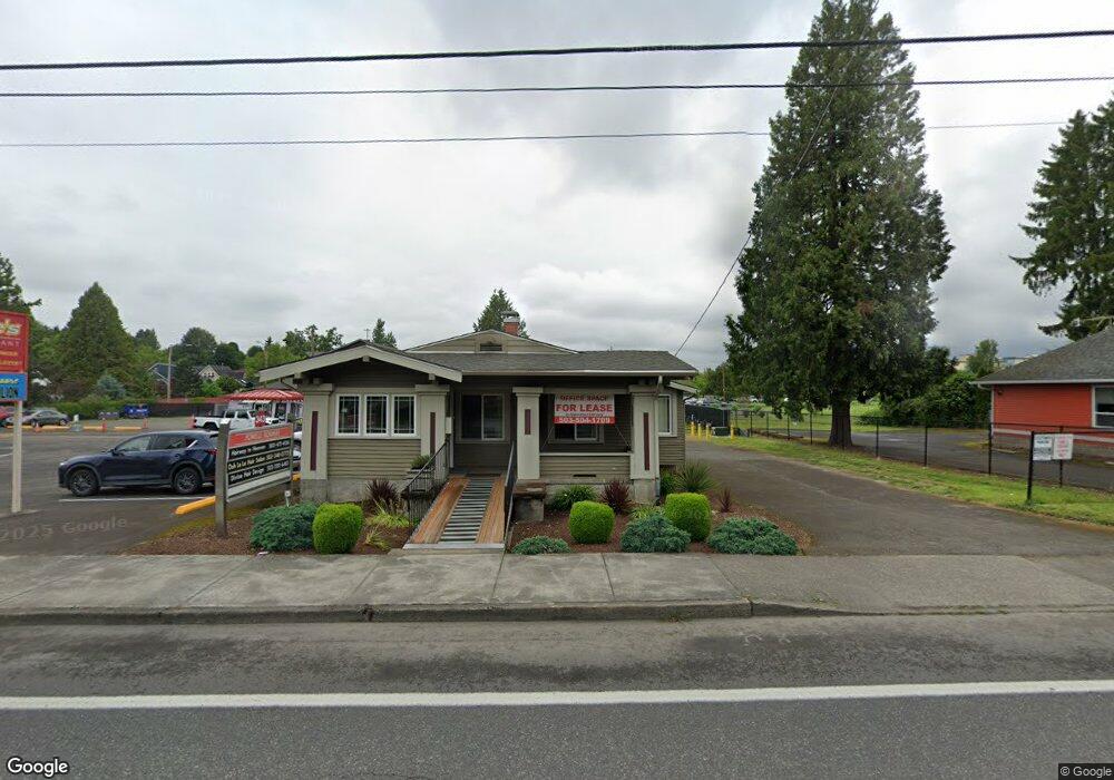
343 W Powell Blvd Gresham, OR 97030
Downtown Gresham NeighborhoodEstimated Value: $474,667
2
Beds
1
Bath
1,904
Sq Ft
$249/Sq Ft
Est. Value
About This Home
This home is located at 343 W Powell Blvd, Gresham, OR 97030 and is currently estimated at $474,667, approximately $249 per square foot. 343 W Powell Blvd is a home located in Multnomah County with nearby schools including Dexter McCarty Middle School, Gresham High School, and Gresham Arthur Academy.
Ownership History
Date
Name
Owned For
Owner Type
Purchase Details
Closed on
Dec 20, 2013
Sold by
Wade Georgianna and Wade Michael D
Bought by
Stanley Larry L
Current Estimated Value
Purchase Details
Closed on
Mar 2, 2007
Sold by
Wade Michael D
Bought by
Wade Georgianna and Wade Michael D
Purchase Details
Closed on
Mar 21, 2003
Sold by
Reed Christine and Wade Christine
Bought by
Wade Michael D
Purchase Details
Closed on
Oct 9, 1995
Sold by
Wade Christine M
Bought by
Wade Michael D and Wade Christine M
Create a Home Valuation Report for This Property
The Home Valuation Report is an in-depth analysis detailing your home's value as well as a comparison with similar homes in the area
Home Values in the Area
Average Home Value in this Area
Purchase History
| Date | Buyer | Sale Price | Title Company |
|---|---|---|---|
| Stanley Larry L | $252,500 | Wfg Title | |
| Wade Georgianna | -- | Accommodation | |
| Wade Michael D | -- | -- | |
| Wade Michael D | -- | Ticor Title |
Source: Public Records
Tax History
| Year | Tax Paid | Tax Assessment Tax Assessment Total Assessment is a certain percentage of the fair market value that is determined by local assessors to be the total taxable value of land and additions on the property. | Land | Improvement |
|---|---|---|---|---|
| 2025 | $3,997 | $196,420 | -- | -- |
| 2024 | $3,826 | $190,700 | -- | -- |
| 2023 | $3,826 | $185,150 | -- | -- |
| 2022 | $3,389 | $179,760 | $0 | $0 |
| 2021 | $3,303 | $174,530 | $0 | $0 |
| 2020 | $3,108 | $169,450 | $0 | $0 |
| 2019 | $3,027 | $164,520 | $0 | $0 |
| 2018 | $2,886 | $159,730 | $0 | $0 |
| 2017 | $2,769 | $155,080 | $0 | $0 |
| 2016 | $2,441 | $150,570 | $0 | $0 |
| 2015 | $2,389 | $146,190 | $0 | $0 |
Source: Public Records
Map
Nearby Homes
- 645 W Powell Blvd
- 0 NE 5th St
- 638 SW 7th St
- 318 NE Roberts Ave Unit 308
- 318 NE Roberts Ave Unit 203
- 159 SW Florence Ave Unit 64
- 159 SW Florence Ave
- 625 SW Miller Ct
- 1113 W Powell Blvd
- 415 SE Roberts Ave
- 417 SE Roberts Ave
- 491 NE Elliott Ave
- 54 NW 13th St
- 994 NW Wallula Ave
- 1325 NW 9th St
- 55 SW Lovhar Dr
- 660 NE 9th St
- 1407 SW Walters Dr
- 894 NE Linden Ave
- 234 NE Cleveland Ave
- 311 W Powell Blvd
- 245 W Powell Blvd
- 439-445 W Powell Blvd Unit 2
- 38 NW Ava Ave
- 9 SW Walters Dr
- 42 NW Ava Ave
- 225 Powell Blvd
- 62 NW Ava Ave
- 225 W Powell Blvd
- 234 NW 1st St Unit 1/002
- 234 NW 1st St Unit 1
- 234 NW 1st St
- 225 W Powell Bl Unit 2
- 72 NW Ava Ave
- 74 NW Ava Ave
- 84 NW Ava Ave
- 43 NW Avarelisting
- 43 NW Ava Ave
- 219 NW 1st St
- 75 NW Ava Ave
Your Personal Tour Guide
Ask me questions while you tour the home.