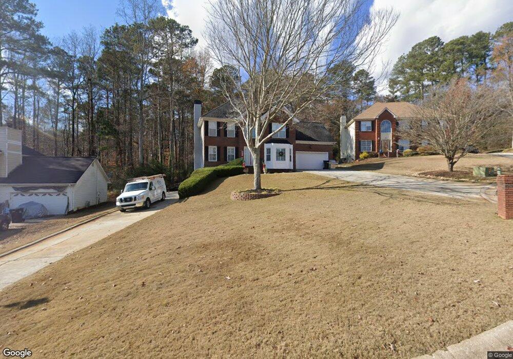
3430 Coles Creek Dr Buford, GA 30519
Estimated Value: $439,000 - $484,000
4
Beds
4
Baths
2,148
Sq Ft
$216/Sq Ft
Est. Value
About This Home
This home is located at 3430 Coles Creek Dr, Buford, GA 30519 and is currently estimated at $463,758, approximately $215 per square foot. 3430 Coles Creek Dr is a home located in Gwinnett County with nearby schools including Patrick Elementary School, Glenn C. Jones Middle School, and Sugar Hill Christian Academy.
Ownership History
Date
Name
Owned For
Owner Type
Purchase Details
Closed on
Jun 12, 2012
Sold by
Dodson Brent Jay
Bought by
Dodson Brent Jay and Dodson Gina Louise
Current Estimated Value
Home Financials for this Owner
Home Financials are based on the most recent Mortgage that was taken out on this home.
Original Mortgage
$159,650
Outstanding Balance
$106,023
Interest Rate
3.11%
Mortgage Type
New Conventional
Estimated Equity
$357,735
Purchase Details
Closed on
May 26, 2006
Sold by
Bennett David B and Bennett Sharon E
Bought by
Dodson Brent J
Home Financials for this Owner
Home Financials are based on the most recent Mortgage that was taken out on this home.
Original Mortgage
$169,150
Interest Rate
6.49%
Mortgage Type
New Conventional
Purchase Details
Closed on
Feb 23, 1996
Sold by
Grenier Paul Amy J
Bought by
Bennett David B Sharon E
Create a Home Valuation Report for This Property
The Home Valuation Report is an in-depth analysis detailing your home's value as well as a comparison with similar homes in the area
Home Values in the Area
Average Home Value in this Area
Purchase History
| Date | Buyer | Sale Price | Title Company |
|---|---|---|---|
| Dodson Brent Jay | -- | -- | |
| Dodson Brent J | $211,500 | -- | |
| Bennett David B Sharon E | $174,900 | -- |
Source: Public Records
Mortgage History
| Date | Status | Borrower | Loan Amount |
|---|---|---|---|
| Open | Dodson Brent Jay | $159,650 | |
| Previous Owner | Dodson Brent J | $169,150 | |
| Closed | Bennett David B Sharon E | $0 |
Source: Public Records
Tax History Compared to Growth
Tax History
| Year | Tax Paid | Tax Assessment Tax Assessment Total Assessment is a certain percentage of the fair market value that is determined by local assessors to be the total taxable value of land and additions on the property. | Land | Improvement |
|---|---|---|---|---|
| 2025 | $4,810 | $176,680 | $40,000 | $136,680 |
| 2024 | $4,010 | $130,880 | $25,200 | $105,680 |
| 2023 | $4,010 | $130,880 | $25,200 | $105,680 |
| 2022 | $3,968 | $130,880 | $25,200 | $105,680 |
| 2021 | $3,633 | $112,120 | $20,800 | $91,320 |
| 2020 | $3,658 | $112,120 | $20,800 | $91,320 |
| 2019 | $3,397 | $104,480 | $20,800 | $83,680 |
| 2018 | $2,888 | $80,880 | $20,800 | $60,080 |
| 2016 | $2,323 | $61,200 | $11,200 | $50,000 |
| 2015 | $2,343 | $61,200 | $11,200 | $50,000 |
| 2014 | -- | $61,200 | $11,200 | $50,000 |
Source: Public Records
Map
Nearby Homes
- 3410 Coles Creek Dr
- 1970 Sturbridge Ln Unit 1
- 3560 Hanover Dr
- 3534 Fallen Oak Ln
- 3476 Harvest Ridge Ln
- 3573 Fallen Oak Dr
- 2140 Harvest Ridge Cir
- 2040 Harvest Ridge Cir NE
- 2040 Harvest Ridge Cir
- 2148 Splitrail Trail
- 3962 Adler Cir Unit 7
- 4152 Adler Cir Unit 42
- 4202 Adler Cir
- 4002 Adler Cir
- 4202 Adler Cir Unit 47
- 3962 Adler Cir
- 4152 Adler Cir
- 2182 Misty Brook Ct
- 2183 Ivy Crest Dr
- 2272 Misty Brook Ct
- 3440 Coles Creek Dr
- 3420 Coles Creek Dr
- 3450 Coles Creek Dr
- 3425 Coles Creek Dr
- 3500 Hanover Dr
- 3501 Hanover Dr
- 3455 Coles Creek Dr
- 3435 Coles Creek Dr
- 3405 Coles Creek Dr
- 3445 Coles Creek Dr
- 3510 Hanover Dr
- 1951 Sturbridge Ln
- 3395 Coles Creek Dr
- 3390 Coles Creek Dr
- 2031 Sturbridge Ln
- 3520 Hanover Dr
- 2001 Sturbridge Ln
- 3385 Coles Creek Dr
- 3380 Coles Creek Dr
- 2102 Cherokee Farms Cove