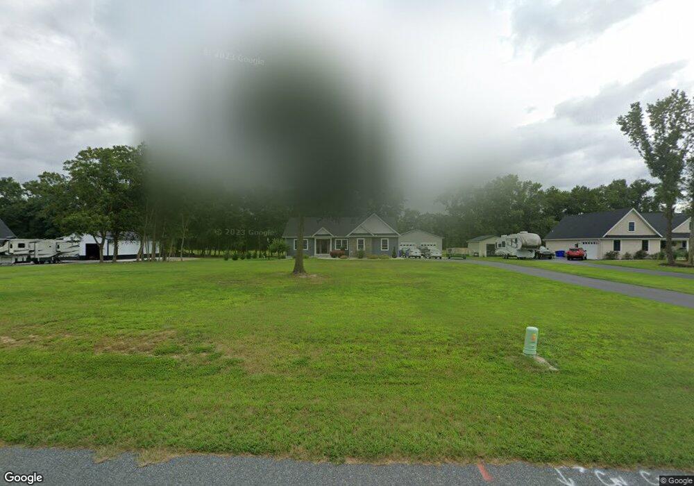
34326 Cowhouse Branch Rd Millsboro, DE 19966
Estimated Value: $412,000 - $434,000
3
Beds
--
Bath
1,707
Sq Ft
$249/Sq Ft
Est. Value
About This Home
This home is located at 34326 Cowhouse Branch Rd, Millsboro, DE 19966 and is currently estimated at $424,925, approximately $248 per square foot. 34326 Cowhouse Branch Rd is a home with nearby schools including East Millsboro Elementary School, Millsboro Middle School, and Sussex Central High School.
Ownership History
Date
Name
Owned For
Owner Type
Purchase Details
Closed on
Jan 28, 2021
Sold by
Ellis Ray A
Bought by
Potter Laura and Potter Brian
Current Estimated Value
Home Financials for this Owner
Home Financials are based on the most recent Mortgage that was taken out on this home.
Original Mortgage
$264,000
Outstanding Balance
$235,709
Interest Rate
2.6%
Mortgage Type
Stand Alone Refi Refinance Of Original Loan
Estimated Equity
$189,216
Create a Home Valuation Report for This Property
The Home Valuation Report is an in-depth analysis detailing your home's value as well as a comparison with similar homes in the area
Home Values in the Area
Average Home Value in this Area
Purchase History
| Date | Buyer | Sale Price | Title Company |
|---|---|---|---|
| Potter Laura | $330,000 | None Available |
Source: Public Records
Mortgage History
| Date | Status | Borrower | Loan Amount |
|---|---|---|---|
| Open | Potter Laura | $264,000 |
Source: Public Records
Tax History Compared to Growth
Tax History
| Year | Tax Paid | Tax Assessment Tax Assessment Total Assessment is a certain percentage of the fair market value that is determined by local assessors to be the total taxable value of land and additions on the property. | Land | Improvement |
|---|---|---|---|---|
| 2025 | $868 | $2,950 | $2,950 | $0 |
| 2024 | $974 | $2,950 | $2,950 | $0 |
| 2023 | $973 | $2,950 | $2,950 | $0 |
| 2022 | $958 | $2,950 | $2,950 | $0 |
| 2021 | $857 | $2,950 | $2,950 | $0 |
| 2020 | $112 | $2,950 | $2,950 | $0 |
| 2019 | $111 | $2,950 | $2,950 | $0 |
| 2018 | $113 | $2,950 | $0 | $0 |
| 2017 | $112 | $2,950 | $0 | $0 |
| 2016 | $100 | $2,950 | $0 | $0 |
| 2015 | $103 | $2,950 | $0 | $0 |
| 2014 | $102 | $2,950 | $0 | $0 |
Source: Public Records
Map
Nearby Homes
- Lot 1 Pear Tree Rd
- 22240 Good Flocking Way
- 32655 Millsboro Hwy
- 34280 Graham Cir
- 36265 Pear Tree Rd
- 0 Laurel Rd Unit DESU2099790
- 37245 Firemans Rd
- 31419 Collins Ct
- 31492 Careys Dr
- 31417 Collins Dr
- 31415 Collins Dr
- 0 Daisey Rd Unit DESU2090614
- 37485 Millsboro Hwy
- 32542 Curley Dr
- 24249 Indian Town Rd
- 26002 Hayfield Ln Unit 44
- 26010 Hayfield Lane - Lot #42
- 63 Beacon Cir
- 26022 Hayfield Ln Unit 39
- 26026 Hayfield Lane - Lot #38
- 34304 Cowhouse Branch Rd
- 34364 Cow House Branch Rd
- lot 4 Cayuga Dr
- 34224 Cowhouse Branch Rd
- 34282 Cow House Branch Rd
- 34350 Cayuga Dr
- 34357 Cayuga Dr
- 34280 Millsboro Hwy
- 34264 Millsboro Hwy
- 34381 Millsboro Hwy
- 34216 Millsboro Hwy
- 34647 Millsboro Hwy
- 34027 Cowhouse Branch Rd
- 34013 Cowhouse Branch Rd
- 34267 Pear Tree Rd
- Lot 1 Westwoods Rd
- 22235 Westwoods Rd
- Lot 2 Westwoods Rd
- 33503 Cowhouse Branch Rd
- 34364 Pear Tree Rd