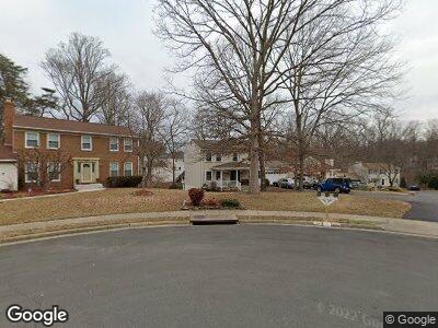
3438 Mount Burnside Way Woodbridge, VA 22192
Estimated Value: $626,000 - $787,000
4
Beds
4
Baths
2,646
Sq Ft
$263/Sq Ft
Est. Value
About This Home
This home is located at 3438 Mount Burnside Way, Woodbridge, VA 22192 and is currently estimated at $694,756, approximately $262 per square foot. 3438 Mount Burnside Way is a home located in Prince William County with nearby schools including Lake Ridge Elementary School, Lake Ridge Middle School, and Woodbridge High School.
Ownership History
Date
Name
Owned For
Owner Type
Purchase Details
Closed on
May 7, 2024
Sold by
Conrad Robert L and Conrad Janet N
Bought by
Conrad Living Trust and Conrad
Current Estimated Value
Purchase Details
Closed on
Jul 15, 2003
Sold by
Nolon John Benson
Bought by
Corad Robert L
Home Financials for this Owner
Home Financials are based on the most recent Mortgage that was taken out on this home.
Original Mortgage
$268,000
Interest Rate
5.45%
Mortgage Type
New Conventional
Create a Home Valuation Report for This Property
The Home Valuation Report is an in-depth analysis detailing your home's value as well as a comparison with similar homes in the area
Home Values in the Area
Average Home Value in this Area
Purchase History
| Date | Buyer | Sale Price | Title Company |
|---|---|---|---|
| Conrad Living Trust | -- | None Listed On Document | |
| Corad Robert L | $335,000 | -- |
Source: Public Records
Mortgage History
| Date | Status | Borrower | Loan Amount |
|---|---|---|---|
| Previous Owner | Conrad Robert L | $221,000 | |
| Previous Owner | Corad Robert L | $268,000 |
Source: Public Records
Tax History Compared to Growth
Tax History
| Year | Tax Paid | Tax Assessment Tax Assessment Total Assessment is a certain percentage of the fair market value that is determined by local assessors to be the total taxable value of land and additions on the property. | Land | Improvement |
|---|---|---|---|---|
| 2024 | $6,098 | $613,200 | $206,600 | $406,600 |
| 2023 | $6,180 | $593,900 | $198,600 | $395,300 |
| 2022 | $6,371 | $565,000 | $187,400 | $377,600 |
| 2021 | $6,020 | $493,600 | $162,900 | $330,700 |
| 2020 | $7,006 | $452,000 | $149,600 | $302,400 |
| 2019 | $7,008 | $452,100 | $148,100 | $304,000 |
| 2018 | $5,407 | $447,800 | $148,100 | $299,700 |
| 2017 | $5,176 | $419,900 | $137,800 | $282,100 |
| 2016 | $4,937 | $404,000 | $131,900 | $272,100 |
| 2015 | $4,723 | $387,200 | $128,500 | $258,700 |
| 2014 | $4,723 | $377,900 | $124,700 | $253,200 |
Source: Public Records
Map
Nearby Homes
- 12062 Cardamom Dr Unit 12062
- 12106 Cardamom Dr Unit 12106
- 12010 Cardamom Dr
- 3200 Foothill St
- 12126 Cardamom Dr Unit 12126
- 12000 Cardamom Dr Unit 12000
- 11998 Cardamom Dr
- 11980 Home Guard Dr
- 12193 Cardamom Dr
- 3367 Flint Hill Place
- 12006 Pebble Brooke Ct
- 3491 Mount Burnside Way
- 11751 Critton Cir
- 11707 Critton Cir
- 3313 Weymouth Ct
- 3468 Aviary Way
- 12240 Nutmeg Ct
- 12060 Willowood Dr
- 3299 Corcyra Ct
- 3630 Sherbrooke Cir Unit 203
- 3438 Mount Burnside Way
- 3436 Mount Burnside Way
- 3442 Mount Burnside Way
- 11839 Parliament Dr
- 11841 Parliament Dr
- 3434 Mount Burnside Way
- 3444 Mount Burnside Way
- 3433 Mount Burnside Way
- 11837 Parliament Dr
- 3435 Mount Burnside Way
- 3429 Mount Burnside Way
- 3431 Mount Burnside Way
- 3437 Mount Burnside Way
- 11995 Hedges Run Dr
- 11835 Parliament Dr
- 11997 Hedges Run Dr
- 3439 Mount Burnside Way
- 3446 Mount Burnside Way
- 12110 Fort Craig Dr
- 11830 Parliament Dr
