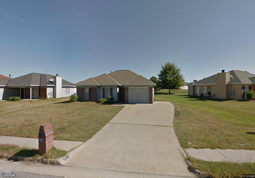
3439 Flintlock Dr Columbus, GA 31907
East Columbus NeighborhoodEstimated Value: $157,000 - $186,000
4
Beds
3
Baths
1,386
Sq Ft
$125/Sq Ft
Est. Value
About This Home
This home is located at 3439 Flintlock Dr, Columbus, GA 31907 and is currently estimated at $173,808, approximately $125 per square foot. 3439 Flintlock Dr is a home located in Muscogee County with nearby schools including Forrest Road Elementary School, Fort Middle School, and Kendrick High School.
Ownership History
Date
Name
Owned For
Owner Type
Purchase Details
Closed on
Mar 25, 2019
Sold by
Morgan Patrice T
Bought by
Morgan Patrice T and Morgan Lonnie C
Current Estimated Value
Home Financials for this Owner
Home Financials are based on the most recent Mortgage that was taken out on this home.
Original Mortgage
$105,552
Outstanding Balance
$93,444
Interest Rate
4.75%
Mortgage Type
FHA
Estimated Equity
$80,364
Create a Home Valuation Report for This Property
The Home Valuation Report is an in-depth analysis detailing your home's value as well as a comparison with similar homes in the area
Home Values in the Area
Average Home Value in this Area
Purchase History
| Date | Buyer | Sale Price | Title Company |
|---|---|---|---|
| Morgan Patrice T | $107,500 | -- | |
| Morgan Patrice T | $107,500 | -- |
Source: Public Records
Mortgage History
| Date | Status | Borrower | Loan Amount |
|---|---|---|---|
| Open | Morgan Patrice T | $105,552 | |
| Closed | Morgan Patrice T | $105,552 |
Source: Public Records
Tax History
| Year | Tax Paid | Tax Assessment Tax Assessment Total Assessment is a certain percentage of the fair market value that is determined by local assessors to be the total taxable value of land and additions on the property. | Land | Improvement |
|---|---|---|---|---|
| 2025 | $1,032 | $59,140 | $8,708 | $50,432 |
| 2024 | $1,031 | $59,140 | $8,708 | $50,432 |
| 2023 | $343 | $59,140 | $8,708 | $50,432 |
| 2022 | $1,075 | $47,496 | $8,708 | $38,788 |
| 2021 | $1,068 | $40,504 | $8,708 | $31,796 |
| 2020 | $1,068 | $39,548 | $8,708 | $30,840 |
| 2019 | $1,620 | $39,548 | $8,708 | $30,840 |
| 2018 | $1,620 | $39,548 | $8,708 | $30,840 |
| 2017 | $1,625 | $39,548 | $8,708 | $30,840 |
| 2016 | $2,006 | $48,625 | $7,200 | $41,425 |
| 2015 | $2,008 | $48,625 | $7,200 | $41,425 |
| 2014 | $2,011 | $48,625 | $7,200 | $41,425 |
| 2013 | -- | $48,625 | $7,200 | $41,425 |
Source: Public Records
Map
Nearby Homes
- 3041 Waddell Dr
- 2708 Courtland Ave
- 2672 Honeysuckle Dr
- 6362 Lemongrass Dr
- 6370 Lemongrass Dr
- 6374 Lemongrass Dr
- 6424 Lemongrass Dr
- 6311 Morning Dew Dr
- 6303 Morning Dew Dr
- 6302 Morning Dew Dr
- 6636 Foxboro Dr
- 6000 Caribou Dr
- 6059 Nassau Cir
- 3301 Musket Dr
- 2946 Gleason Ave
- 2924 Gleason Ave
- 2312 Burnside Dr
- 2939 Gleason Ave
- 2525 Corineth Dr
- 3120 Urban Ave
- 3437 Flintlock Dr
- 3443 Flintlock Dr
- 3435 Flintlock Dr
- 2915 Eagle Pointe Dr
- 2919 Eagle Pointe Dr
- 2911 Eagle Pointe Dr
- 2001 Arrow Point Ln
- 3431 Flintlock Dr
- 3003 Longmont Ln
- 3432 Flintlock Dr
- 3440 Flintlock Dr
- 3005 Longmont Ln
- 3428 Flintlock Dr
- 2923 Eagle Pointe Dr
- 3442 Flintlock Dr
- 2003 Arrow Point Ln
- 3444 Flintlock Dr
- 3007 Longmont Ln
- 3446 Flintlock Dr
- 3423 Flintlock Dr
Your Personal Tour Guide
Ask me questions while you tour the home.