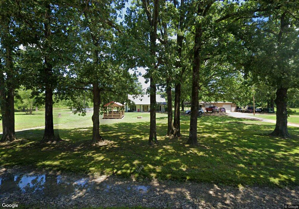
344 Little River 302 Ashdown, AR 71822
Estimated Value: $158,000 - $209,000
--
Bed
2
Baths
1,854
Sq Ft
$97/Sq Ft
Est. Value
About This Home
This home is located at 344 Little River 302, Ashdown, AR 71822 and is currently estimated at $180,116, approximately $97 per square foot. 344 Little River 302 is a home located in Little River County with nearby schools including Ashdown Elementary School, L.F. Henderson Interm. School, and Ashdown Junior High School.
Ownership History
Date
Name
Owned For
Owner Type
Purchase Details
Closed on
Dec 22, 2014
Bought by
Boyer Roger and Boyer Stephanie
Current Estimated Value
Purchase Details
Closed on
Nov 29, 2011
Bought by
Paludan Marsha K
Purchase Details
Closed on
Jan 20, 2009
Bought by
Blanton Robert
Purchase Details
Closed on
Sep 5, 2002
Bought by
Fuhrman Henry C and Fuhrman Melanie
Purchase Details
Closed on
Sep 10, 1997
Bought by
Horn Andrew L and Horn Sherry L
Purchase Details
Closed on
Jul 16, 1985
Bought by
Horn Andrew L and Rt 2 Box 131
Create a Home Valuation Report for This Property
The Home Valuation Report is an in-depth analysis detailing your home's value as well as a comparison with similar homes in the area
Home Values in the Area
Average Home Value in this Area
Purchase History
| Date | Buyer | Sale Price | Title Company |
|---|---|---|---|
| Boyer Roger | $145,000 | -- | |
| Paludan Marsha K | $135,000 | -- | |
| Blanton Robert | $128,000 | -- | |
| Fuhrman Henry C | $87,000 | -- | |
| Horn Andrew L | -- | -- | |
| Horn Andrew L | $8,000 | -- | |
| Horn Andrew L | $48,000 | -- |
Source: Public Records
Tax History Compared to Growth
Tax History
| Year | Tax Paid | Tax Assessment Tax Assessment Total Assessment is a certain percentage of the fair market value that is determined by local assessors to be the total taxable value of land and additions on the property. | Land | Improvement |
|---|---|---|---|---|
| 2024 | $564 | $22,470 | $1,520 | $20,950 |
| 2023 | $430 | $21,950 | $1,520 | $20,430 |
| 2022 | $665 | $21,950 | $1,520 | $20,430 |
| 2021 | $626 | $18,570 | $1,520 | $17,050 |
| 2020 | $589 | $18,570 | $1,520 | $17,050 |
| 2019 | $505 | $18,570 | $1,520 | $17,050 |
| 2018 | $374 | $18,550 | $1,520 | $17,030 |
| 2017 | $341 | $18,550 | $1,520 | $17,030 |
| 2016 | $658 | $15,700 | $1,200 | $14,500 |
| 2015 | $308 | $15,700 | $1,200 | $14,500 |
| 2014 | $284 | $15,700 | $1,200 | $14,500 |
Source: Public Records
Map
Nearby Homes
- 1249 S 9th St
- 263 Lr 182
- 1331 Grant St
- 210 E Cowling St
- 682 U S Highway 71
- 680 U S Highway 71
- TBD Lr 21
- 0000 Fresco Addn
- 999 Lr 17
- 850 Oak St
- 1211 Buck Wright Rd
- 640 Willow St
- 630 Rankin St
- 1609 Buck Wright Rd
- 912 N Smith Cir
- 1531 Rankin St
- 1520 Pine Dr
- 1560 Leona Dr
- 1665 Peyton Ave
- 179 Little River 67
- 364 Little River 302
- 363 Little River 302
- 443 Highway 32 W
- 367 Little River 302
- 399 Highway 32 W
- 407 Highway 32 W
- 395 Highway 32 W
- 365 Little River 302
- 455 Highway 32 W
- 253 Little River 302
- 485 Highway 32 W
- 495 Highway 32 W
- 432 Little River 17
- 342 Highway 32 W
- 211 Little River 302
- 143 Little River 712
- 143 Little River 712
- 312 Little River 17
- 393 Little River 17
- 157 Little River 712