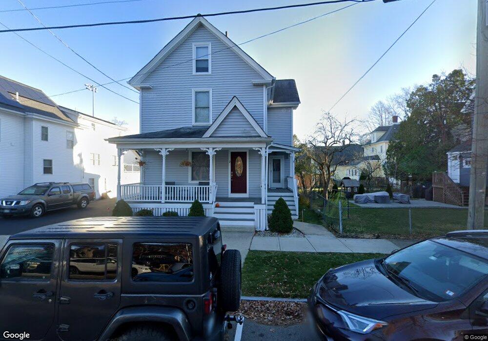
344 Parrott Ave Portsmouth, NH 03801
Estimated Value: $1,057,014 - $1,802,000
4
Beds
3
Baths
1,761
Sq Ft
$728/Sq Ft
Est. Value
About This Home
This home is located at 344 Parrott Ave, Portsmouth, NH 03801 and is currently estimated at $1,282,754, approximately $728 per square foot. 344 Parrott Ave is a home located in Rockingham County with nearby schools including Little Harbour School, Portsmouth Middle School, and Portsmouth High School.
Ownership History
Date
Name
Owned For
Owner Type
Purchase Details
Closed on
Jun 27, 2019
Sold by
Tremblay Marie J
Bought by
344 Parrott Ave Llc
Current Estimated Value
Purchase Details
Closed on
Feb 28, 1995
Bought by
Tremblay Marie J
Create a Home Valuation Report for This Property
The Home Valuation Report is an in-depth analysis detailing your home's value as well as a comparison with similar homes in the area
Home Values in the Area
Average Home Value in this Area
Purchase History
| Date | Buyer | Sale Price | Title Company |
|---|---|---|---|
| 344 Parrott Ave Llc | $725,000 | -- | |
| Tremblay Marie J | -- | -- |
Source: Public Records
Mortgage History
| Date | Status | Borrower | Loan Amount |
|---|---|---|---|
| Previous Owner | Tremblay Marie J | $229,000 | |
| Previous Owner | Tremblay Marie J | $240,000 | |
| Previous Owner | Tremblay Marie J | $50,000 |
Source: Public Records
Tax History Compared to Growth
Tax History
| Year | Tax Paid | Tax Assessment Tax Assessment Total Assessment is a certain percentage of the fair market value that is determined by local assessors to be the total taxable value of land and additions on the property. | Land | Improvement |
|---|---|---|---|---|
| 2024 | $11,105 | $993,300 | $567,200 | $426,100 |
| 2023 | $9,889 | $613,100 | $337,600 | $275,500 |
| 2022 | $9,319 | $613,100 | $337,600 | $275,500 |
| 2021 | $9,215 | $613,100 | $337,600 | $275,500 |
| 2020 | $9,013 | $613,100 | $337,600 | $275,500 |
| 2019 | $8,559 | $576,000 | $337,600 | $238,400 |
| 2018 | $8,449 | $533,400 | $306,900 | $226,500 |
| 2017 | $8,204 | $533,400 | $306,900 | $226,500 |
| 2016 | $7,475 | $438,700 | $235,600 | $203,100 |
| 2015 | $7,366 | $438,700 | $235,600 | $203,100 |
| 2014 | $7,010 | $387,300 | $208,000 | $179,300 |
| 2013 | $6,775 | $378,300 | $208,000 | $170,300 |
| 2012 | $5,948 | $338,900 | $208,000 | $130,900 |
Source: Public Records
Map
Nearby Homes
- 34 Highland St
- 238 Austin St
- 21 Madison St
- 115 Court St
- 5 Old Parish Way
- 198 Islington St Unit 6
- 161 Wibird St
- 4 Rock St Unit B
- 51 Islington St Unit 406
- 90 Fleet St Unit 4-5
- 210 South St
- 332 Hanover St
- 70 Maplewood Ave Unit 305
- 70 Maplewood Ave Unit 202
- 70 Maplewood Ave Unit 204
- 70 Maplewood Ave Unit 303
- 70 Maplewood Ave Unit 302
- 70 Maplewood Ave Unit 205
- 70 Maplewood Ave Unit 206
- 70 Maplewood Ave Unit 304
- 334 Parrott Ave
- 165 Richards Ave
- 157 Richards Ave
- 324 Parrott Ave
- 177 Richards Ave
- 135 Richards Ave Unit 139
- 197 Richards Ave
- 121 Richards Ave
- 111 Richards Ave
- 160 Richards Ave
- 182 Richards Ave
- 148 Richards Ave
- 215 Richards Ave
- 105 Richards Ave
- 193 Richards Ave
- 134 Richards Ave
- 204 Richards Ave
- 118 Richards Ave
- 97 Richards Ave
- 104 Richards Ave