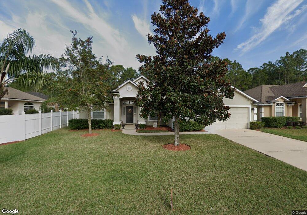
344 Sparrow Branch Cir Saint Johns, FL 32259
Estimated Value: $510,000 - $558,000
5
Beds
2
Baths
2,510
Sq Ft
$210/Sq Ft
Est. Value
About This Home
This home is located at 344 Sparrow Branch Cir, Saint Johns, FL 32259 and is currently estimated at $527,144, approximately $210 per square foot. 344 Sparrow Branch Cir is a home located in St. Johns County with nearby schools including Durbin Creek Elementary School, Fruit Cove Middle School, and Creekside High School.
Ownership History
Date
Name
Owned For
Owner Type
Purchase Details
Closed on
Dec 22, 2004
Sold by
D R Horton Inc Jacksonville
Bought by
Schmoyer Steven A and Schmoyer Carolyn J
Current Estimated Value
Home Financials for this Owner
Home Financials are based on the most recent Mortgage that was taken out on this home.
Original Mortgage
$210,000
Outstanding Balance
$98,246
Interest Rate
4.75%
Mortgage Type
Purchase Money Mortgage
Estimated Equity
$428,898
Create a Home Valuation Report for This Property
The Home Valuation Report is an in-depth analysis detailing your home's value as well as a comparison with similar homes in the area
Home Values in the Area
Average Home Value in this Area
Purchase History
| Date | Buyer | Sale Price | Title Company |
|---|---|---|---|
| Schmoyer Steven A | $274,200 | Dhi Title Of Florida Inc |
Source: Public Records
Mortgage History
| Date | Status | Borrower | Loan Amount |
|---|---|---|---|
| Open | Schmoyer Steven A | $210,000 |
Source: Public Records
Tax History Compared to Growth
Tax History
| Year | Tax Paid | Tax Assessment Tax Assessment Total Assessment is a certain percentage of the fair market value that is determined by local assessors to be the total taxable value of land and additions on the property. | Land | Improvement |
|---|---|---|---|---|
| 2025 | $3,947 | $261,596 | -- | -- |
| 2024 | $3,947 | $254,224 | -- | -- |
| 2023 | $3,947 | $246,819 | $0 | $0 |
| 2022 | $3,861 | $239,630 | $0 | $0 |
| 2021 | $3,633 | $232,650 | $0 | $0 |
| 2020 | $3,574 | $229,438 | $0 | $0 |
| 2019 | $3,622 | $224,280 | $0 | $0 |
| 2018 | $3,547 | $220,098 | $0 | $0 |
| 2017 | $3,506 | $215,571 | $0 | $0 |
| 2016 | $3,485 | $217,471 | $0 | $0 |
| 2015 | $3,537 | $215,959 | $0 | $0 |
| 2014 | $3,546 | $213,018 | $0 | $0 |
Source: Public Records
Map
Nearby Homes
- 527 Pine Haven Dr
- 300 Sparrow Branch Cir
- 252 Pine Haven Dr
- 4505 S Pennycress Place
- 2708 Caldar Ct
- 4340 Rye Ct
- 1925 Barham Ct
- 572 Sparrow Branch Cir
- 1001 Andrea Way
- 145 Sugar Sand Ln
- 1232 Loch Tanna Loop
- 1121 Andrea Way
- 4160 Lonicera Loop
- 254 Dock House Rd
- 124 Mollusk Rd
- 200 Gladstone Ct
- 281 Lakeview Pass Way
- 105 Castlegate Ln
- 969 W Tennessee Trace
- 200 Huntston Way
- 340 Sparrow Branch Cir
- 2400 Cassia Ct
- 2404 Cassia Ct
- 336 Sparrow Branch Cir
- 2493 Cassia Ct
- 2408 Cassia Ct
- 349 Sparrow Branch Cir
- 332 Sparrow Branch Cir
- 345 Sparrow Branch Cir
- 341 Sparrow Branch Cir
- 337 Sparrow Branch Cir
- 2908 Cassia Ct
- 2658 Cassia Ct
- 2580 Cassia Ct
- 2574 Cassia Ct
- 2610 Cassia Ct
- 2864 Cassia Ct
- 2598 Cassia Ct
- 2592 Cassia Ct
- 2902 Cassia Ct