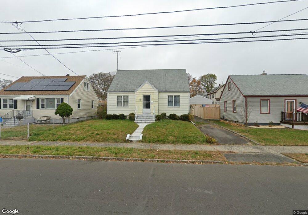
344 Thorme St Bridgeport, CT 06606
North End NeighborhoodEstimated Value: $370,965 - $404,000
2
Beds
1
Bath
1,328
Sq Ft
$294/Sq Ft
Est. Value
About This Home
This home is located at 344 Thorme St, Bridgeport, CT 06606 and is currently estimated at $389,991, approximately $293 per square foot. 344 Thorme St is a home located in Fairfield County with nearby schools including Blackham School, Central High School, and St Andrew School.
Create a Home Valuation Report for This Property
The Home Valuation Report is an in-depth analysis detailing your home's value as well as a comparison with similar homes in the area
Home Values in the Area
Average Home Value in this Area
Tax History Compared to Growth
Tax History
| Year | Tax Paid | Tax Assessment Tax Assessment Total Assessment is a certain percentage of the fair market value that is determined by local assessors to be the total taxable value of land and additions on the property. | Land | Improvement |
|---|---|---|---|---|
| 2025 | $6,267 | $144,230 | $75,310 | $68,920 |
| 2024 | $6,267 | $144,230 | $75,310 | $68,920 |
| 2023 | $6,267 | $144,230 | $75,310 | $68,920 |
| 2022 | $6,267 | $144,230 | $75,310 | $68,920 |
| 2021 | $6,267 | $144,230 | $75,310 | $68,920 |
| 2020 | $5,458 | $101,100 | $43,270 | $57,830 |
| 2019 | $5,458 | $101,100 | $43,270 | $57,830 |
| 2018 | $5,497 | $101,100 | $43,270 | $57,830 |
| 2017 | $5,497 | $101,100 | $43,270 | $57,830 |
| 2016 | $5,497 | $101,100 | $43,270 | $57,830 |
| 2015 | $5,614 | $133,040 | $49,980 | $83,060 |
| 2014 | $5,614 | $133,040 | $49,980 | $83,060 |
Source: Public Records
Map
Nearby Homes
- 260 Birmingham St
- 113 Clark St
- 214 Burnsford Ave
- 184 Merritt St
- 3401 Main St
- 234 Savoy St
- 376 Savoy St
- 604 Birmingham St
- 339 Goldenrod Ave
- 1095 Wayne St
- 354 Beechmont Ave
- 520 Savoy St
- 375 Ruth St
- 485 Westfield Ave
- 631 Fairview Ave
- 605 Merritt St
- 45 Stevens St Unit 2
- 105 Tremont Ave Unit E
- 105 Tremont Ave Unit B
- 1265 Lindley St