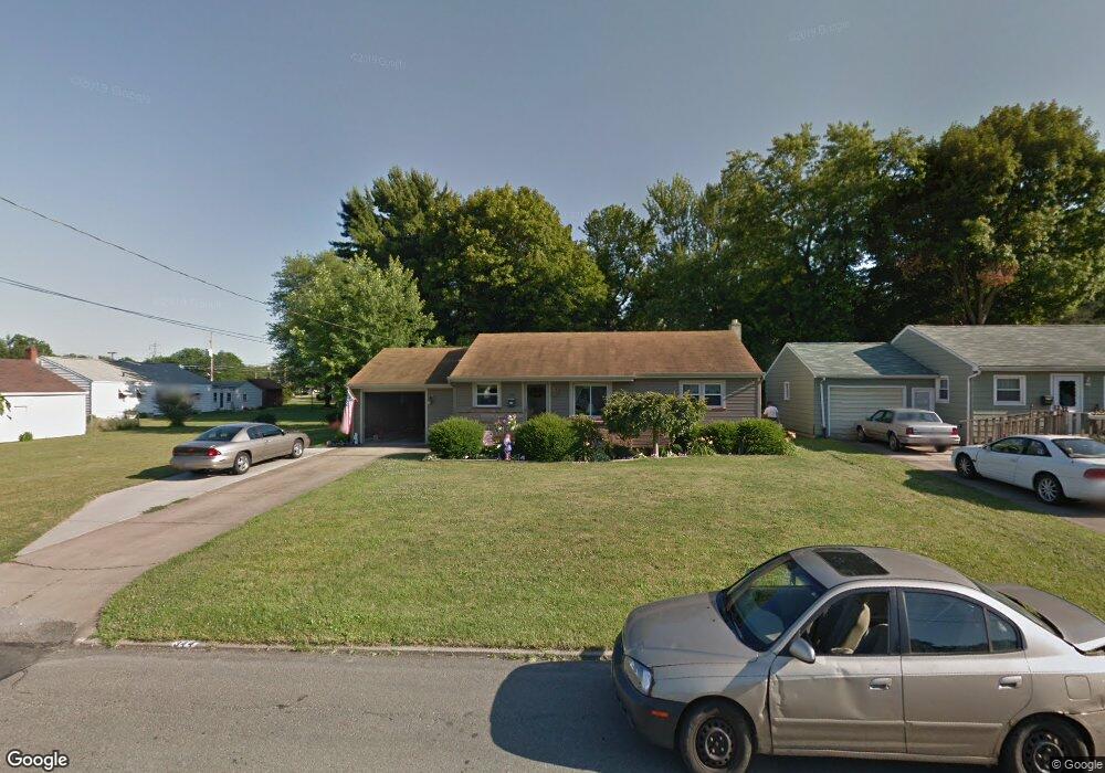
344 W Omar St Struthers, OH 44471
Estimated Value: $148,556 - $168,000
2
Beds
1
Bath
1,064
Sq Ft
$149/Sq Ft
Est. Value
About This Home
This home is located at 344 W Omar St, Struthers, OH 44471 and is currently estimated at $158,889, approximately $149 per square foot. 344 W Omar St is a home located in Mahoning County with nearby schools including Struthers Elementary School, Struthers Middle School, and Struthers High School.
Ownership History
Date
Name
Owned For
Owner Type
Purchase Details
Closed on
Jul 24, 2007
Sold by
Williams Patrick J and Williams Jodi L
Bought by
Kurpe Janet L and Kurpe Donald P
Current Estimated Value
Purchase Details
Closed on
Dec 19, 2000
Sold by
Durisko Linda L and Durisko Linda L
Bought by
Williams Patrick J and Mullins Jodi L
Home Financials for this Owner
Home Financials are based on the most recent Mortgage that was taken out on this home.
Original Mortgage
$59,469
Outstanding Balance
$20,969
Interest Rate
7.83%
Mortgage Type
FHA
Estimated Equity
$137,920
Purchase Details
Closed on
Aug 19, 1996
Sold by
Thomas Joseph E
Bought by
Durisko Linda L
Home Financials for this Owner
Home Financials are based on the most recent Mortgage that was taken out on this home.
Original Mortgage
$55,800
Interest Rate
8.18%
Mortgage Type
New Conventional
Create a Home Valuation Report for This Property
The Home Valuation Report is an in-depth analysis detailing your home's value as well as a comparison with similar homes in the area
Home Values in the Area
Average Home Value in this Area
Purchase History
We collect this data history from publicly available records. To have your information removed, we recommend requesting removal directly through your county’s website.
| Date | Buyer | Sale Price | Title Company |
|---|---|---|---|
| Kurpe Janet L | $80,800 | Attorney | |
| Williams Patrick J | $59,500 | -- | |
| Durisko Linda L | $62,000 | -- |
Source: Public Records
Mortgage History
We collect this data history from publicly available records. To have your information removed, we recommend requesting removal directly through your county’s website.
| Date | Status | Borrower | Loan Amount |
|---|---|---|---|
| Open | Williams Patrick J | $59,469 | |
| Previous Owner | Durisko Linda L | $55,800 |
Source: Public Records
Tax History
| Year | Tax Paid | Tax Assessment Tax Assessment Total Assessment is a certain percentage of the fair market value that is determined by local assessors to be the total taxable value of land and additions on the property. | Land | Improvement |
|---|---|---|---|---|
| 2025 | $1,140 | $37,510 | $5,050 | $32,460 |
| 2024 | $1,155 | $37,510 | $5,050 | $32,460 |
| 2023 | $1,161 | $37,510 | $5,050 | $32,460 |
| 2022 | $1,227 | $31,430 | $4,750 | $26,680 |
| 2021 | $1,215 | $31,430 | $4,750 | $26,680 |
| 2020 | $1,221 | $31,430 | $4,750 | $26,680 |
| 2019 | $1,102 | $27,330 | $4,130 | $23,200 |
| 2018 | $1,544 | $27,330 | $4,130 | $23,200 |
| 2017 | $1,541 | $27,330 | $4,130 | $23,200 |
| 2016 | $1,243 | $22,550 | $4,820 | $17,730 |
| 2015 | $1,214 | $22,550 | $4,820 | $17,730 |
| 2014 | $1,218 | $22,550 | $4,820 | $17,730 |
| 2013 | $1,132 | $22,550 | $4,820 | $17,730 |
Source: Public Records
Map
Nearby Homes
- 447 W Omar St
- 2413 W Manor Ave
- 499 W Harvey St
- 525 W Omar St
- 0 Smithfield St Unit 4336782
- 795 5th St
- 511 Edison St
- 2364 Lyon Blvd
- 178 Como St
- 2215 Knollwood Ave
- 627 Poland Ave
- 5529 Beechwood Dr
- 563 Geneva Ave
- 592 W Omar St
- 107 Renee Dr
- 2301 Lyon Blvd
- 449 Creed St
- 548 W Wilson St
- 59 Harvey St
- 60 Renee Dr
Your Personal Tour Guide
Ask me questions while you tour the home.