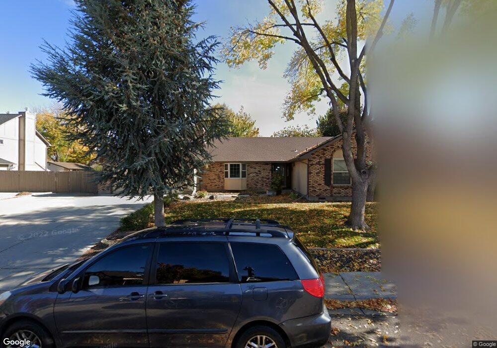
3440 Columbine Ave Boise, ID 83713
West Boise NeighborhoodEstimated Value: $520,000 - $552,000
4
Beds
3
Baths
2,327
Sq Ft
$232/Sq Ft
Est. Value
About This Home
This home is located at 3440 Columbine Ave, Boise, ID 83713 and is currently estimated at $538,811, approximately $231 per square foot. 3440 Columbine Ave is a home located in Ada County with nearby schools including Frontier Elementary School, Lowell Scott Middle School, and Centennial High School.
Ownership History
Date
Name
Owned For
Owner Type
Purchase Details
Closed on
Feb 23, 2024
Sold by
Mcwilliams Trisha
Bought by
Harrington Amanda Tori and Harrington Ryan Andrew
Current Estimated Value
Home Financials for this Owner
Home Financials are based on the most recent Mortgage that was taken out on this home.
Original Mortgage
$340,500
Outstanding Balance
$334,471
Interest Rate
6.6%
Mortgage Type
New Conventional
Estimated Equity
$204,340
Create a Home Valuation Report for This Property
The Home Valuation Report is an in-depth analysis detailing your home's value as well as a comparison with similar homes in the area
Home Values in the Area
Average Home Value in this Area
Purchase History
| Date | Buyer | Sale Price | Title Company |
|---|---|---|---|
| Harrington Amanda Tori | -- | Venture Title |
Source: Public Records
Mortgage History
| Date | Status | Borrower | Loan Amount |
|---|---|---|---|
| Open | Harrington Amanda Tori | $340,500 |
Source: Public Records
Tax History Compared to Growth
Tax History
| Year | Tax Paid | Tax Assessment Tax Assessment Total Assessment is a certain percentage of the fair market value that is determined by local assessors to be the total taxable value of land and additions on the property. | Land | Improvement |
|---|---|---|---|---|
| 2025 | $2,527 | $525,600 | -- | -- |
| 2024 | $2,329 | $507,100 | -- | -- |
| 2023 | $2,329 | $459,600 | $0 | $0 |
| 2022 | $2,824 | $543,300 | $0 | $0 |
| 2021 | $2,614 | $423,100 | $0 | $0 |
| 2020 | $2,219 | $322,600 | $0 | $0 |
| 2019 | $2,618 | $304,400 | $0 | $0 |
| 2018 | $2,453 | $272,700 | $0 | $0 |
| 2017 | $2,271 | $250,400 | $0 | $0 |
| 2016 | $2,243 | $239,700 | $0 | $0 |
| 2015 | $1,058 | $227,200 | $0 | $0 |
| 2012 | -- | $175,500 | $0 | $0 |
Source: Public Records
Map
Nearby Homes
- 11900 W Ramrod Dr
- 11288 W Race Ct
- 11143 W Ramrod Dr
- 3958 N Bryson Way
- 12116 W Musket Dr
- 11175 W Hinsdale St
- Plan 1910 at Mooseland
- Plan 2301 at Mooseland
- Plan 2800 at Mooseland
- 11000 W Ramrod Dr
- 2834 N Cloverdale Rd Unit 146
- 12137 W Ginger Creek Dr
- 12159 W Ginger Creek Dr
- 12169 W Ginger Creek Dr
- 12163 W Ginger Creek Dr
- 12153 W Ginger Creek Dr
- 12137 Ginger Creek Dr
- 12123 W Ginger Creek Dr
- 11934 W Ardyce St
- 3552 N Covered Wagon Way
- 3440 N Columbine Ave
- 3458 N Columbine Ave
- 3428 Columbine Ave
- 3458 Columbine Ave
- 3439 Tumbleweed Ave
- 3457 Tumbleweed Ave
- 3431 Columbine Ave
- 3443 N Columbine Ave
- 3443 Columbine Ave
- 3373 Tumbleweed Ave
- 3374 Columbine Ave
- 3486 Columbine Ave
- 3375 Columbine Ave
- 3459 Columbine Ave
- 3485 Tumbleweed Ave
- 3347 N Columbine Ave
- 3347 Columbine Ave
- 3434 N Lena Ave
- 3462 N Lena Ave
- 3438 Tumbleweed Ave