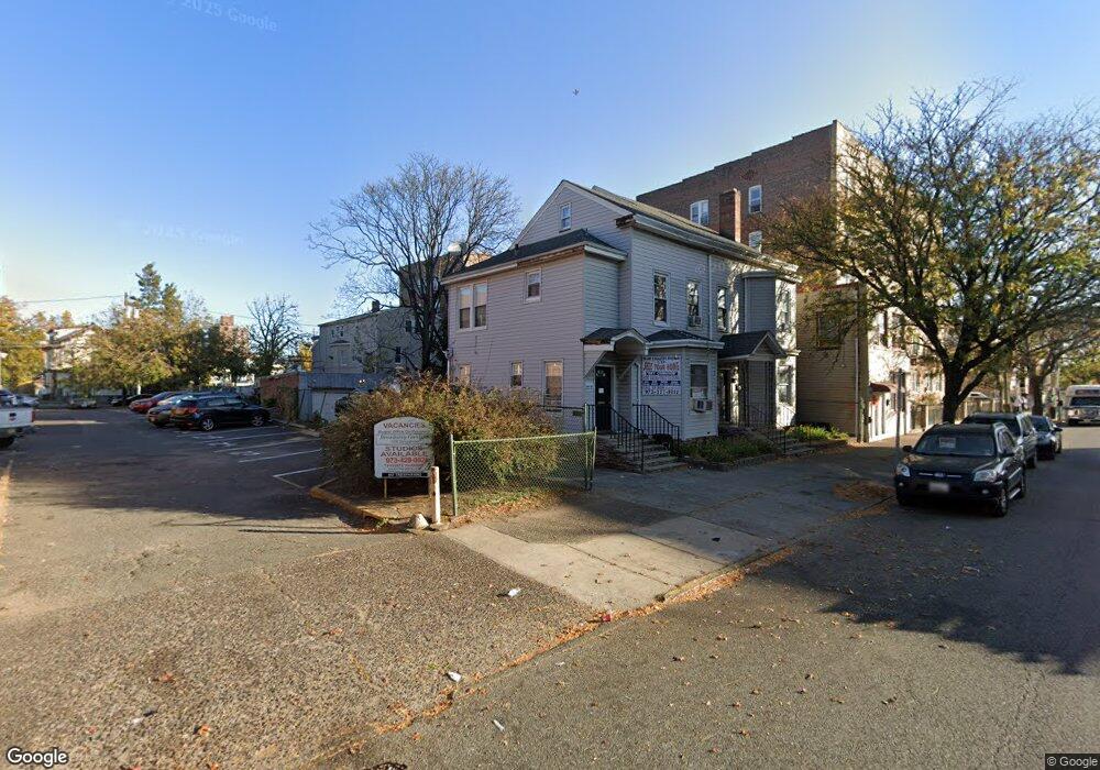
345 Broadway Unit 2 Paterson, NJ 07501
Eastside NeighborhoodEstimated Value: $637,000 - $850,000
3
Beds
1
Bath
3,686
Sq Ft
$195/Sq Ft
Est. Value
About This Home
This home is located at 345 Broadway Unit 2, Paterson, NJ 07501 and is currently estimated at $718,204, approximately $194 per square foot. 345 Broadway Unit 2 is a home located in Passaic County with nearby schools including Edward W. Kilpatrick School of Discovery, Dale Avenue Elementary School, and Paterson School 6.
Ownership History
Date
Name
Owned For
Owner Type
Purchase Details
Closed on
Jun 30, 2022
Sold by
Peter Hill Llc
Bought by
Glm Investments Llc
Current Estimated Value
Purchase Details
Closed on
Oct 15, 2010
Sold by
253 E 33Rd St Llc
Bought by
Peter Hill Llc
Home Financials for this Owner
Home Financials are based on the most recent Mortgage that was taken out on this home.
Original Mortgage
$100,000
Interest Rate
4.39%
Mortgage Type
Purchase Money Mortgage
Create a Home Valuation Report for This Property
The Home Valuation Report is an in-depth analysis detailing your home's value as well as a comparison with similar homes in the area
Home Values in the Area
Average Home Value in this Area
Purchase History
| Date | Buyer | Sale Price | Title Company |
|---|---|---|---|
| Glm Investments Llc | -- | -- | |
| Glm Investments Llc | -- | None Listed On Document | |
| Peter Hill Llc | $120,000 | -- |
Source: Public Records
Mortgage History
| Date | Status | Borrower | Loan Amount |
|---|---|---|---|
| Previous Owner | Peter Hill Llc | $100,000 |
Source: Public Records
Tax History Compared to Growth
Tax History
| Year | Tax Paid | Tax Assessment Tax Assessment Total Assessment is a certain percentage of the fair market value that is determined by local assessors to be the total taxable value of land and additions on the property. | Land | Improvement |
|---|---|---|---|---|
| 2025 | $15,667 | $307,500 | $21,300 | $286,200 |
| 2024 | $15,077 | $307,500 | $21,300 | $286,200 |
| 2022 | $14,274 | $307,500 | $21,300 | $286,200 |
| 2021 | $13,764 | $307,500 | $21,300 | $286,200 |
| 2020 | $12,838 | $307,500 | $21,300 | $286,200 |
| 2019 | $12,427 | $300,600 | $21,100 | $279,500 |
| 2018 | $11,572 | $267,500 | $21,000 | $246,500 |
| 2017 | $11,041 | $265,400 | $20,900 | $244,500 |
| 2016 | $12,171 | $280,500 | $22,100 | $258,400 |
| 2015 | $11,523 | $280,500 | $22,100 | $258,400 |
| 2014 | $8,129 | $280,300 | $130,100 | $150,200 |
Source: Public Records
Map
Nearby Homes
- 282 Hamilton Ave
- 265 Hamilton Ave
- 377 Ellison St Unit 379
- 127 Godwin Ave
- 430 Ellison St
- 436 Ellison St
- 125 Pearl St
- 343 Hamilton Ave
- 354 Hamilton Ave
- 337 Ellison St
- 338 Ellison St
- 192 12th Ave Unit 2
- 327 Ellison St
- 204 Governor St
- 213 16th Ave
- 292 Van Houten St
- 138 16th Ave
- 217 Governor St
- 78 Pearl St
- 197 12th Ave
- 345 Broadway Unit 347
- 349 Broadway
- 288 Rosa Parks Blvd Unit 36
- 288 Rosa Parks Blvd Unit 49
- 288 Rosa Parks Blvd Unit 45
- 288 Rosa Parks Blvd
- 288 Rosa Parks Blvd Unit 20
- 288 Rosa Parks Blvd
- 279 Fair St Unit 283
- 287 Fair St
- 289 Fair St
- 270 Rosa Parks Blvd
- 277 Fair St
- 324 Broadway
- 363 Van Houten St
- 271 Rosa Parks Blvd
- 264 Rosa Parks Blvd Unit 266
- 266 Graham Ave
- 266 Graham Ave Unit 1
- 266 Rosa Parks Blvd