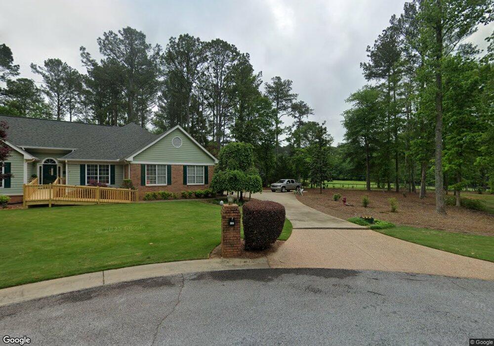
345 Ellison Rd Tyrone, GA 30290
Estimated Value: $645,000 - $797,970
--
Bed
--
Bath
3,513
Sq Ft
$205/Sq Ft
Est. Value
About This Home
This home is located at 345 Ellison Rd, Tyrone, GA 30290 and is currently estimated at $720,243, approximately $205 per square foot. 345 Ellison Rd is a home located in Fayette County with nearby schools including Robert J. Burch Elementary School, Flat Rock Middle School, and Sandy Creek High School.
Ownership History
Date
Name
Owned For
Owner Type
Purchase Details
Closed on
Jan 26, 2009
Sold by
Residential Funding Co Llc
Bought by
Bush Thomas P and Bush Lauren N
Current Estimated Value
Home Financials for this Owner
Home Financials are based on the most recent Mortgage that was taken out on this home.
Original Mortgage
$370,000
Interest Rate
5.18%
Purchase Details
Closed on
Aug 5, 2008
Sold by
Sneed Joyce A
Bought by
Residential Fndg Co Llc
Purchase Details
Closed on
Aug 9, 2006
Sold by
Green J L
Bought by
Sneed Joyce A
Home Financials for this Owner
Home Financials are based on the most recent Mortgage that was taken out on this home.
Original Mortgage
$525,000
Interest Rate
6.74%
Mortgage Type
New Conventional
Create a Home Valuation Report for This Property
The Home Valuation Report is an in-depth analysis detailing your home's value as well as a comparison with similar homes in the area
Home Values in the Area
Average Home Value in this Area
Purchase History
| Date | Buyer | Sale Price | Title Company |
|---|---|---|---|
| Bush Thomas P | $300,000 | -- | |
| Residential Fndg Co Llc | $621,000 | -- | |
| Sneed Joyce A | -- | -- | |
| Sneed Joyce A | $670,000 | -- |
Source: Public Records
Mortgage History
| Date | Status | Borrower | Loan Amount |
|---|---|---|---|
| Previous Owner | Bush Thomas P | $370,000 | |
| Previous Owner | Sneed Joyce A | $525,000 |
Source: Public Records
Tax History Compared to Growth
Tax History
| Year | Tax Paid | Tax Assessment Tax Assessment Total Assessment is a certain percentage of the fair market value that is determined by local assessors to be the total taxable value of land and additions on the property. | Land | Improvement |
|---|---|---|---|---|
| 2024 | $5,244 | $302,716 | $106,964 | $195,752 |
| 2023 | $5,244 | $280,192 | $93,592 | $186,600 |
| 2022 | $4,812 | $241,448 | $83,568 | $157,880 |
| 2021 | $4,481 | $204,764 | $76,884 | $127,880 |
| 2020 | $3,253 | $167,548 | $53,308 | $114,240 |
| 2019 | $4,540 | $161,228 | $53,308 | $107,920 |
| 2018 | $4,257 | $149,668 | $48,228 | $101,440 |
| 2017 | $3,832 | $134,452 | $45,692 | $88,760 |
| 2016 | $3,594 | $123,572 | $45,692 | $77,880 |
| 2015 | $3,465 | $117,132 | $45,692 | $71,440 |
| 2014 | $3,178 | $105,692 | $45,692 | $60,000 |
| 2013 | -- | $103,692 | $0 | $0 |
Source: Public Records
Map
Nearby Homes
- 335 Weeping Willow Way
- 250 Chimney Springs
- 0 Swanson Rd Unit 10617165
- 175 Flat Creek Ct
- 140 Julie Rd
- 170 Brennan Dr
- 230 Gaelic Way
- 365 Pendleton Trail
- 160 Wickham Dr
- 210 Gaelic Way
- 159 Sims Rd
- 140 Devonshire Place
- Lot 3 Dogwood Trail Unit 5 ACRES
- 1333 Sandy Creek Rd
- 110 Sutton Ct
- 230 Hedgewick Way
- 839 Sandy Creek Rd
- 90 Mckown Rd
- 270 Annelise Park Dr
- 506 Avalon Dr