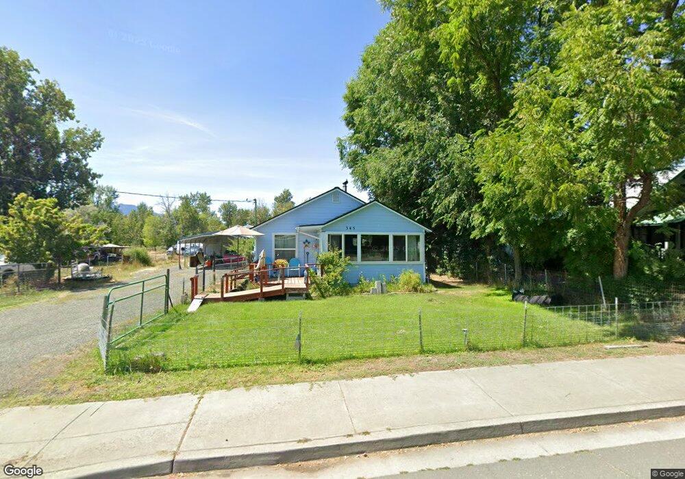
345 Ingle St Mount Vernon, OR 97865
Estimated Value: $207,120 - $261,000
--
Bed
--
Bath
1,190
Sq Ft
$193/Sq Ft
Est. Value
About This Home
This home is located at 345 Ingle St, Mount Vernon, OR 97865 and is currently estimated at $229,780, approximately $193 per square foot. 345 Ingle St is a home with nearby schools including Grant Union Junior/Senior High School.
Create a Home Valuation Report for This Property
The Home Valuation Report is an in-depth analysis detailing your home's value as well as a comparison with similar homes in the area
Home Values in the Area
Average Home Value in this Area
Tax History Compared to Growth
Tax History
| Year | Tax Paid | Tax Assessment Tax Assessment Total Assessment is a certain percentage of the fair market value that is determined by local assessors to be the total taxable value of land and additions on the property. | Land | Improvement |
|---|---|---|---|---|
| 2024 | $1,432 | $98,137 | $33,465 | $64,672 |
| 2023 | $1,387 | $95,279 | $32,490 | $62,789 |
| 2022 | $1,348 | $92,504 | $31,543 | $60,961 |
| 2021 | $1,312 | $89,810 | $30,621 | $59,189 |
| 2020 | $1,379 | $87,195 | $29,730 | $57,465 |
| 2019 | $1,340 | $84,656 | $28,871 | $55,785 |
| 2018 | $1,299 | $82,191 | $27,360 | $54,831 |
| 2017 | $1,274 | $79,798 | $26,568 | $53,230 |
| 2016 | $1,237 | $77,474 | $25,793 | $51,681 |
| 2015 | $1,206 | $73,028 | $24,313 | $48,715 |
| 2014 | $1,206 | $73,028 | $24,313 | $48,715 |
| 2013 | $1,135 | $70,901 | $23,602 | $47,299 |
Source: Public Records
Map
Nearby Homes
- 251 SE Council Dr
- 54797 U S Highway 26
- 210 Mountain Blvd
- 809 Ingle St
- 410 N Mountain Blvd
- 440 N Mountain Blvd
- 55550 McKern Ln
- 54797 U S 26
- 59720 Highway 26
- 58392 Antelope Ln
- 0 Hwy 395 Unit 220203788
- 0 Hwy 395 Unit 603386933
- 59920 Highway 26
- 59920 Hwy 26
- 31367 Clarks Creek Rd
- 27637 La Costa Rd
- 27637 La Costa Ave
- 59591 High Ridge Ln
- 0 E Side Ln Unit 201102803
- 0 County Rd 74b Unit 11554207