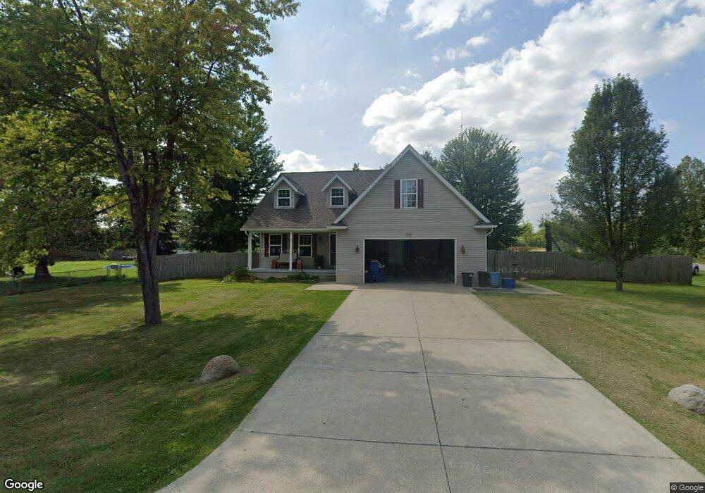
345 Lincoln Ave Unit Bldg-Unit Kimball, MI 48074
Estimated Value: $272,000 - $348,000
4
Beds
3
Baths
1,200
Sq Ft
$253/Sq Ft
Est. Value
About This Home
This home is located at 345 Lincoln Ave Unit Bldg-Unit, Kimball, MI 48074 and is currently estimated at $303,222, approximately $252 per square foot. 345 Lincoln Ave Unit Bldg-Unit is a home located in St. Clair County with nearby schools including St. Clair County Intervention Academy and Blue Water SDA Elementary School.
Ownership History
Date
Name
Owned For
Owner Type
Purchase Details
Closed on
Feb 27, 2018
Sold by
Vail James P and Vail Andrea L
Bought by
Morris James D and Morris Davon H
Current Estimated Value
Home Financials for this Owner
Home Financials are based on the most recent Mortgage that was taken out on this home.
Original Mortgage
$189,504
Outstanding Balance
$161,887
Interest Rate
4.25%
Mortgage Type
FHA
Estimated Equity
$141,335
Create a Home Valuation Report for This Property
The Home Valuation Report is an in-depth analysis detailing your home's value as well as a comparison with similar homes in the area
Home Values in the Area
Average Home Value in this Area
Purchase History
| Date | Buyer | Sale Price | Title Company |
|---|---|---|---|
| Morris James D | $193,000 | Liberty Title |
Source: Public Records
Mortgage History
| Date | Status | Borrower | Loan Amount |
|---|---|---|---|
| Open | Morris James D | $189,504 |
Source: Public Records
Tax History Compared to Growth
Tax History
| Year | Tax Paid | Tax Assessment Tax Assessment Total Assessment is a certain percentage of the fair market value that is determined by local assessors to be the total taxable value of land and additions on the property. | Land | Improvement |
|---|---|---|---|---|
| 2025 | $2,988 | $100,700 | $0 | $0 |
| 2024 | $1,096 | $102,700 | $0 | $0 |
| 2023 | $1,044 | $100,400 | $0 | $0 |
| 2022 | $2,712 | $88,500 | $0 | $0 |
| 2021 | $2,383 | $85,200 | $0 | $0 |
| 2020 | $2,383 | $89,800 | $89,800 | $0 |
| 2019 | $2,339 | $81,500 | $0 | $0 |
| 2018 | $910 | $88,300 | $0 | $0 |
| 2017 | $891 | $55,700 | $0 | $0 |
| 2016 | $352 | $55,700 | $0 | $0 |
| 2015 | -- | $49,000 | $49,000 | $0 |
| 2014 | -- | $30,200 | $30,200 | $0 |
| 2013 | -- | $52,500 | $0 | $0 |
Source: Public Records
Map
Nearby Homes
- 4745 Smiths Creek Rd
- 192 Pickford Rd
- 4601 Gratiot Rd
- 0 Georgia Ave Unit 20251028141
- 250 Oregon Ave
- 929 Georgia Ave
- 711 Georgia Ave
- 000 Montana Ave
- 917 Carolina
- 1320 Georgia Ave
- 1337 Carolina
- 0 Gratiot Blvd Unit 50105825
- 765 Lomasney Ln
- 808 5th St
- 183 Nevada Ave
- 1329 Vermont Ave
- 720 Arlington Cir
- 277 Liberty Ave
- 260 Capitol Dr
- 1253 18th St
- 345 Lincoln Ave
- 0 Ninth St Unit 31337881
- 325 Lincoln Ave
- 0 9th St Unit 4251524
- 0 9th St Unit 868456
- 0 9th St Unit 937507
- 4625 9th St
- 320 Lincoln Ave
- 315 Lincoln Ave
- 4615 9th St
- 312 Lincoln Ave
- 309 Lincoln Ave
- 325 Garfield Rd
- 325 Garfield Rd
- 301 Lincoln Ave
- 354 Marion Ave
- 300 Lincoln Ave
- 300 Lincoln Ave
- 4595 9th St
- 315 Garfield Rd