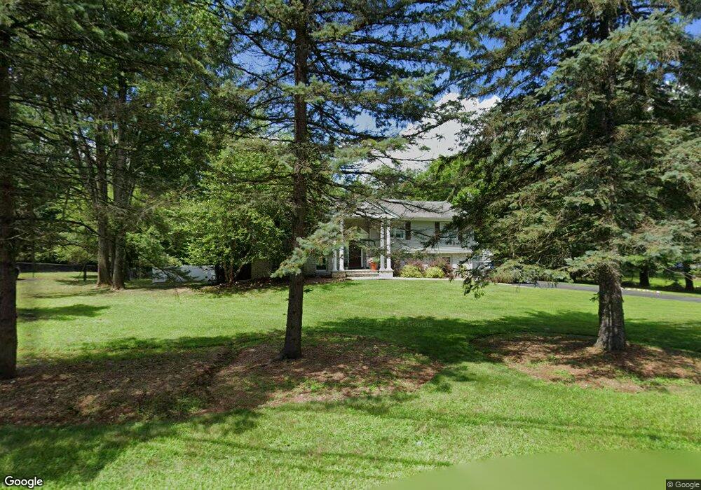
345 Shadyside Rd Ramsey, NJ 07446
Estimated Value: $1,080,000 - $1,286,000
4
Beds
4
Baths
3,525
Sq Ft
$336/Sq Ft
Est. Value
About This Home
This home is located at 345 Shadyside Rd, Ramsey, NJ 07446 and is currently estimated at $1,185,946, approximately $336 per square foot. 345 Shadyside Rd is a home located in Bergen County with nearby schools including Ramsey High School, Young World Day School, and Guidepost Montessori at Mahwah.
Ownership History
Date
Name
Owned For
Owner Type
Purchase Details
Closed on
Apr 30, 2018
Sold by
Meyers Timothy D and Meyers Dawn A
Bought by
Simins Michael and Simons Anna
Current Estimated Value
Home Financials for this Owner
Home Financials are based on the most recent Mortgage that was taken out on this home.
Original Mortgage
$498,000
Outstanding Balance
$406,843
Interest Rate
4.4%
Mortgage Type
Purchase Money Mortgage
Estimated Equity
$779,103
Purchase Details
Closed on
Oct 7, 2015
Sold by
Delventhal Richard H and Delventhal Joanne M
Bought by
Meyers Timothy D and Meyers Dawn A
Home Financials for this Owner
Home Financials are based on the most recent Mortgage that was taken out on this home.
Original Mortgage
$633,318
Interest Rate
3.88%
Mortgage Type
VA
Create a Home Valuation Report for This Property
The Home Valuation Report is an in-depth analysis detailing your home's value as well as a comparison with similar homes in the area
Home Values in the Area
Average Home Value in this Area
Purchase History
| Date | Buyer | Sale Price | Title Company |
|---|---|---|---|
| Simins Michael | $662,000 | -- | |
| Meyers Timothy D | $726,000 | Title Mark Llc |
Source: Public Records
Mortgage History
| Date | Status | Borrower | Loan Amount |
|---|---|---|---|
| Open | Simins Michael | $498,000 | |
| Previous Owner | Meyers Timothy D | $633,318 |
Source: Public Records
Tax History Compared to Growth
Tax History
| Year | Tax Paid | Tax Assessment Tax Assessment Total Assessment is a certain percentage of the fair market value that is determined by local assessors to be the total taxable value of land and additions on the property. | Land | Improvement |
|---|---|---|---|---|
| 2025 | $20,578 | $1,027,600 | $419,100 | $608,500 |
| 2024 | $19,958 | $729,200 | $336,800 | $392,400 |
| 2023 | $19,127 | $729,200 | $336,800 | $392,400 |
| 2022 | $19,127 | $729,200 | $336,800 | $392,400 |
| 2021 | $18,908 | $729,200 | $336,800 | $392,400 |
| 2020 | $18,740 | $729,200 | $336,800 | $392,400 |
| 2019 | $17,924 | $729,200 | $336,800 | $392,400 |
| 2018 | $16,304 | $680,200 | $336,800 | $343,400 |
| 2017 | $15,998 | $680,200 | $336,800 | $343,400 |
| 2016 | $15,556 | $680,200 | $336,800 | $343,400 |
| 2015 | $15,728 | $582,300 | $286,800 | $295,500 |
| 2014 | $15,460 | $582,300 | $286,800 | $295,500 |
Source: Public Records
Map
Nearby Homes
- 156 Deer Trail N
- 916 Thoreau Ct
- 506 Mark Twain Way
- 1008 Thoreau Ct
- 1007 Thoreau Ct
- 1006 Thoreau Ct
- 1006 Thoreau Ct Unit Bldg 10
- 7 Birchwood Ln
- 1904 Faulkner Ct
- 141 W Oak St
- 2009 Hawthorne Ln Unit 2009
- 366 Cottonwood Way
- 199 Darlington Ave
- 309 Linden St
- 128 Oak Ridge Rd
- 206 Peterson Place
- 561 Holly Ct Unit B3
- 45 Center St
- 7 Snyder Ave
- 689 Plum Terrace Unit 31E