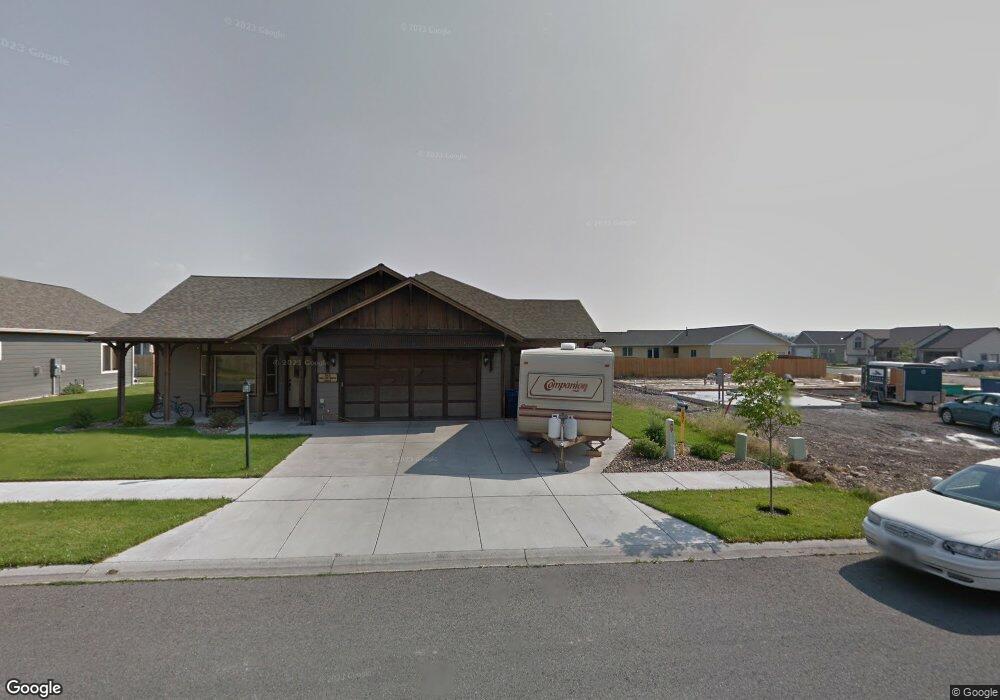
345 Shelter Grove Cir Bozeman, MT 59718
Four Corners NeighborhoodEstimated Value: $712,000 - $734,000
4
Beds
3
Baths
1,612
Sq Ft
$447/Sq Ft
Est. Value
About This Home
This home is located at 345 Shelter Grove Cir, Bozeman, MT 59718 and is currently estimated at $720,630, approximately $447 per square foot. 345 Shelter Grove Cir is a home located in Gallatin County with nearby schools including Monforton Primary School, Monforton Elementary School, and Monforton Junior High School.
Ownership History
Date
Name
Owned For
Owner Type
Purchase Details
Closed on
Sep 12, 2024
Sold by
Clements Mark K and Clements Shelbi A
Bought by
Clements Living Trust and Clements
Current Estimated Value
Purchase Details
Closed on
Apr 10, 2009
Sold by
Jmb Inc
Bought by
Clements Mark K and Clements Shelbi A
Home Financials for this Owner
Home Financials are based on the most recent Mortgage that was taken out on this home.
Original Mortgage
$244,896
Interest Rate
5.06%
Mortgage Type
Purchase Money Mortgage
Purchase Details
Closed on
Nov 20, 2008
Sold by
Valkyrie Llc
Bought by
Jmb Inc and Pro Builders
Home Financials for this Owner
Home Financials are based on the most recent Mortgage that was taken out on this home.
Original Mortgage
$202,475
Interest Rate
5.9%
Mortgage Type
Construction
Create a Home Valuation Report for This Property
The Home Valuation Report is an in-depth analysis detailing your home's value as well as a comparison with similar homes in the area
Home Values in the Area
Average Home Value in this Area
Purchase History
| Date | Buyer | Sale Price | Title Company |
|---|---|---|---|
| Clements Living Trust | -- | None Listed On Document | |
| Clements Mark K | -- | Security Title Company | |
| Jmb Inc | -- | Security Title Company |
Source: Public Records
Mortgage History
| Date | Status | Borrower | Loan Amount |
|---|---|---|---|
| Previous Owner | Clements Mark K | $244,896 | |
| Previous Owner | Jmb Inc | $202,475 |
Source: Public Records
Tax History Compared to Growth
Tax History
| Year | Tax Paid | Tax Assessment Tax Assessment Total Assessment is a certain percentage of the fair market value that is determined by local assessors to be the total taxable value of land and additions on the property. | Land | Improvement |
|---|---|---|---|---|
| 2025 | $3,017 | $774,600 | $0 | $0 |
| 2024 | $4,093 | $739,600 | $0 | $0 |
| 2023 | $4,441 | $739,600 | $0 | $0 |
| 2022 | $3,326 | $476,900 | $0 | $0 |
| 2021 | $3,718 | $476,900 | $0 | $0 |
| 2020 | $3,993 | $430,200 | $0 | $0 |
| 2019 | $3,963 | $430,200 | $0 | $0 |
| 2018 | $3,548 | $352,500 | $0 | $0 |
| 2017 | $2,892 | $352,500 | $0 | $0 |
| 2016 | $3,010 | $288,700 | $0 | $0 |
| 2015 | $2,926 | $288,700 | $0 | $0 |
| 2014 | $2,925 | $174,476 | $0 | $0 |
Source: Public Records
Map
Nearby Homes
- 93 Cedar Shade Ln
- 817 Milky Way Dr Unit B
- 84 Tail Feather Ln Unit B
- 20 Prairie Grass Ct Unit B
- 37 Voyager Ln
- 106 Milky Way Dr
- 101 Milky Way Dr
- Lot 2 River Rd
- Lot 5 River Rd
- 27901 Norris Rd Unit 89
- 26 Big Chief Trail
- 223 New Ventures Dr Unit E
- 223 New Ventures Dr Unit D
- 247 New Ventures Dr Unit B
- 26 Locomotive Loop
- 5044 Monforton School Rd
- 25 Big Chief Trail
- 15 Chinook Trail
- 9704 River Rd
- TBD River Rd
- 331 Shelter Grove Cir
- 369 Shelter Grove Cir
- 317 Shelter Grove Cir
- 113 Forest Grove Ln
- 131 Forest Grove Ln
- 105 Forest Grove Ln
- 311 Shelter Grove Cir
- 358 Shelter Grove Cir
- 91 Forest Grove Ln
- 145 Forest Grove Ln
- 370 Shelter Grove Cir
- 79 Forest Grove Ln
- 297 Shelter Grove Cir
- 382 Shelter Grove Cir
- 298 Shelter Grove Cir
- 118 Forest Grove Ln
- 132 Forest Grove Ln
- 106 Forest Grove Ln
- Lot 71 Forest Grove Ln
- 394 Shelter Grove Cir