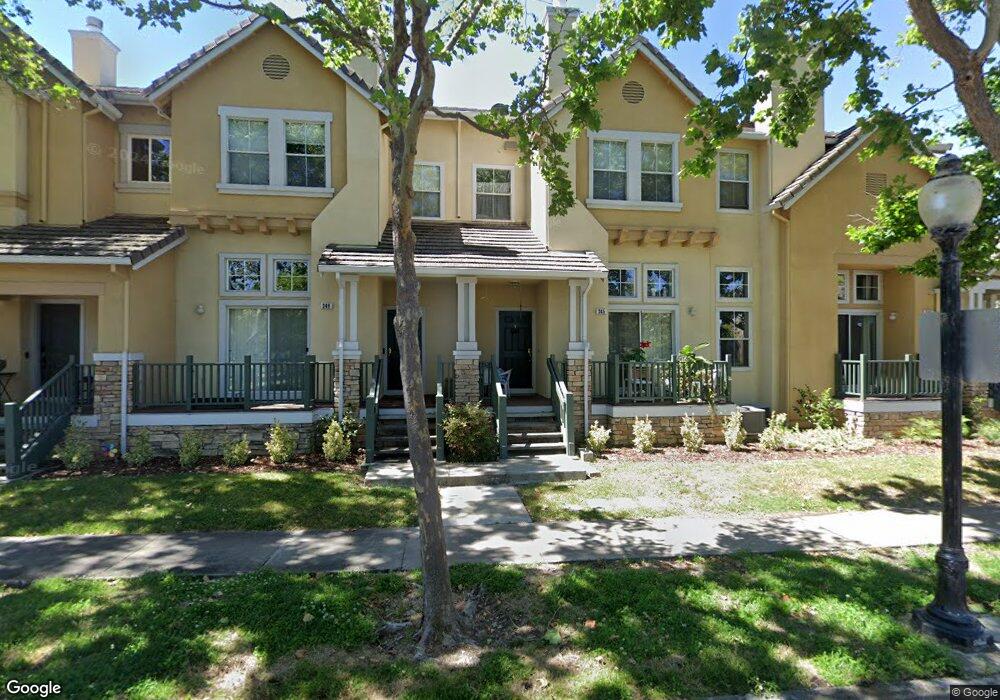
345 Whisman Station Dr Unit 222 Mountain View, CA 94043
Whisman NeighborhoodEstimated Value: $1,108,520 - $1,427,000
2
Beds
3
Baths
1,173
Sq Ft
$1,103/Sq Ft
Est. Value
About This Home
This home is located at 345 Whisman Station Dr Unit 222, Mountain View, CA 94043 and is currently estimated at $1,293,880, approximately $1,103 per square foot. 345 Whisman Station Dr Unit 222 is a home located in Santa Clara County with nearby schools including Edith Landels Elementary School, Crittenden Middle School, and Mountain View High School.
Ownership History
Date
Name
Owned For
Owner Type
Purchase Details
Closed on
Jul 25, 2015
Sold by
Johnson Anne
Bought by
Johnson Anne
Current Estimated Value
Purchase Details
Closed on
Nov 17, 1997
Sold by
Kaufman & Broad South Bay Inc
Bought by
Johnson Anne
Home Financials for this Owner
Home Financials are based on the most recent Mortgage that was taken out on this home.
Original Mortgage
$206,350
Outstanding Balance
$33,716
Interest Rate
7.23%
Estimated Equity
$1,260,164
Purchase Details
Closed on
Nov 2, 1997
Sold by
Johnson Eric N
Bought by
Johnson Anne
Home Financials for this Owner
Home Financials are based on the most recent Mortgage that was taken out on this home.
Original Mortgage
$206,350
Outstanding Balance
$33,716
Interest Rate
7.23%
Estimated Equity
$1,260,164
Create a Home Valuation Report for This Property
The Home Valuation Report is an in-depth analysis detailing your home's value as well as a comparison with similar homes in the area
Home Values in the Area
Average Home Value in this Area
Purchase History
| Date | Buyer | Sale Price | Title Company |
|---|---|---|---|
| Johnson Anne | -- | None Available | |
| Johnson Anne | $258,500 | First American Title Guarant | |
| Johnson Anne | -- | First American Title Guarant |
Source: Public Records
Mortgage History
| Date | Status | Borrower | Loan Amount |
|---|---|---|---|
| Open | Johnson Anne | $206,350 |
Source: Public Records
Tax History Compared to Growth
Tax History
| Year | Tax Paid | Tax Assessment Tax Assessment Total Assessment is a certain percentage of the fair market value that is determined by local assessors to be the total taxable value of land and additions on the property. | Land | Improvement |
|---|---|---|---|---|
| 2025 | $4,955 | $412,099 | $159,665 | $252,434 |
| 2024 | $4,955 | $404,020 | $156,535 | $247,485 |
| 2023 | $4,906 | $396,099 | $153,466 | $242,633 |
| 2022 | $4,893 | $388,333 | $150,457 | $237,876 |
| 2021 | $4,777 | $380,719 | $147,507 | $233,212 |
| 2020 | $4,783 | $376,816 | $145,995 | $230,821 |
| 2019 | $4,589 | $369,429 | $143,133 | $226,296 |
| 2018 | $4,551 | $362,186 | $140,327 | $221,859 |
| 2017 | $4,370 | $355,085 | $137,576 | $217,509 |
| 2016 | $4,199 | $348,124 | $134,879 | $213,245 |
| 2015 | $4,082 | $342,895 | $132,853 | $210,042 |
| 2014 | $4,047 | $336,179 | $130,251 | $205,928 |
Source: Public Records
Map
Nearby Homes
- 427 Nicholas Dr
- 3418 Pyramid Way
- 125 Orbit Way
- 163 Gladys Ave
- 201 Ada Ave Unit 25
- 325 Sylvan Ave
- 325 Sylvan Ave Unit 47
- 198 Ada Ave
- 493 Magritte Way
- 71 Gladys Ave
- 433 Sylvan Ave
- 433 Sylvan Ave Unit 84
- 110 E Middlefield Rd Unit C
- 149 Flynn Ave
- 139 Flynn Ave
- 280 Easy St Unit 311
- 94 Flynn Ave Unit D
- 90 Flynn Ave Unit C
- 99 Sherland Ave Unit B
- 280 Orchard Ave Unit K
- 349 Whisman Station Dr
- 341 Whisman Station Dr
- 353 Whisman Station Dr Unit 24
- 131 Chetwood Dr
- 129 Chetwood Dr
- 337 Whisman Station Dr
- 333 Whisman Station Dr
- 132 Chetwood Dr
- 329 Whisman Station Dr
- 125 Chetwood Dr
- 127 Chetwood Dr
- 336 Whisman Station Dr Unit 335
- 128 Chetwood Dr
- 325 Whisman Station Dr Unit 12
- 332 Whisman Station Dr
- 151 Irene Ct
- 328 Whisman Station Dr Unit 333
- 137 Beverly St
- 321 Whisman Station Dr Unit 111
- 144 Holly Ct