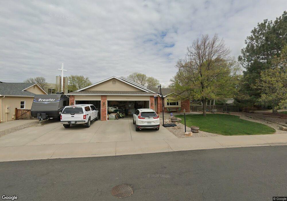
3450 Fillmore Ave Loveland, CO 80538
Estimated Value: $522,658 - $600,000
3
Beds
2
Baths
1,982
Sq Ft
$278/Sq Ft
Est. Value
About This Home
This home is located at 3450 Fillmore Ave, Loveland, CO 80538 and is currently estimated at $550,165, approximately $277 per square foot. 3450 Fillmore Ave is a home located in Larimer County with nearby schools including Peakview Academy at Conrad Ball, Mary Blair Elementary School, and Mountain View High School.
Ownership History
Date
Name
Owned For
Owner Type
Purchase Details
Closed on
Feb 22, 2019
Sold by
Burns Snell Stephanie C and Snell Brian L
Bought by
Burns Snell Stephanie C and Snell Brian L
Current Estimated Value
Purchase Details
Closed on
Jul 12, 2018
Sold by
Burns Donald E and Snell Stephanie C
Bought by
Burnssnell Stephanie C and Snell Bnrian L
Purchase Details
Closed on
Mar 30, 2009
Sold by
Burns Donald E and Snell Stephanie C
Bought by
Burns Donald E and Snell Stephanie C
Purchase Details
Closed on
Dec 6, 1996
Sold by
Burns Donald E and Burns Stephanie C
Bought by
Burns Donald E and Burns Stephanie C
Purchase Details
Closed on
May 1, 1996
Sold by
D E Burns Construction Co
Bought by
Burns Donald E and Burns Stephanie C
Create a Home Valuation Report for This Property
The Home Valuation Report is an in-depth analysis detailing your home's value as well as a comparison with similar homes in the area
Home Values in the Area
Average Home Value in this Area
Purchase History
| Date | Buyer | Sale Price | Title Company |
|---|---|---|---|
| Burns Snell Stephanie C | -- | None Available | |
| Burnssnell Stephanie C | -- | None Available | |
| Burns Donald E | -- | None Available | |
| Burns Donald E | -- | -- | |
| Burns Donald E | $28,000 | -- |
Source: Public Records
Tax History Compared to Growth
Tax History
| Year | Tax Paid | Tax Assessment Tax Assessment Total Assessment is a certain percentage of the fair market value that is determined by local assessors to be the total taxable value of land and additions on the property. | Land | Improvement |
|---|---|---|---|---|
| 2025 | $2,630 | $36,636 | $3,216 | $33,420 |
| 2024 | $2,536 | $36,636 | $3,216 | $33,420 |
| 2022 | $2,075 | $26,083 | $3,336 | $22,747 |
| 2021 | $2,133 | $26,834 | $3,432 | $23,402 |
| 2020 | $2,070 | $26,040 | $3,432 | $22,608 |
| 2019 | $2,036 | $26,040 | $3,432 | $22,608 |
| 2018 | $1,957 | $23,774 | $3,456 | $20,318 |
| 2017 | $1,685 | $23,774 | $3,456 | $20,318 |
| 2016 | $1,601 | $21,834 | $3,821 | $18,013 |
| 2015 | $1,588 | $21,830 | $3,820 | $18,010 |
| 2014 | $1,461 | $19,430 | $3,820 | $15,610 |
Source: Public Records
Map
Nearby Homes
- 3244 Hawthorn Dr
- 502 Honey Locust Dr
- 3402 White Ash Ct
- 367 Limber Place
- 3638 Butternut Dr Unit 7A
- 171 E 42nd St Unit C
- 3321 Butternut Dr
- 324 Sagewood Dr
- 119 E 42nd St Unit 3B
- 4342 Sunridge Dr
- 4105 N Garfield Ave Unit 100
- 4105 N Garfield Ave Unit 61
- 2437 Mountain View Dr
- 6429 Union Creek Dr
- 6465 Union Creek Dr
- 1208 Silver Fir Dr
- 4453 N Lincoln Ave
- 4386 Suncreek Dr
- 3750 Sheridan Ave
- 2562 Tupelo Dr
- 3484 Fillmore Ave
- 3416 Fillmore Ave
- 396 Spring Snow Dr
- 3518 Fillmore Ave
- 486 Prairie Fire Dr
- 3394 Fillmore Ave
- 388 Spring Snow Dr
- 3337 Honey Locust Dr
- 399 Spring Snow Dr
- 3552 Fillmore Ave
- 3349 Honey Locust Dr
- 3362 Fillmore Ave
- 470 Prairie Fire Dr
- 391 Spring Snow Dr
- 3569 Fillmore Ave
- 380 Spring Snow Dr
- 3325 Honey Locust Dr
- 305 Spring Snow Dr
- 3353 Honey Locust Dr
- 345 Spring Snow Dr