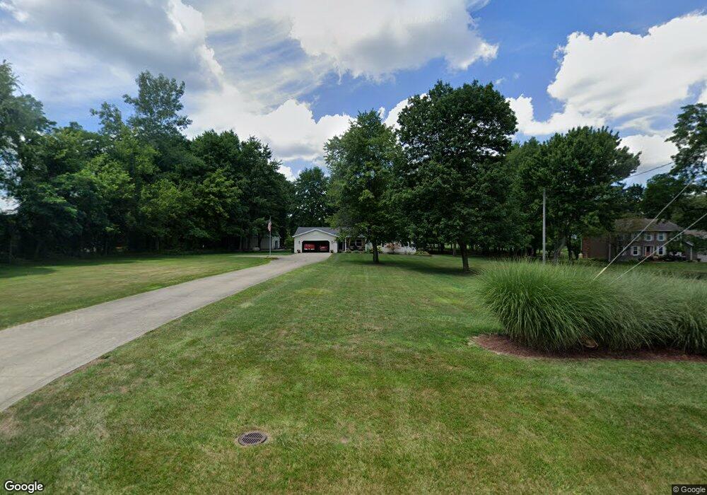
346 Colonial Dr Mansfield, OH 44903
Estimated Value: $334,000 - $383,000
3
Beds
2
Baths
1,860
Sq Ft
$192/Sq Ft
Est. Value
About This Home
This home is located at 346 Colonial Dr, Mansfield, OH 44903 and is currently estimated at $356,606, approximately $191 per square foot. 346 Colonial Dr is a home located in Richland County with nearby schools including Madison High School.
Ownership History
Date
Name
Owned For
Owner Type
Purchase Details
Closed on
Apr 12, 2004
Sold by
Zimmerman Todd A and Zimmerman Tammie R
Bought by
Zimmerman Todd A and Zimmerman Tammie R
Current Estimated Value
Home Financials for this Owner
Home Financials are based on the most recent Mortgage that was taken out on this home.
Original Mortgage
$73,000
Interest Rate
5.66%
Mortgage Type
New Conventional
Purchase Details
Closed on
Sep 18, 1991
Sold by
Daniels Randy E
Bought by
Zimmerman Todd A
Purchase Details
Closed on
Aug 6, 1990
Bought by
Daniels Randy E
Create a Home Valuation Report for This Property
The Home Valuation Report is an in-depth analysis detailing your home's value as well as a comparison with similar homes in the area
Home Values in the Area
Average Home Value in this Area
Purchase History
| Date | Buyer | Sale Price | Title Company |
|---|---|---|---|
| Zimmerman Todd A | -- | Southern Title | |
| Zimmerman Todd A | $14,700 | -- | |
| Daniels Randy E | $14,000 | -- |
Source: Public Records
Mortgage History
| Date | Status | Borrower | Loan Amount |
|---|---|---|---|
| Closed | Zimmerman Todd A | $73,000 |
Source: Public Records
Tax History Compared to Growth
Tax History
| Year | Tax Paid | Tax Assessment Tax Assessment Total Assessment is a certain percentage of the fair market value that is determined by local assessors to be the total taxable value of land and additions on the property. | Land | Improvement |
|---|---|---|---|---|
| 2024 | $4,681 | $92,610 | $11,840 | $80,770 |
| 2023 | $4,681 | $92,610 | $11,840 | $80,770 |
| 2022 | $3,504 | $63,860 | $9,400 | $54,460 |
| 2021 | $3,503 | $63,860 | $9,400 | $54,460 |
| 2020 | $3,530 | $63,860 | $9,400 | $54,460 |
| 2019 | $3,210 | $54,210 | $7,970 | $46,240 |
| 2018 | $3,183 | $54,210 | $7,970 | $46,240 |
| 2017 | $3,124 | $54,210 | $7,970 | $46,240 |
| 2016 | $3,196 | $54,170 | $7,540 | $46,630 |
| 2015 | $3,196 | $54,170 | $7,540 | $46,630 |
| 2014 | $3,133 | $54,170 | $7,540 | $46,630 |
| 2012 | $1,479 | $55,840 | $7,770 | $48,070 |
Source: Public Records
Map
Nearby Homes
- 2750 Lutz Ave
- 2641 State Route 430
- 0 Peterson Rd
- 609 Mcbride Rd
- 0 McBride Road Parcel # 1 Unit 9066028
- 598 Impala Dr
- 0 Satinwood Dr
- 775 Touby Ln
- 630 Impala Dr
- 2495 Emma Ln
- 640 Running Brook Way
- 2270 Lakecrest Dr Unit 2272
- 641 Laver Rd
- 76 Ford Rd N
- 76 Ford Rd N Unit 20
- 0 Mcelroy Rd
- 3290 Shad Dr W
- 304 Esley Ln
- 1910 Crider Rd
- 0 State Route 39 & I-71 Northeast Quadrant
- 2751 Peterson Rd
- 324 Colonial Dr
- 2735 Peterson Rd
- 349 Colonial Dr
- 2795 Peterson Rd
- 2715 Peterson Rd
- 300 Colonial Dr
- 2758 Peterson Rd
- 2744 Peterson Rd
- 323 Colonial Dr
- 2770 Peterson Rd
- 2730 Peterson Rd
- 2718 Peterson Rd
- 2772 Cherokee Dr
- 2704 Peterson Rd
- 2697 Peterson Rd
- 2772 Cherokee Ave
- 2817 Peterson Rd
- 2817 Peterson Rd
- 271 Colonial Dr