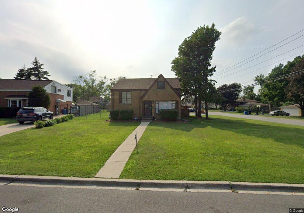
346 High Ridge Rd Hillside, IL 60162
Estimated Value: $246,000 - $348,000
3
Beds
2
Baths
9,329
Sq Ft
$31/Sq Ft
Est. Value
About This Home
This home is located at 346 High Ridge Rd, Hillside, IL 60162 and is currently estimated at $290,305, approximately $31 per square foot. 346 High Ridge Rd is a home located in Cook County with nearby schools including Hillside Elementary School, Proviso West High School, and Meca Elementary School.
Ownership History
Date
Name
Owned For
Owner Type
Purchase Details
Closed on
Dec 30, 2025
Sold by
Recendez Lucy and Perez Jaime Arciga
Bought by
Recendez Lucy
Current Estimated Value
Purchase Details
Closed on
Nov 24, 2025
Sold by
Recendez Lucy
Bought by
Recendez Lucy and Perez Jaime Arciga
Purchase Details
Closed on
Sep 19, 2025
Sold by
Flores Reinaldo Recendez
Bought by
Recendez Lucy
Purchase Details
Closed on
Dec 19, 2014
Sold by
Bates Eileen E
Bought by
Recendez Reinaldo
Purchase Details
Closed on
Jan 16, 2013
Sold by
Bates William J and Bates Eillen E
Bought by
Bates William J and Bates Eileen E
Create a Home Valuation Report for This Property
The Home Valuation Report is an in-depth analysis detailing your home's value as well as a comparison with similar homes in the area
Home Values in the Area
Average Home Value in this Area
Purchase History
| Date | Buyer | Sale Price | Title Company |
|---|---|---|---|
| Recendez Lucy | -- | None Listed On Document | |
| Recendez Lucy | -- | None Listed On Document | |
| Recendez Lucy | -- | None Listed On Document | |
| Recendez Reinaldo | $100,000 | First American Title | |
| Bates William J | -- | None Available |
Source: Public Records
Tax History
| Year | Tax Paid | Tax Assessment Tax Assessment Total Assessment is a certain percentage of the fair market value that is determined by local assessors to be the total taxable value of land and additions on the property. | Land | Improvement |
|---|---|---|---|---|
| 2025 | $6,851 | $19,126 | $5,131 | $13,995 |
| 2024 | $6,851 | $19,126 | $5,131 | $13,995 |
| 2023 | $7,022 | $19,126 | $5,131 | $13,995 |
| 2022 | $7,022 | $17,801 | $3,498 | $14,303 |
| 2021 | $6,874 | $17,800 | $3,498 | $14,302 |
| 2020 | $6,679 | $17,800 | $3,498 | $14,302 |
| 2019 | $5,312 | $13,247 | $3,265 | $9,982 |
| 2018 | $5,162 | $13,247 | $3,265 | $9,982 |
| 2017 | $4,960 | $13,247 | $3,265 | $9,982 |
| 2016 | $4,178 | $10,925 | $3,031 | $7,894 |
| 2015 | $4,043 | $10,925 | $3,031 | $7,894 |
| 2014 | $3,941 | $10,925 | $3,031 | $7,894 |
| 2013 | $2,105 | $10,888 | $3,031 | $7,857 |
Source: Public Records
Map
Nearby Homes
- 311 Buckthorn Ln
- 500 N Laverne Ave
- 605 N Wolf Rd Unit B9
- 226 N Lind Ave
- 70 N Laverne Ave
- 326 N Forest Ave
- 250 N Irving Ave
- 504 N Irving Ave
- 4353 Butterfield Rd
- 512 50th Ave
- 768 N Rohde Ave
- 540 47th Ave
- 4938 W Randolph St
- 4904 W Hawthorne Ave
- 4929 W Randolph St
- 319 50th Ave
- 1529 N Hillside Ave
- 1426 N Rohde Ave
- 2050 Atwood Ave
- 429 Geneva Ave
- 340 High Ridge Rd
- 336 High Ridge Rd
- 345 Iroquois Rd
- 341 Iroquois Rd
- 402 High Ridge Rd
- 337 Iroquois Rd
- 332 High Ridge Rd
- 401 Iroquois Rd
- 333 Iroquois Rd
- 341 High Ridge Rd
- 345 High Ridge Rd
- 328 High Ridge Rd
- 333 High Ridge Rd
- 401 High Ridge Rd
- 4719 Butterfield Rd
- 4719 Butterfield Rd
- 4715 Butterfield Rd
- 4715 Butterfield Rd
- 324 High Ridge Rd
Your Personal Tour Guide
Ask me questions while you tour the home.