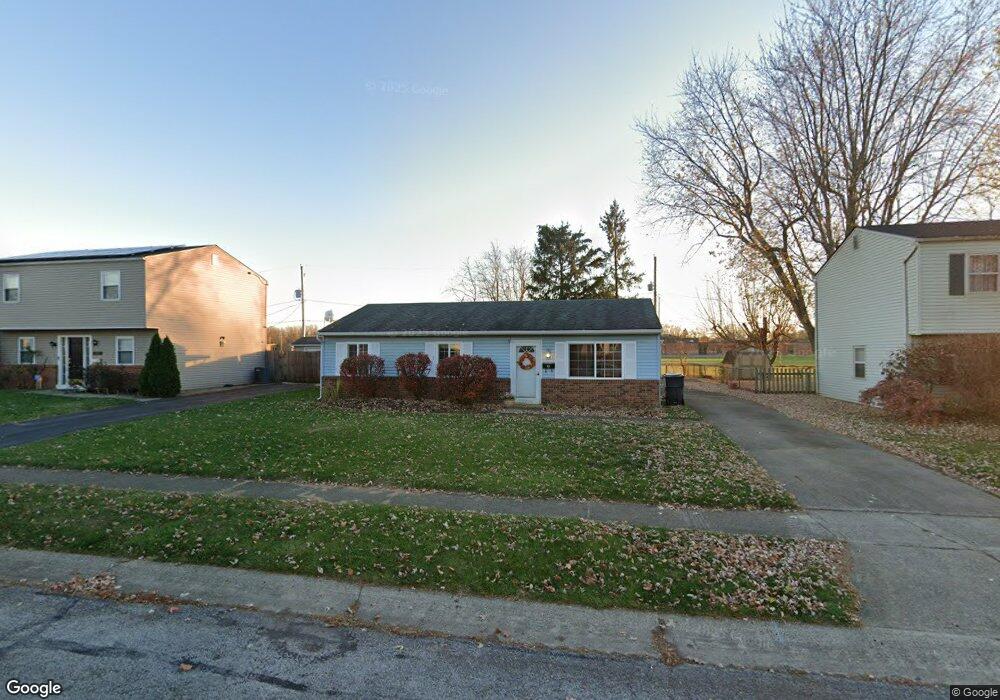
3463 Arnsby Rd Columbus, OH 43232
East Columbus-White Ash NeighborhoodEstimated Value: $187,134 - $203,000
3
Beds
1
Bath
936
Sq Ft
$207/Sq Ft
Est. Value
About This Home
This home is located at 3463 Arnsby Rd, Columbus, OH 43232 and is currently estimated at $194,034, approximately $207 per square foot. 3463 Arnsby Rd is a home located in Franklin County with nearby schools including Groveport Madison High School, A+ Arts Academy, and Brice Christian Academy Elementary School.
Ownership History
Date
Name
Owned For
Owner Type
Purchase Details
Closed on
Dec 1, 2010
Sold by
Cole Steven S
Bought by
Cole Patricia M and Williams Patricia M
Current Estimated Value
Home Financials for this Owner
Home Financials are based on the most recent Mortgage that was taken out on this home.
Original Mortgage
$40,000
Outstanding Balance
$27,222
Interest Rate
4.82%
Mortgage Type
New Conventional
Estimated Equity
$166,812
Purchase Details
Closed on
Apr 16, 1991
Bought by
Cole Steven S
Purchase Details
Closed on
Jan 1, 1980
Create a Home Valuation Report for This Property
The Home Valuation Report is an in-depth analysis detailing your home's value as well as a comparison with similar homes in the area
Home Values in the Area
Average Home Value in this Area
Purchase History
| Date | Buyer | Sale Price | Title Company |
|---|---|---|---|
| Cole Patricia M | -- | Attorney | |
| Cole Steven S | $46,000 | -- | |
| -- | $33,000 | -- |
Source: Public Records
Mortgage History
| Date | Status | Borrower | Loan Amount |
|---|---|---|---|
| Open | Cole Patricia M | $40,000 |
Source: Public Records
Tax History Compared to Growth
Tax History
| Year | Tax Paid | Tax Assessment Tax Assessment Total Assessment is a certain percentage of the fair market value that is determined by local assessors to be the total taxable value of land and additions on the property. | Land | Improvement |
|---|---|---|---|---|
| 2024 | $2,544 | $52,540 | $16,310 | $36,230 |
| 2023 | $2,528 | $52,535 | $16,310 | $36,225 |
| 2022 | $1,630 | $26,850 | $6,060 | $20,790 |
| 2021 | $1,672 | $26,850 | $6,060 | $20,790 |
| 2020 | $1,676 | $26,850 | $6,060 | $20,790 |
| 2019 | $1,645 | $23,170 | $5,250 | $17,920 |
| 2018 | $1,704 | $23,170 | $5,250 | $17,920 |
| 2017 | $1,709 | $23,170 | $5,250 | $17,920 |
| 2016 | $1,754 | $22,200 | $3,960 | $18,240 |
| 2015 | $1,754 | $22,200 | $3,960 | $18,240 |
| 2014 | $1,607 | $22,200 | $3,960 | $18,240 |
| 2013 | $780 | $24,640 | $4,375 | $20,265 |
Source: Public Records
Map
Nearby Homes
- 3246 Latonia Rd
- 5522 Newport Ct
- 5391 Newport Rd
- 5254 Sedalia Dr
- 5397 Jack Russell Way
- 3387 Retriever Rd
- 5152 Burdett Dr
- 3773 Tylor Dr
- 3773 Clearwater Dr
- 3739 Atkinson Rd
- 3496 Cadell Rd
- 3567 Wymore Place
- 5408 Rohden Dr
- 5106 Harbor Blvd
- 5416 Branchville Dr
- 2998 Osgood Rd E
- 5464 Rohden Dr
- 3289 Kady Ln
- 5125 Upton Rd N
- 3000 Whitlow Rd
- 3471 Arnsby Rd
- 3455 Arnsby Rd
- 3479 Arnsby Rd
- 3447 Arnsby Rd
- 3456 Arnsby Rd
- 3464 Arnsby Rd
- 3493 Arnsby Rd
- 3439 Arnsby Rd
- 3419 Everson Rd W
- 3448 Arnsby Rd
- 3431 Arnsby Rd
- 3505 Arnsby Rd
- 3440 Arnsby Rd
- 3423 Arnsbury Rd
- 3432 Arnsby Rd
- 3423 Arnsby Rd
- 5389 Deforest Dr
- 3508 Arnsby Rd
- 3411 Everson Rd W
- 5381 Deforest Dr