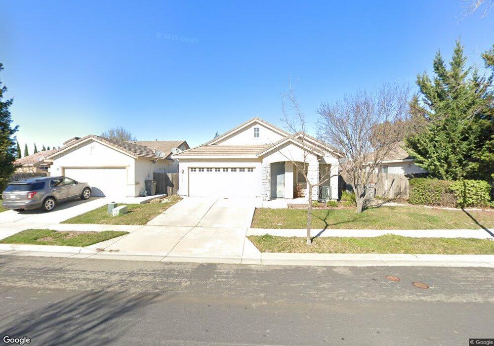
3464 Big Island Rd West Sacramento, CA 95691
Southport NeighborhoodEstimated Value: $328,000 - $521,000
3
Beds
2
Baths
1,362
Sq Ft
$343/Sq Ft
Est. Value
About This Home
This home is located at 3464 Big Island Rd, West Sacramento, CA 95691 and is currently estimated at $467,827, approximately $343 per square foot. 3464 Big Island Rd is a home located in Yolo County with nearby schools including Bridgeway Island Elementary School, River City High, and Empowering Possibilities International Charter School.
Ownership History
Date
Name
Owned For
Owner Type
Purchase Details
Closed on
Feb 24, 2003
Sold by
Loscher Christopher A and Loscher Melissa A
Bought by
Loscher Christopher A and Loscher Melissa A
Current Estimated Value
Home Financials for this Owner
Home Financials are based on the most recent Mortgage that was taken out on this home.
Original Mortgage
$160,000
Outstanding Balance
$69,035
Interest Rate
5.93%
Estimated Equity
$398,792
Purchase Details
Closed on
Apr 11, 2001
Sold by
Beazer Homes Holdings Corp
Bought by
Loscher Christopher A and Loscher Melissa A
Home Financials for this Owner
Home Financials are based on the most recent Mortgage that was taken out on this home.
Original Mortgage
$157,250
Interest Rate
6.98%
Create a Home Valuation Report for This Property
The Home Valuation Report is an in-depth analysis detailing your home's value as well as a comparison with similar homes in the area
Home Values in the Area
Average Home Value in this Area
Purchase History
| Date | Buyer | Sale Price | Title Company |
|---|---|---|---|
| Loscher Christopher A | -- | Chicago | |
| Loscher Christopher A | $166,000 | First American Title Ins Co |
Source: Public Records
Mortgage History
| Date | Status | Borrower | Loan Amount |
|---|---|---|---|
| Open | Loscher Christopher A | $160,000 | |
| Closed | Loscher Christopher A | $157,250 |
Source: Public Records
Tax History Compared to Growth
Tax History
| Year | Tax Paid | Tax Assessment Tax Assessment Total Assessment is a certain percentage of the fair market value that is determined by local assessors to be the total taxable value of land and additions on the property. | Land | Improvement |
|---|---|---|---|---|
| 2025 | $4,814 | $257,220 | $70,810 | $186,410 |
| 2023 | $4,814 | $247,233 | $68,061 | $179,172 |
| 2022 | $4,568 | $242,386 | $66,727 | $175,659 |
| 2021 | $4,522 | $237,634 | $65,419 | $172,215 |
| 2020 | $4,396 | $235,199 | $64,749 | $170,450 |
| 2019 | $4,345 | $230,588 | $63,480 | $167,108 |
| 2018 | $4,280 | $226,068 | $62,236 | $163,832 |
| 2017 | $4,233 | $221,636 | $61,016 | $160,620 |
| 2016 | $4,143 | $217,291 | $59,820 | $157,471 |
| 2015 | $3,903 | $214,028 | $58,922 | $155,106 |
| 2014 | $3,903 | $209,836 | $57,768 | $152,068 |
Source: Public Records
Map
Nearby Homes
- 3286 Owl Ct
- 3522 Pelican Ct
- 3515 Sparrow Ct
- 3213 Longspur Ln
- 3230 Longspur Ln
- 3424 Molokai Rd
- 3132 Tanager Ct
- 3244 Ballena Bay Rd
- 3138 Dove Ct
- 2961 Anacapa Island Ct
- 3580 Saint Lucia Place
- 3226 Farallon Rd
- 3147 Grizzly Bay Rd
- 3255 Marshall Rd
- 3348 San Salvador St
- 3315 Victoria Island Ct
- 3450 Seymour Ave
- 3025 Stable Dr
- 2972 Violet Dr
- The 3998 Plan at River's Edge
- 3456 Big Island Rd
- 3472 Big Island Rd
- 3448 Big Island Rd
- 3445 Kauai Rd
- 3441 Kauai Rd
- 3453 Kauai Rd
- 3433 Kauai Rd
- 3440 Big Island Rd
- 3461 Kauai Rd
- 3060 Hawaii Ct
- 3425 Kauai Rd
- 3055 Hawaii Ct
- 3421 Kauai Rd
- 3432 Big Island Rd
- 3070 Hawaii Ct
- 3065 Hawaii Ct
- 3417 Kauai Rd
- 3473 Kauai Rd
- 3060 Lanai Ct
- 3424 Big Island Rd