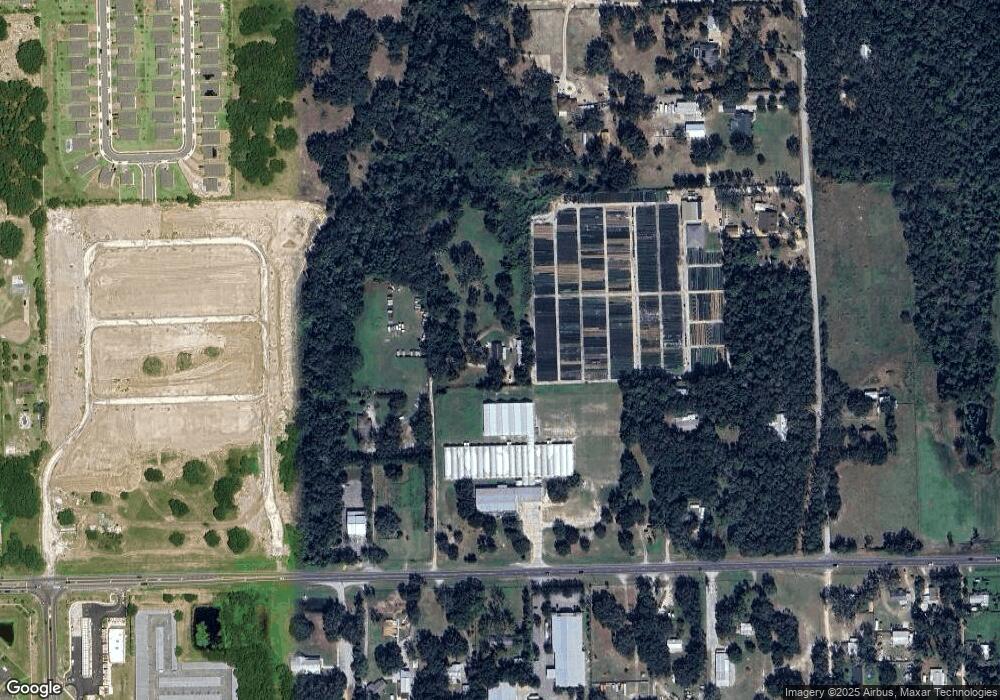
34646 Rust Rd Eustis, FL 32736
Northeast Eustis NeighborhoodEstimated Value: $429,000 - $482,000
3
Beds
2
Baths
1,462
Sq Ft
$312/Sq Ft
Est. Value
About This Home
This home is located at 34646 Rust Rd, Eustis, FL 32736 and is currently estimated at $456,592, approximately $312 per square foot. 34646 Rust Rd is a home located in Lake County with nearby schools including Eustis Elementary School, Eustis Middle School, and Eustis High School.
Ownership History
Date
Name
Owned For
Owner Type
Purchase Details
Closed on
Nov 16, 2021
Sold by
Rehman D Douglas D and Rehman Jody L
Bought by
Litton Charles Robert and Litton Rochelle Helen
Current Estimated Value
Home Financials for this Owner
Home Financials are based on the most recent Mortgage that was taken out on this home.
Original Mortgage
$275,000
Outstanding Balance
$232,300
Interest Rate
2.99%
Mortgage Type
Seller Take Back
Estimated Equity
$224,292
Purchase Details
Closed on
Apr 3, 2012
Sold by
Rust Earl F and Rust Louise B
Bought by
Rust Earl F
Create a Home Valuation Report for This Property
The Home Valuation Report is an in-depth analysis detailing your home's value as well as a comparison with similar homes in the area
Home Values in the Area
Average Home Value in this Area
Purchase History
| Date | Buyer | Sale Price | Title Company |
|---|---|---|---|
| Litton Charles Robert | $375,000 | Accommodation | |
| Rust Earl F | -- | None Available |
Source: Public Records
Mortgage History
| Date | Status | Borrower | Loan Amount |
|---|---|---|---|
| Open | Litton Charles Robert | $275,000 |
Source: Public Records
Tax History
| Year | Tax Paid | Tax Assessment Tax Assessment Total Assessment is a certain percentage of the fair market value that is determined by local assessors to be the total taxable value of land and additions on the property. | Land | Improvement |
|---|---|---|---|---|
| 2026 | $4,610 | $351,205 | $204,875 | $146,330 |
| 2025 | $4,222 | $350,537 | $204,875 | $145,662 |
| 2024 | $4,222 | $350,537 | $204,875 | $145,662 |
| 2023 | $4,222 | $346,380 | $204,875 | $141,505 |
| 2022 | $3,022 | $189,053 | $102,930 | $86,123 |
| 2021 | $1,295 | $103,316 | $0 | $0 |
| 2020 | $2,852 | $165,859 | $0 | $0 |
| 2019 | $2,857 | $165,038 | $0 | $0 |
| 2018 | $2,558 | $146,958 | $0 | $0 |
| 2017 | $2,348 | $134,820 | $0 | $0 |
| 2016 | $2,389 | $134,820 | $0 | $0 |
| 2015 | $2,442 | $133,640 | $0 | $0 |
| 2014 | $2,451 | $132,566 | $0 | $0 |
Source: Public Records
Map
Nearby Homes
- 20036 State Road 44
- 4062 Serene Water Ave
- 512 Darshire Ave
- 4053 Serene Water Ave
- 4045 Serene Water Ave
- 535 Darshire Ave
- 19621 Lake Lincoln Ln
- 4040 Casterly Rock Ct
- 8045 Waterbury Way
- 4030 Brookshire Cir
- 8050 Waterbury Way
- 8052 Waterbury Way
- 19337 Spring Oak Dr
- JENNINGS Plan at Lakes of Mount Dora
- CLIFTON Plan at Lakes of Mount Dora
- DELRAY Plan at Lakes of Mount Dora
- BOWEN Plan at Lakes of Mount Dora
- MADISON Plan at Lakes of Mount Dora
- AVON Plan at Lakes of Mount Dora
- DENHAM Plan at Lakes of Mount Dora
- 19711 State Road 44
- 19830 Lookout Ln
- 19721 State Road 44
- 19915 State Road 44
- 34753 Marshall Rd
- 436 Shadow Gorge Way
- 34717 Marshall Rd
- 19903 State Road 44
- 4001 E Orange Ave
- 448 Shadow Gorge Way
- 19801 Lookout Ln
- 3905 Mayhill Loop
- 3947 Mayhill Loop
- 3924 Mayhill Loop
- 3959 Mayhill Loop
- 3932 Mayhill Loop
- 3912 Mayhill Loop
- 3963 Mayhill Loop
- 3936 Mayhill Loop
