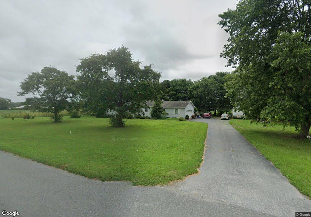
34647 Millsboro Hwy Millsboro, DE 19966
Estimated Value: $340,559 - $378,000
2
Beds
2
Baths
1,568
Sq Ft
$229/Sq Ft
Est. Value
About This Home
This home is located at 34647 Millsboro Hwy, Millsboro, DE 19966 and is currently estimated at $358,640, approximately $228 per square foot. 34647 Millsboro Hwy is a home located in Sussex County with nearby schools including East Millsboro Elementary School, Millsboro Middle School, and Sussex Central High School.
Ownership History
Date
Name
Owned For
Owner Type
Purchase Details
Closed on
Jan 28, 2016
Sold by
Baker Darryl L and Baker Donna L
Bought by
Bowman Jonathan J and Bowman Veronica L
Current Estimated Value
Home Financials for this Owner
Home Financials are based on the most recent Mortgage that was taken out on this home.
Original Mortgage
$185,576
Outstanding Balance
$148,034
Interest Rate
3.97%
Mortgage Type
FHA
Estimated Equity
$210,606
Create a Home Valuation Report for This Property
The Home Valuation Report is an in-depth analysis detailing your home's value as well as a comparison with similar homes in the area
Home Values in the Area
Average Home Value in this Area
Purchase History
| Date | Buyer | Sale Price | Title Company |
|---|---|---|---|
| Bowman Jonathan J | $189,000 | Tunnell & Raysor Pa |
Source: Public Records
Mortgage History
| Date | Status | Borrower | Loan Amount |
|---|---|---|---|
| Open | Bowman Jonathan J | $185,576 |
Source: Public Records
Tax History Compared to Growth
Tax History
| Year | Tax Paid | Tax Assessment Tax Assessment Total Assessment is a certain percentage of the fair market value that is determined by local assessors to be the total taxable value of land and additions on the property. | Land | Improvement |
|---|---|---|---|---|
| 2025 | $659 | $19,350 | $2,100 | $17,250 |
| 2024 | $1,007 | $19,350 | $2,100 | $17,250 |
| 2023 | $1,006 | $19,350 | $2,100 | $17,250 |
| 2022 | $990 | $19,350 | $2,100 | $17,250 |
| 2021 | $863 | $19,350 | $2,100 | $17,250 |
| 2020 | $753 | $19,350 | $2,100 | $17,250 |
| 2019 | $750 | $19,350 | $2,100 | $17,250 |
| 2018 | $757 | $19,350 | $0 | $0 |
| 2017 | $763 | $19,350 | $0 | $0 |
| 2016 | $675 | $19,350 | $0 | $0 |
| 2015 | $671 | $19,350 | $0 | $0 |
| 2014 | $661 | $19,350 | $0 | $0 |
Source: Public Records
Map
Nearby Homes
- 22240 Good Flocking Way
- Lot 1 Pear Tree Rd
- 34280 Graham Cir
- 36265 Pear Tree Rd
- 32655 Millsboro Hwy
- 37245 Firemans Rd
- 0 Laurel Rd Unit DESU2099790
- 0 Daisey Rd Unit DESU2090614
- 37485 Millsboro Hwy
- 31419 Collins Ct
- 31492 Careys Dr
- 31417 Collins Dr
- 31415 Collins Dr
- 37007 Peanut Tingle Rd
- 32542 Curley Dr
- 24249 Indian Town Rd
- 26002 Hayfield Ln Unit 44
- 26010 Hayfield Lane - Lot #42
- 63 Beacon Cir
- 26022 Hayfield Ln Unit 39
- 22235 Westwoods Rd
- 0 Westwoods Rd Unit 1001154130
- 0 Westwoods Rd Unit 5641150
- 0 Westwoods Rd Unit 5640954
- 0 Westwoods Rd Unit 1009028012
- 0 Westwoods Rd Unit 1009027940
- 0 Westwoods Rd Unit 1009027902
- 0 Westwoods Rd Unit 1009027882
- 34733 Millsboro Hwy
- 22427 Bradford Rd
- 0 E Route 26 Unit DESU133292
- 34816 Millsboro Hwy
- 22433 Drive Way
- 22433 Drive Way
- 22447 Bradford Rd
- Lot 16 Drive Way
- Lot 4 Drive Way
- 34381 Millsboro Hwy
- 22463 Bradford Rd
- 34870 Millsboro Hwy